Powder River
- 26.2 mi
- distance
- 4,388 ft
- high point
- May–Jun, Sep
- best months
Powder River is a canoeing destination in Oregon, about 3 miles from the town of Wingville. It sits in the same area as a cluster of trails and campgrounds, which makes it easy to pair a day on the water with time on foot or a place to stay. Summer is the most comfortable season for paddling. Typical averages from a nearby weather station in Baker City, which sits roughly 1,000 feet lower than the river, show July and August highs around 88°F with only three or four wet days a month, while September cools to about 79°F. Several trails and campgrounds lie within about 10 miles. The closest are the Elkhorn Crest National Recreation Trail, about 5 miles away, and the Twin Lakes Trail, about 6 miles away. Union Creek Campground is about 8.5 miles off, and the Powder River Recreation Area Paved Trail is about 9 miles away.
Local outfitters
- White Pine Outfitters37 mi away
Not on Roamze yet. Their page has how to reach them.
- Elkhorn Crest National Recreation TrailHiking4.9 mi
- Twin Lakes TrailHiking6.4 mi
- Union Creek CampgroundCamping8.5 mi
 Phillips Lake North Shoreline TrailHikingPhoto: Robert Ashworth from Bellingham, WA., USA, CC BY 2.0 (via Wikimedia Commons)9 mi
- Powder River Recreation Area Paved TrailHikingPhoto: Robert Ashworth from Bellingham, WA., USA, CC BY 2.0 (via Wikimedia Commons)9.1 mi
- Powder River Recreation Dirt TrailHiking9.2 mi
- Coyote Cove TrailHikingPhoto: Robert Ashworth from Bellingham, WA., USA, CC BY 2.0 (via Wikimedia Commons)9.5 mi
- Killamacue Lake TrailHiking9.5 mi
Source: Roamze catalog (indexable pages within 10 miles, PostGIS distance)
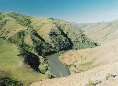 Grande Ronde RiverCanoeing · ~48 min drivePhoto: Dsdugan, Public domain (via Wikimedia Commons)
- Union Creek Boat LaunchBoat launch · ~15 min drive
 Catherine CreekCanoeing · ~50 min drivePhoto: Ian Poellet (User:Werewombat), CC BY-SA 3.0 (via Wikimedia Commons)
- Mason Dam Boat LaunchBoat launch · ~15 min drive
 Middle Fork John Day RiverCanoeing · ~1h 4m drivePhoto: Sam Beebe, CC BY 2.0 (via Wikimedia Commons)
- Anthony Lake Boat LaunchBoat launch · ~30 min drive
 Lostine RiverCanoeing · ~1h 16m drivePhoto: Finetooth, CC BY-SA 3.0 (via Wikimedia Commons)
- Grande Ronde Boat LaunchBoat launch · ~32 min drive
 Minam RiverCanoeing · ~1h 3m drivePhoto: Williamborg, CC BY-SA 3.0 (via Wikimedia Commons)
- Swede's Landing Boat LaunchBoat launch · ~1h 14m drive
Also worth it near here
- Snake River-Mormon Basin Back Country BywayScenic drive · ~13 min drive
 Rock Creek ButteSummit · ~13 min drivePhoto: David Dugan, CC BY-SA 3.0 (via Wikimedia Commons)
- Phillips Lake North Shoreline TrailHiking · ~15 min drivePhoto: Robert Ashworth from Bellingham, WA., USA, CC BY 2.0 (via Wikimedia Commons)
- North Powder Pond Number TwoLake fishing · ~23 min drive
Best time to visit Powder River
Best months: May–June and September. Best months have typical highs of 55–85 °F, lows of 30 °F or warmer (32 °F where the station doesn't record snow), at most one snowy day and no more than 12 wet days.
Jan
38° / 20°
10 wet
Feb
44° / 23°
9 wet
Mar
54° / 28°
10 wet
Apr
61° / 31°
10 wet
May
70° / 39°
10 wet
Jun
77° / 44°
8 wet
Jul
88° / 49°
4 wet
Aug
88° / 47°
3 wet
Sep
79° / 39°
4 wet
Oct
64° / 30°
6 wet
Nov
48° / 25°
9 wet
Dec
37° / 20°
10 wet
Typical high / low (°F) and days with rain or snow, 1991–2020. Measured at Baker City Muni Ap, OR, 7.6 mi away at 3,361 ft. The station sits about 1,000 ft lower than this place, so expect it a little cooler here. This station doesn't record snowfall. Source: NOAA NCEI U.S. Climate Normals 1991–2020.
