North Fork John Day River
- 22.4 mi
- distance
- 6,255 ft
- high point
Caution today
Agency alerts are in effect for this area; weather is good · USFS, OpenWeather · checked just now
Is North Fork John Day River open right now?
Closure in the area
There's a closure order in North Fork John Day Ranger District. It doesn't name North Fork John Day River, so check the source for the area it covers.
Salmon Olive Butte Fire Area Closure
Agency closure covering North Fork John Day Ranger District · Order 06-04-01-26-13 · USFS · North Fork John Day Ranger District
As of · Source: USFS · North Fork John Day Ranger District. Agencies don't list every closure — check before you go.
North Fork John Day River offers a 22-mile paddling stretch near Sumpter, Oregon, flowing through country managed by the Forest Service. The run sits within the North Fork John Day Wilderness and the North Fork John Day Ranger District of Umatilla National Forest. The river flows year-round, with a modeled average flow of about 724 cfs. Its gradient averages about 92 feet per mile, a steady drop that carries through the full 22.4 miles of the stretch. North Fork John Day Campground lies about half a mile away, and Granite Creek, another paddling run, is about 5 miles off. Peavy Cabin and the Cunningham Cove Trail are both roughly 8 miles from the river.
Local outfitters
- White Pine Outfitters33 mi away
Not on Roamze yet. Their page has how to reach them.
- North Fork John Day CgCamping0.6 mi
- Granite CreekCanoeing5.3 mi
 Peavy CabinCampingPhoto: Recreation.gov (RIDB) / public domain7.8 mi
- Cunningham Cove TrailHiking7.8 mi
 Crawfish Lake TrailHikingPhoto: U.S. Forest Service- Pacific Northwest Region, Public domain (via Wikimedia Commons)8.3 mi
- Caretakers CabinCamping8.5 mi
- Anthony LakesRock climbing9.5 mi
- Clear CreekCanoeing9.7 mi
Source: Roamze catalog (indexable pages within 10 miles, PostGIS distance)
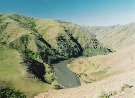 Grande Ronde RiverCanoeing · ~28 min drivePhoto: Dsdugan, Public domain (via Wikimedia Commons)
- Anthony Lake Boat LaunchBoat launch · ~17 min drive
 Middle Fork John Day RiverCanoeing · ~36 min drivePhoto: Sam Beebe, CC BY 2.0 (via Wikimedia Commons)
- Union Creek Boat LaunchBoat launch · ~43 min drive
 Catherine CreekCanoeing · ~1h 1m drivePhoto: Ian Poellet (User:Werewombat), CC BY-SA 3.0 (via Wikimedia Commons)
- Mason Dam Boat LaunchBoat launch · ~44 min drive
- Granite CreekCanoeing · ~9 min drive
- Grande Ronde Boat LaunchBoat launch · ~17 min drive
- Clear CreekCanoeing · ~17 min drive
- Magone Lake Boat LaunchBoat launch · ~60 min drive
Also worth it near here
- Crawfish Lake TrailHiking · ~14 min drivePhoto: U.S. Forest Service- Pacific Northwest Region, Public domain (via Wikimedia Commons)
 Sheep RockSummit · ~16 min drivePhoto: Finetooth, CC BY-SA 3.0 (via Wikimedia Commons)
- Anthony LakesRock climbing · ~16 min drive
- Anthony Lakes Mountain ResortDownhill skiing · ~17 min drive
