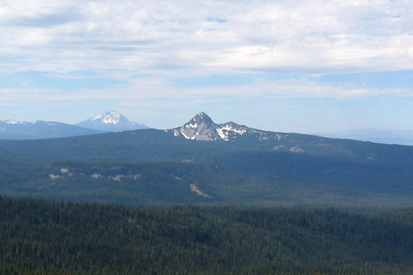
Middle Fork Rogue River
- 15.0 mi
- distance
- 4,442 ft
- high point
- May–Sep
- best months
Is Middle Fork Rogue River open right now?
Alert in the area
The Forest Service lists an alert for High Cascades Ranger District.
Fish Lake Boat Ramp Closure
Agency alert covering High Cascades Ranger District · Order 06-10-24-26-02 · USFS · High Cascades Ranger District
As of · Source: USFS · High Cascades Ranger District. Agencies don't list every closure — check before you go.
The Middle Fork Rogue River is a paddling route in Oregon's Rogue River-Siskiyou National Forests, within the High Cascades Ranger District. The Forest Service manages the land, and the river runs about 15 miles long. Summer is the most comfortable time to paddle. Typical averages from a nearby weather station show July highs around 85°F with lows near 42°F and only a few wet days, while winter brings highs in the upper 30s and regular snow days from December through February. Several other spots sit within a few miles. The Middle Fork and South Fork hikes are both under 3 miles away, and Bessie Shelter offers camping about 3 miles off. Red Blanket Creek, another canoeing route, is roughly 3.7 miles away.
Local outfitters
- The Fishin Hole Fly Shop25 mi away
- Sky Lakes Wilderness Adventures26 mi away
Not on Roamze yet. Their page has how to reach them.
- Middle ForkHiking2.7 mi
- South ForkHiking2.9 mi
- Tom and JerryHiking3 mi
- Bessie ShelterCamping3 mi
- Red Blanket CreekCanoeing3.7 mi
- Lodgepole Guard StationCamping5.4 mi
- Lower South Fork CampgroundCamping5.6 mi
- Beaver Dam CreekCanoeing8.2 mi
Source: Roamze catalog (indexable pages within 10 miles, PostGIS distance)
 Elk CreekCanoeing · ~27 min drivePhoto: Little Mountain 5, CC BY-SA 3.0 (via Wikimedia Commons)
- Fourmile Lake CampgroundFloat trip · ~31 min drive
- Cole Rivers Hatchery Boat RampBoat launch · ~31 min drive
 Little Butte CreekCanoeing · ~49 min drivePhoto: An employee of the USDA Forest Service, Public domain (via Wikimedia Commons)
- Casey Park Boat RampBoat launch · ~33 min drive
 South Umpqua RiverCanoeing · ~50 min drivePhoto: McD22, CC BY 2.0 (via Wikimedia Commons)
- Rocky Point Public Boat RampBoat launch · ~37 min drive
 Rogue RiverCanoeing · ~30 min drivePhoto: Bob Heims, U.S. Army Corps of Engineers, Public domain (via Wikimedia Commons)
- Rogue Elk Boat RampBoat launch · ~37 min drive
- Beaver Dam CreekCanoeing · ~14 min drive
Also worth it near here
Best time to visit Middle Fork Rogue River
Best months: May–September. Best months have typical highs of 55–85 °F, lows of 30 °F or warmer (32 °F where the station doesn't record snow), at most one snowy day and no more than 12 wet days.
Jan
39° / 19°
13 wet · 6 snow
Feb
44° / 22°
11 wet · 5 snow
Mar
50° / 25°
11 wet · 4 snow
Apr
57° / 28°
10 wet · 2 snow
May
66° / 33°
8 wet
Jun
75° / 37°
4 wet
Jul
85° / 42°
3 wet
Aug
84° / 41°
2 wet
Sep
77° / 34°
4 wet
Oct
64° / 27°
7 wet
Nov
48° / 24°
12 wet · 3 snow
Dec
39° / 19°
14 wet · 7 snow
Typical high / low (°F) and days with rain or snow, 1991–2020. Measured at Chiloquin 12 Nw (Fort Klamath), OR, 17.4 mi away at 4,180 ft. Source: NOAA NCEI U.S. Climate Normals 1991–2020.
Closures we've recorded since August 2026
Stage 2 Public Use Fire Restrictions (Forest-wide)
Rogue River-Siskiyou National Forests · Order dated September 4, 2026; seen Sep 3, 2026 → lifted Oct 28, 2026 · Forest Service
Stage 3 Public Use Fire Restrictions (Forest-wide)
Rogue River-Siskiyou National Forests · Order dated July 17, 2026; seen Aug 23, 2026 → lifted Sep 3, 2026 · Forest Service