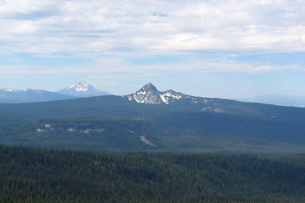
Bessie Shelter
- May–Sep
- best months
Is Bessie Shelter open right now?
Closure in the area
There's a closure order in High Cascades Ranger District. It doesn't name Bessie Shelter, so check the source for the area it covers.
Upper Rogue Cooperative Travel Management Area (Green Dot)
Agency closure covering High Cascades Ranger District · Order 06-10-24-26-04 · USFS · High Cascades Ranger District
Fish Lake Boat Ramp Closure
Agency alert covering High Cascades Ranger District · Order 06-10-24-26-02 · USFS · High Cascades Ranger District
As of · Source: USFS · High Cascades Ranger District. Agencies don't list every closure — check before you go.
- At 4,964 ft
- High Cascades Ranger DistrictRogue River-Siskiyou National Forests
Bessie Shelter is a Forest Service campground in the High Cascades Ranger District of the Rogue River-Siskiyou National Forests in southern Oregon. No fees are required to use the site, which makes it an easy stop for anyone exploring the area. Summer is the most comfortable time to visit. Typical averages from a nearby weather station at Chiloquin show July highs around 85°F with lows near 42°F and only about three wet days in the month. That station sits roughly 780 feet lower than the shelter, so temperatures at the site run a little cooler. The Tom and Jerry hike starts just 0.1 mile away, and the Mudjekeewis Trail and Middle Fork are both within about 2.5 miles. Paddlers can reach the Middle Fork Rogue River about 3 miles off.
Local outfitters
- Diamond Lake Resort28 mi away
- Holiday RV Park42 mi away
Not on Roamze yet. Their page has how to reach them.
Best time to go · May–Sep
Best time to visit Bessie Shelter
Best months: May–September. Best months have typical highs of 55–85 °F, lows of 30 °F or warmer (32 °F where the station doesn't record snow), at most one snowy day and no more than 12 wet days.
Jan
39° / 19°
13 wet · 6 snow
Feb
44° / 22°
11 wet · 5 snow
Mar
50° / 25°
11 wet · 4 snow
Apr
57° / 28°
10 wet · 2 snow
May
66° / 33°
8 wet
Jun
75° / 37°
4 wet
Jul
85° / 42°
3 wet
Aug
84° / 41°
2 wet
Sep
77° / 34°
4 wet
Oct
64° / 27°
7 wet
Nov
48° / 24°
12 wet · 3 snow
Dec
39° / 19°
14 wet · 7 snow
Typical high / low (°F) and days with rain or snow, 1991–2020. Measured at Chiloquin 12 Nw (Fort Klamath), OR, 15.6 mi away at 4,180 ft. The station sits about 800 ft lower than this place, so expect it a little cooler here. Source: NOAA NCEI U.S. Climate Normals 1991–2020.
Closures we've recorded since August 2026
Stage 2 Public Use Fire Restrictions (Forest-wide)
Rogue River-Siskiyou National Forests · Order dated September 4, 2026; seen Sep 3, 2026 → lifted Oct 28, 2026 · Forest Service
Stage 3 Public Use Fire Restrictions (Forest-wide)
Rogue River-Siskiyou National Forests · Order dated July 17, 2026; seen Aug 23, 2026 → lifted Sep 3, 2026 · Forest Service
Keep exploring — more campsites worth the drive
BED
Jim Creek Group Campground
~23 min drive
SEE
Imnaha Cabin Recreation Site
~7 min drive
BED
Fourmile Lake Campground
~34 min drive
BED
Bessie Shelter Horse Camp
Next door
Bessie Shelter Horse Camp is a campground in Oregon at about 4,963 feet. It is managed by the U.S. Forest Service.
BED
Imnaha Campground
~7 min drive
Imnaha Campground is a campground in Oregon at about 3,778 feet. It is managed by the U.S. Forest Service.
BED
South Fork Campground
~14 min drive
South Fork Campground is a campground in Oregon at about 4,012 feet. It is managed by the U.S. Forest Service.
BED
Lower South Fork Campground
~14 min drive
BED
Medco Pond Dispersed Camping
~15 min drive
Medco Pond Dispersed Camping is a campground in Oregon at about 3,001 feet.
BED
Mill Creek Campground
~16 min drive
BED
Mill Creek Campground USFS
~16 min drive
Mill Creek Campground USFS is a campground in Oregon at about 2,803 feet. It is managed by the U.S. Forest Service.
Also worth it near here