Oregon Desert Trail
- 17.3 mi
- one way
- 1,461 ft
- climb
- 4,784 ft
- high point
- Point to point
- route
- May–Sep
- best months
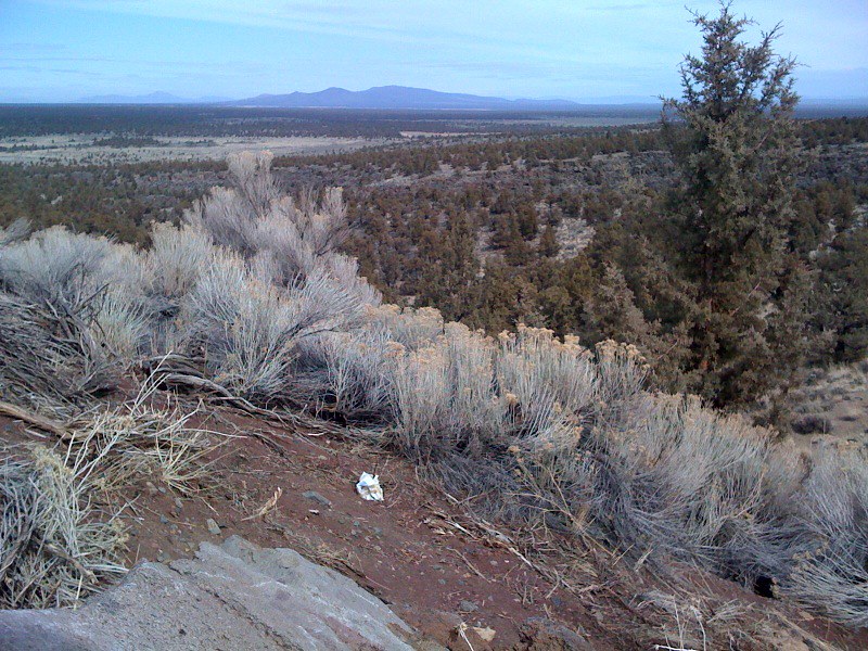
The Oregon Desert Trail is a 17.3-mile point-to-point hike on Bureau of Land Management land in the Prineville Deschutes Field Office in central Oregon. It is a hard route, with a total elevation gain of 1,461 feet and a total loss of 1,547 feet over the course of the trip. The trail starts at about 4,681 feet and reaches a high point of 4,784 feet before descending to a low of 3,404 feet. The steepest stretch comes at about 4.2 miles in, where the grade reaches 13 percent. Horses are allowed, but bikes are not. Summer is the most comfortable time to go. Typical averages from a nearby weather station in Sunriver, Oregon, run to highs around 84°F in July and 76°F in September, with lows in the low 40s. That station sits about 600 feet lower than the trail's high point, so temperatures on the route run cooler. The trip takes about 6.5 hours. Horse to Horse, a mountain biking route, starts just 0.1 mile away, and Horse Ridge is a hike about 1.8 miles off. Climbers can head to Castle, about 6.4 miles away, and Pine Mountain campground is about 9.3 miles away.
Local outfitters
- Wanderlust Tours16 mi away
- Oregon Adaptive Sports17 mi away
Not on Roamze yet. Their page has how to reach them.
- Horse to HorseMountain biking0.1 mi
- Crazy Horse - Has No HorseMountain biking1.1 mi
- Horse RidgeHiking1.8 mi
- Crazy Horse - Horse to HorseMountain biking1.9 mi
- Crooked ArmMountain biking2.2 mi
 CastleRock climbingPhoto: Bureau of Land Management Oregon and Washington from Portland, America, Public domain (via Wikimedia Commons)6.4 mi
- The Drive InRock climbing7.1 mi
- Pine MountainCamping9.3 mi
Source: Roamze catalog (indexable pages within 10 miles, PostGIS distance)
 ParkwayHiking · ~6 min drivePhoto: Sapphireblue, CC BY 2.0 (via Flickr)
- Escape from MoscowHiking · ~6 min drivePhoto: Sapphireblue, CC BY 2.0 (via Flickr)
 Tumulus TrailHiking · ~16 min drivePhoto: Bureau of Land Management Oregon and Washington, Public domain (via Wikimedia Commons)
- Swamp Wells Trail Number 61Hiking · ~18 min drive
 Dry River TrailHiking · ~8 min drivePhoto: Bureau of Land Management Oregon and Washington, Public domain (via Wikimedia Commons)
 Sand Lily TrailHiking · ~13 min drivePhoto: Bureau of Land Management Oregon and Washington, Public domain (via Wikimedia Commons)
- Coyote LoopHiking · ~18 min drive
- Mazama Ash TrailHiking · ~13 min drivePhoto: Bureau of Land Management Oregon and Washington, Public domain (via Wikimedia Commons)
- Badlands Rock TrailHiking · ~8 min drive
- Arnold Ice CaveHiking · ~18 min drive
Best time to visit Oregon Desert Trail
Best months: May–September. Best months have typical highs of 55–85 °F, lows of 30 °F or warmer (32 °F where the station doesn't record snow), at most one snowy day and no more than 12 wet days.
Jan
40° / 20°
Feb
43° / 21°
Mar
50° / 24°
Apr
57° / 25°
May
65° / 33°
Jun
72° / 37°
Jul
84° / 41°
Aug
83° / 40°
Sep
76° / 34°
Oct
62° / 28°
Nov
46° / 24°
Dec
37° / 19°
Typical high / low (°F) and days with rain or snow, 1991–2020. Measured at Sunriver, OR, 17.8 mi away at 4,180 ft. The station sits about 600 ft lower than this place, so expect it a little cooler here. This station doesn't record snowfall. Source: NOAA NCEI U.S. Climate Normals 1991–2020.
Map and trail data © OpenStreetMap contributors
