Horse to Horse
- 1.5 mi
- round trip
- 469 ft
- climb
- Mixed
- surface
- Out and back
- route
- May–Sep
- best months
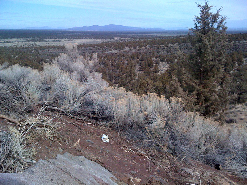
Horse to Horse is a short, easy mountain biking ride on Bureau of Land Management land in the Prineville Deschutes Field Office of Oregon. The route is an out-and-back of about 3 miles, with a low point at 4,645 feet and a high of 4,784 feet, and the steepest stretch comes within the first third of the ride, where a 14% grade climbs from the starting point at 4,681 feet. Late spring and early fall are the most comfortable times to ride. Typical averages from a nearby weather station at Sunriver put May highs around 65°F and September highs near 76°F, with July the warmest month at about 84°F. The Oregon Desert Trail passes just 0.1 mile away, and the Crazy Horse - Has No Horse route sits about a mile off. The Horse Ridge hike and the Crazy Horse - Horse to Horse route are each within 2 miles.
Local outfitters
- Mt. Bachelor Sports Education Foundation17 mi away
- The AdventurUs17 mi away
Not on Roamze yet. Their page has how to reach them.
Best time to go · May–Sep
Best time to visit Horse to Horse
Best months: May–September. Best months have typical highs of 55–85 °F, lows of 30 °F or warmer (32 °F where the station doesn't record snow), at most one snowy day and no more than 12 wet days.
Jan
40° / 20°
Feb
43° / 21°
Mar
50° / 24°
Apr
57° / 25°
May
65° / 33°
Jun
72° / 37°
Jul
84° / 41°
Aug
83° / 40°
Sep
76° / 34°
Oct
62° / 28°
Nov
46° / 24°
Dec
37° / 19°
Typical high / low (°F) and days with rain or snow, 1991–2020. Measured at Sunriver, OR, 17.8 mi away at 4,180 ft. The station sits about 600 ft lower than this place, so expect it a little cooler here. This station doesn't record snowfall. Source: NOAA NCEI U.S. Climate Normals 1991–2020.
Keep exploring — more rides worth the drive
 Photo: Bureau of Land Management Oregon and Washington from Portland, America, Public domain (via Wikimedia Commons)
Tumulus Trail
~15 min drive
7.90-mile dirt trail in Oregon with 3,736 ft elevation gain.
RIDE
Crazy Horse - Has No Horse
~2 min drive
0.27-mile easy singletrack in Oregon with 15 ft of elevation gain.
 Photo: Bureau of Land Management Oregon and Washington from Portland, America, Public domain (via Wikimedia Commons)
Black Lava Trail
~15 min drive
3.20-mile dirt trail in Tumulus Trailhead with 129 ft elevation gain.
RIDE
Crazy Horse - Has No Horse
~2 min drive
0.49-mile easy singletrack in Oregon with 85 ft elevation gain.
Photo: Bureau of Land Management Oregon and Washington from Portland, America, Public domain (via Wikimedia Commons)Basalt Trail
~16 min drive
0.59-mile dirt trail at Tumulus Trailhead, Oregon with 40 ft elevation gain.
RIDE
Crazy Horse - Horse to Horse
~3 min drive
2.38-mile easy singletrack out-and-back with 109 ft gain in Oregon.
 Photo: Neptunerover, CC BY-SA 3.0 (via Wikimedia Commons)
Newberry #65
~30 min drive
0.89-mile trail at Lakeshore Domes with 316 ft elevation gain.
RIDE
Crooked Arm
~4 min drive
1.15-mile out-and-back trail in Oregon with 139 ft of elevation gain.
RIDE
Crater Rim Trail #3957
~25 min drive
14.41-mile dirt trail in Oregon's Lakeshore Domes trail system
RIDE
Horse Ridge
~5 min drive
4.43-mile easy singletrack in Oregon with 1,116 ft elevation gain.

Map and trail data © OpenStreetMap contributors
