Moon Point
- 2.2 mi
- round trip
- 549 ft
- climb
- 5,152 ft
- high point
- Out and back
- route
- May–Oct
- best months
Is Moon Point open right now?
Closure in the area
There's a closure order in Middle Fork Ranger District. It doesn't name Moon Point, so check the source for the area it covers (2 listed).
Cedar Creek Area Closure
Agency closure covering Middle Fork Ranger District · Order 06-18-10-26-04 · USFS · Middle Fork Ranger District
Cedar Creek Fire Closure
Agency closure covering Willamette National Forest · Order 06-18-10-26-04 · USFS · Willamette National Forest
FIRE CLOSURES: Current wildfire closures on the Willamette National Forest
Agency alert covering Willamette National Forest · USFS · Willamette National Forest
2026 Active Wildfire
Agency alert covering Middle Fork Ranger District · USFS · Middle Fork Ranger District
As of · Source: USFS · Middle Fork Ranger District. Agencies don't list every closure — check before you go.
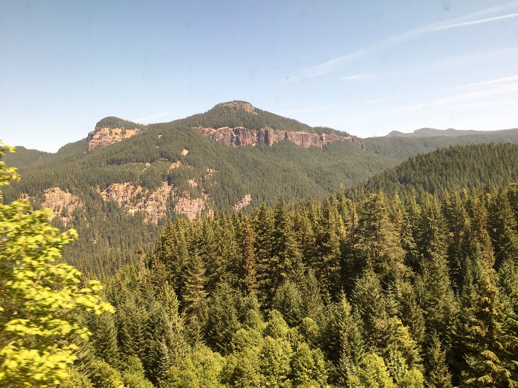
Moon Point is an easy, short out-and-back hike in the Middle Fork Ranger District of Oregon's Willamette National Forest, about 2.2 miles long with a total elevation gain of 102 feet. The trail is managed by the Forest Service and is open year-round. The route rises from about 5,057 feet to about 5,152 feet, with the steepest stretch at roughly 0.28 miles in, where the grade reaches 15%. The trail surface is natural, and both horses and bikes are allowed. Summer is the most comfortable time to go. Typical averages from a nearby weather station at Odell Lake show July and August highs around 73 to 74°F with only about three wet days a month, while winter brings highs in the mid-30s and regular snow days. Young's Rock and Young's Rock Trail #3685 are both about 0.6 miles away. Warner Mountain Lookout is about 1.7 miles off, and Adam's Boulders, a climbing area, is about 4.7 miles away.
Local outfitters
- Casey's Riverside RV Resort15 mi away
- Shelter Cove Resort & Marina18 mi away
Not on Roamze yet. Their page has how to reach them.
Conditions and forecast on Moon Point
Daily highs and lows, wind and the chance of precipitation at the summit and route start for the next 7 days, from the Open-Meteo model.
- Young's RockHiking0.6 mi
- Young's Rock Trail #3685Hiking0.6 mi
- Warner Mountain LookoutCamping1.7 mi
- Youngs Flat/Everage FlatCamping3.5 mi
- Adam's BouldersRock climbing4.7 mi
- Hills CreekCanoeing7.2 mi
- Swift CreekCanoeing7.2 mi
- Hills Creek SpiresRock climbing8.9 mi
Source: Roamze catalog (indexable pages within 10 miles, PostGIS distance)
 Devil's GardenHiking · ~20 min drivePhoto: neverbutterfly, CC BY 2.0 (via Flickr)
 GreenwatersHiking · ~22 min drivePhoto: johnynek, CC BY-SA 2.0 (via Flickr)
- Middle Fork National Recreation TrailHiking · ~9 min drive
- Vivian Lake Trail #3662Hiking · ~18 min drive
 VerdunHiking · ~22 min drivePhoto: Bruce Fingerhood from Springfield, Oregon, US, CC BY 2.0 (via Wikimedia Commons)
 VIVIAN LAKEHiking · ~22 min drivePhoto: James Wellington, CC BY 2.0 (via Flickr)
- Noonday Wagon TrailHiking · ~21 min drive
- Larison Creek Trail #3646Hiking · ~19 min drive
- High DivideHiking · ~15 min drive
 Vivian LakeHiking · ~22 min drivePhoto: Don Henise, CC BY 2.0 (via Flickr)
Best time to visit Moon Point
Best months: May–October. Best months have typical highs of 55–85 °F, lows of 30 °F or warmer (32 °F where the station doesn't record snow), at most one snowy day and no more than 12 wet days.
Jan
35° / 20°
14 wet · 10 snow
Feb
38° / 21°
13 wet · 9 snow
Mar
42° / 24°
14 wet · 8 snow
Apr
46° / 28°
11 wet · 4 snow
May
55° / 34°
9 wet · 1 snow
Jun
63° / 38°
6 wet
Jul
73° / 44°
3 wet
Aug
74° / 42°
3 wet
Sep
68° / 36°
5 wet
Oct
55° / 30°
9 wet · 1 snow
Nov
41° / 26°
14 wet · 6 snow
Dec
34° / 20°
15 wet · 10 snow
Typical high / low (°F) and days with rain or snow, 1991–2020. Measured at Odell Lake-East, OR, 21.7 mi away at 4,800 ft. Source: NOAA NCEI U.S. Climate Normals 1991–2020.
Route details
- Distance
- 2.2 mi round trip
- Climbing
- About 549 ft
- Summit
- 5,138 ft
- Difficulty
- Easy
- Time
- About 1 hour
Season
Season: Year-round.
Questions about this route
How long is the Moon Point on Moon Point?
About 2.2 mi round trip.
How much elevation gain is on the Moon Point?
About 549 ft of climbing round trip.
How hard is the Moon Point?
It is rated easy.
How long does the Moon Point take?
About 1 hour round trip.
When is the best time for the Moon Point?
Year-round.
