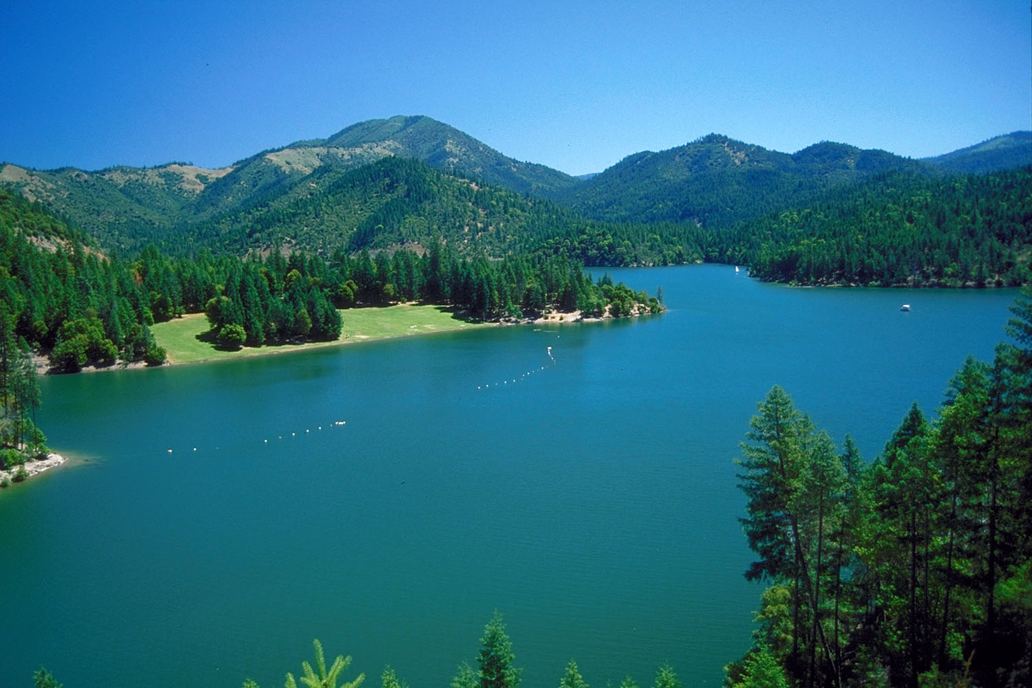
Miller Lake
 Photo: theforestprimeval, CC BY-SA 2.0 (via Flickr)
- 1.4 mi
- round trip
- 2,705 ft
- climb
- 5,882 ft
- high point
- Out and back
- route
Caution at last check
Agency alerts are in effect for this area; weather is good · USFS, OpenWeather · checked 23 h ago
Is Miller Lake open right now?
Closure in the area
There's a closure order in Siskiyou Mountains Ranger District. It doesn't name Miller Lake, so check the source for the area it covers.
Ashland Municipal Watershed Camping and Fire Prohibition
Agency closure covering Siskiyou Mountains Ranger District · Order 06-10-20-23-52 · USFS · Siskiyou Mountains Ranger District
As of · Source: USFS · Siskiyou Mountains Ranger District. Agencies don't list every closure — check before you go.
Miller Lake is an out-and-back hike in the Siskiyou Mountains Ranger District of the Rogue River-Siskiyou National Forests in Oregon, managed by the Forest Service. The trail is about 1.4 miles one way, with a total round-trip distance of roughly 2.8 miles. It gains about 1,060 feet one way, totaling about 2,705 feet round trip. The trail is rated easy and is open to both hikers and riders. Bikes and horses are allowed, and the surface is natural. The route isn't accessible. The steepest stretch comes around mile 3, with a grade of about 27%. For more time on foot, O'brien Creek and Elk Creek are both about 3 miles away, and Sturgis Fork is a little farther. Carberry Creek offers canoeing about 6 miles off, and Watkins Campground sits about 8 miles away.
Local outfitters
- Applegate Trail Rides10 mi away
- Huntfluent Guide Service25 mi away
Not on Roamze yet. Their page has how to reach them.
Keep exploring — more trails worth the drive
 Photo: Curt Kline, CC BY 3.0 (via Wikimedia Commons)
Mountain View Mine Trail
~7 min drive
6.06-mile out-and-back hike in Oregon with 3,933 ft elevation gain and loss.
 Photo: James Wellington, CC BY 2.0 (via Flickr)
Cliff Nature Trail
~10 min drive
0.49-mile loop with 494 ft gain in Oregon.
Photo: James Wellington, CC BY 2.0 (via Flickr)No Name Trail
~11 min drive
1.48-mile out-and-back hike in Oregon with 1,342 ft elevation gain
HIKE
Boundary Trail
~8 min drive
Boundary Trail is a 15.23-mile out-and-back trail in Oregon.
 Photo: n.p.young, CC BY 3.0 (via Wikimedia Commons)
Da-Ku-Be-Te-De
~14 min drive
8.32-mile out-and-back trail in Oregon with 2,067 ft gain
HIKE
Sturgis Fork
~5 min drive
0.84-mile out-and-back trail in Oregon with 682 ft elevation gain.
 Photo: Forest Service Pacific Northwest Region, Public Domain Mark (via Flickr)
Kings Saddle
~15 min drive
3.00-mile out-and-back trail in Oregon with 334 ft gain and 664 ft loss.
HIKE
Big Tree Trail
~9 min drive
3.37-mile out-and-back trail in Oregon with 899 ft gain.
 Photo: n.p.young, CC BY 3.0 (via Wikimedia Commons)
Payette
~15 min drive
15.16-mile out-and-back trail in Oregon with 2,383 ft gain.
HIKE
Whisky Peak Trail
~7 min drive
0.98-mile out-and-back hike in Oregon with 782 ft of elevation gain