Maiden Lake Trail #3841
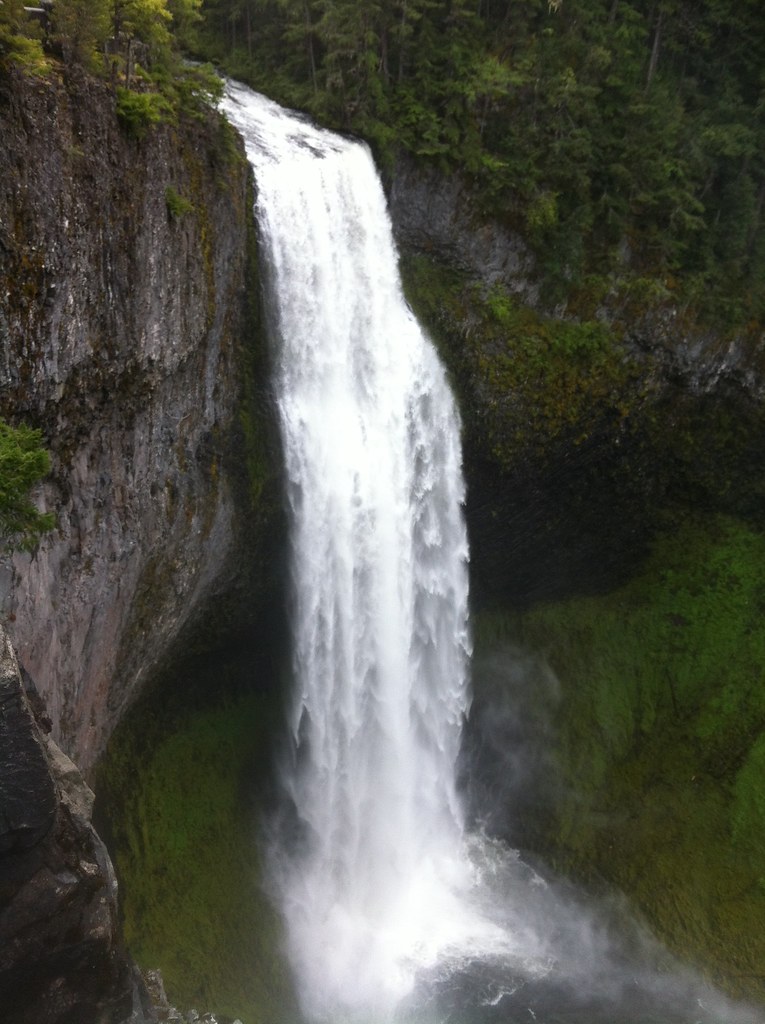
 Photo: Šarūnas Burdulis from USA, CC BY-SA 2.0 (via Wikimedia Commons)
- 5.4 mi
- round trip
- 2,549 ft
- climb
- 6,544 ft
- high point
- Out and back
- route
Is Maiden Lake Trail #3841 open right now?
Closure in the area
There's a closure order in Deschutes National Forest. It doesn't name Maiden Lake Trail #3841, so check the source for the area it covers.
West Bend Area Trail Closures
Agency closure covering Deschutes National Forest · USFS · Deschutes National Forest
Camping & Campfire Restrictions Forest Order
Agency alert covering Deschutes National Forest · Order 06-01-26-01 · USFS · Deschutes National Forest
Cave Resource Protection Forest Order
Agency alert covering Deschutes National Forest · Order 06-01-26-02 · USFS · Deschutes National Forest
Deschutes 14-Day Camping Order
Agency alert covering Deschutes National Forest · Order 06-01-25-01 · USFS · Deschutes National Forest
Wilderness Permit, Camping & Fire Restrictions Order
Agency alert covering Deschutes National Forest · Order 06-01-24-01 · USFS · Deschutes National Forest
As of · Source: USFS · Deschutes National Forest. Agencies don't list every closure — check before you go.
Maiden Lake Trail #3841 is a hard hike on the Forest Service land of the Crescent Ranger District of Deschutes National Forest in central Oregon. It is an out-and-back route of about 11 miles, with a total climb of roughly 2,500 feet and a high point of about 6,544 feet. The trail starts at about 6,030 feet and ends at about 5,001 feet, so the round trip includes about 2,500 feet of descent as well as ascent. The steepest stretch comes at about mile 2.8, with a grade of about 24%. The route is a rolling climb rather than a straight up. The trail is also a short walk from Maiden Lake Nordic, which sits about 0.1 mile away, and from Taits Loop Nordic, about half a mile off. That makes it easy to link a Nordic outing with this hike or its bike version, Taits Loop Bike. Estimated time is about five hours. The nearest camp is Princess Creek Campground, about 1.9 miles away. Odell Lake, roughly 2.9 miles off, offers fishing.
Local outfitters
- Shelter Cove Resort & Marina3 mi away
- Casey's Riverside RV Resort28 mi away
Not on Roamze yet. Their page has how to reach them.
- MAIDEN LAKE NORDICHikingPhoto: Šarūnas Burdulis from USA, CC BY-SA 2.0 (via Wikimedia Commons)0.1 mi
- Taits Loop NordicCross-country skiing0.5 mi
- Taits Loop BikeHiking0.5 mi
 Princess Creek CampgroundCampingPhoto: Recreation.gov (RIDB) / public domain1.9 mi
- Odell LakeLake fishing2.9 mi
 Trapper Creek CampgroundCampingPhoto: Recreation.gov (RIDB) / public domain3 mi
- Gold Lake CampgroundCamping3.4 mi
- Salt CreekCanoeing5.7 mi
Source: Roamze catalog (indexable pages within 10 miles, PostGIS distance)
 TAITS LOOP SOUTH TIEHiking · ~1 min drivePhoto: Šarūnas Burdulis from USA, CC BY-SA 2.0 (via Wikimedia Commons)
 Pct - Oregon Section EHiking · ~3 min drivePhoto: Bruce Fingerhood from Springfield, Oregon, US, CC BY 2.0 (via Wikimedia Commons)
 Yoran Lake TrailHiking · ~6 min drivePhoto: lamblukas, CC BY 2.0 (via Flickr)
 Gold LakeHiking · ~8 min drivePhoto: Bonnie Moreland (free images), Public Domain Mark (via Flickr)
 LOWER MARILYN LAKES NORDICHiking · ~4 min drivePhoto: OregonDOT, CC BY 2.0 (via Flickr)
- WHITEFISH CREEKHiking · ~5 min drivePhoto: lamblukas, CC BY 2.0 (via Flickr)
 MAKLAKS NORDIC LOOPHiking · ~9 min drivePhoto: functoruser, CC BY 2.0 (via Flickr)
- Twins PeakHiking · ~8 min drivePhoto: Bonnie Moreland (free images), Public Domain Mark (via Flickr)
- DIAMOND VIEW LOOP NORDICHiking · ~4 min drivePhoto: OregonDOT, CC BY 2.0 (via Flickr)
 FUJI CREEK NORDICHiking · ~10 min drivePhoto: cjmartin, CC BY 2.0 (via Flickr)

Map and trail data © OpenStreetMap contributors
