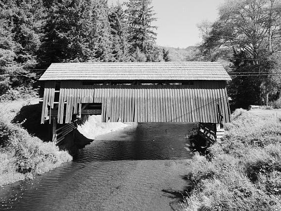
Drift Creek Falls
 Photo: Forest Service Pacific Northwest Region, Public Domain Mark (via Flickr)
- 3.0 mi
- round trip
- 1,377 ft
- climb
- 965 ft
- high point
- Out and back
- route
- Jun–Sep
- best months
Is Drift Creek Falls open right now?
Closure in the area
There's a closure order in Hebo Ranger District. It doesn't name Drift Creek Falls, so check the source for the area it covers (2 listed).
Cascade Head Road (FSR 1861) Motor Vehicle Traffic Closure
Agency closure covering Hebo Ranger District · Order 06-12-01-26-03 · USFS · Hebo Ranger District
Homestead Trailhead Closure
Agency closure covering Siuslaw National Forest · Order 06-12-10-26-11 · USFS · Siuslaw National Forest
Sutton Lake Boat Ramp Closure
Agency alert covering Siuslaw National Forest · Order 06-12-10-26-07 · USFS · Siuslaw National Forest
Forest Service Road 1633 Road Closure
Agency alert covering Hebo Ranger District · Order 06-12-01-26-01 · USFS · Hebo Ranger District
As of · Source: USFS · Hebo Ranger District. Agencies don't list every closure — check before you go.
Drift Creek Falls is a moderate 3-mile out-and-back hike on the Drift Creek Trailhead in the Hebo Ranger District of Oregon's Siuslaw National Forest. The trail is open year-round and takes about 1.5 hours to complete. The route starts at 559 feet and climbs steadily to 965 feet, with a total gain and loss of 1,377 feet for the round trip. The steepest part of the hike comes early, at about 0.28 miles in, where the grade reaches 18 percent. Bikes are allowed on the gravel surface, and the trail is not accessible. Summer is the most comfortable time to go. At a nearby weather station in Otis, typical July and August highs average around 71 to 72°F with only about seven wet days a month, while winter months bring highs in the upper 40s and rain on more than half the days. The North Loop Trail lies just 0.2 miles away. Paddlers can find Drift Creek about 2.6 miles off and Sampson Creek about 2.9 miles off. Valley Of The Giants is a hike roughly 7 miles away.
Local outfitters
- Salmon River RV Park6 mi away
- Rock Your World8 mi away
Not on Roamze yet. Their page has how to reach them.
Best time to go · Jun–Sep
Best time to visit Drift Creek Falls
Best months: June–September. Best months have typical highs of 55–85 °F, lows of 30 °F or warmer (32 °F where the station doesn't record snow), at most one snowy day and no more than 12 wet days.
Jan
49° / 38°
26 wet
Feb
51° / 38°
21 wet
Mar
55° / 39°
22 wet
Apr
59° / 41°
19 wet
May
63° / 45°
15 wet
Jun
66° / 49°
12 wet
Jul
71° / 51°
7 wet
Aug
72° / 52°
7 wet
Sep
70° / 49°
10 wet
Oct
61° / 45°
17 wet
Nov
53° / 41°
23 wet
Dec
48° / 37°
27 wet
Typical high / low (°F) and days with rain or snow, 1991–2020. Measured at Otis 2 Ne, OR, 7.5 mi away at 150 ft. The station sits about 800 ft lower than this place, so expect it a little cooler here. Source: NOAA NCEI U.S. Climate Normals 1991–2020.
Keep exploring — more trails worth the drive
 Photo: OregonDOT, CC BY 2.0 (via Flickr)
Alder Island Nature Trail
~14 min drive
0.64-mile loop trail in Oregon with 71 ft elevation gain.
 Photo: Art Anderson, CC BY-SA 3.0 (via Wikimedia Commons)
Cascade Head Trail
~17 min drive
3.29-mile point-to-point trail in Oregon with 2,524 ft elevation gain
HIKE
Cascade Head
~18 min drive
6-mile out-and-back trail at Cascade Head in Oregon with 654 ft gain.
 Photo: Leslie Seaton from Seattle, WA, USA, CC BY 2.0 (via Wikimedia Commons)
High Meadow Trail
~17 min drive
1.2-mile out-and-back trail in Oregon with 592 ft elevation gain
 Photo: Leslie Seaton from Seattle, WA, USA, CC BY 2.0 (via Wikimedia Commons)
Hart's Cove
~19 min drive
5.16-mile out-and-back trail in Oregon with 1,933 ft gain.
HIKE
Pioneer Indian
~35 min drive
16-mile out-and-back trail in Oregon with 2,029 ft elevation gain.
 Photo: ixmati, CC BY 2.0 (via Flickr)
Old Baldy Trail
~17 min drive
0.66-mile out-and-back trail in Oregon with 169 ft of elevation gain.
Photo: Forest Service Pacific Northwest Region, Public Domain Mark (via Flickr)North Loop Trail
Next door
1.62-mile out-and-back trail in Oregon with 1,126 ft elevation gain
Photo: Leslie Seaton from Seattle, WA, USA, CC BY 2.0 (via Wikimedia Commons)Ranch Hill Loop Trail
~17 min drive
0.57-mile loop trail in Oregon with 205 ft elevation gain.
 Photo: lumachrome, CC BY-SA 2.0 (via Flickr)
Niagra Falls
~38 min drive
2.02-mile out-and-back trail in Oregon with 471 ft gain and 715 ft loss.