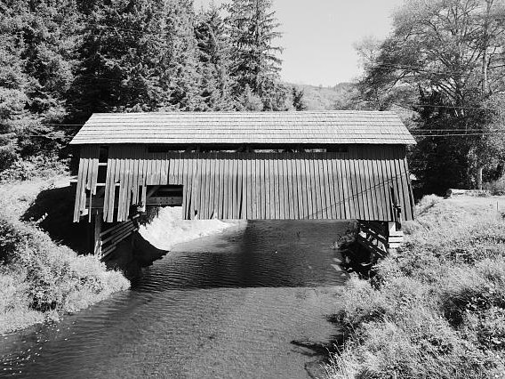
Alder Island Nature Trail
 Photo: OregonDOT, CC BY 2.0 (via Flickr)
- 0.6 mi
- loop
- 17 ft
- high point
- Loop
- route
- Easy
- difficulty
- Jun–Sep
- best months
Alder Island Nature Trail is a short, easy loop on Bureau of Land Management land in the Siletz River area of Oregon, about 0.6 miles long and roughly 17 feet from its lowest point to its highest. The trail is flat, with no elevation gain, and the steepest stretch comes at about 0.36 miles in, with a grade of about 2 percent. Summer is the most comfortable time to go. Typical averages from a nearby weather station show July and August highs around 71 to 72°F, with only about seven wet days a month, while winter months bring highs in the upper 40s and rain on more than half the days. Agnes Creek South Trail and Agnes Creek North Trail are both within about 4 miles. Schooner Creek, a canoeing route, is about 4 miles away, and Drift Creek Falls is about 8 miles off.
Local outfitters
- Rock Your World5 mi away
- Boiler Bay RV Park5 mi away
Not on Roamze yet. Their page has how to reach them.
- Agnes Creek South TrailHiking3.8 mi
- Agnes Creek North TrailHiking4.1 mi
- Schooner CreekCanoeing4.2 mi
 D RiverCanoeingPhoto: Becherka, Public domain (via Wikimedia Commons)5 mi
 Drift CreekCanoeingPhoto: Unknown author, Public domain (via Wikimedia Commons)5.6 mi
- Cedar CreekCanoeing6.4 mi
- Depoe Bay Park TrailHiking6.6 mi
 Drift Creek FallsHikingPhoto: Forest Service Pacific Northwest Region, Public Domain Mark (via Flickr)8 mi
Source: Roamze catalog (indexable pages within 10 miles, PostGIS distance)
- Drift Creek FallsHiking · ~14 min drivePhoto: Forest Service Pacific Northwest Region, Public Domain Mark (via Flickr)
 High Meadow TrailHiking · ~17 min drivePhoto: Leslie Seaton from Seattle, WA, USA, CC BY 2.0 (via Wikimedia Commons)
- Cascade HeadHiking · ~21 min drive
- North Loop TrailHiking · ~14 min drivePhoto: Forest Service Pacific Northwest Region, Public Domain Mark (via Flickr)
 Old Baldy TrailHiking · ~17 min drivePhoto: ixmati, CC BY 2.0 (via Flickr)
 Cascade Head TrailHiking · ~17 min drivePhoto: Art Anderson, CC BY-SA 3.0 (via Wikimedia Commons)
- Salmon River TrailHiking · ~17 min drivePhoto: Leslie Seaton from Seattle, WA, USA, CC BY 2.0 (via Wikimedia Commons)
 Hart's CoveHiking · ~20 min drivePhoto: Leslie Seaton from Seattle, WA, USA, CC BY 2.0 (via Wikimedia Commons)
- Ranch Hill Loop TrailHiking · ~17 min drivePhoto: Leslie Seaton from Seattle, WA, USA, CC BY 2.0 (via Wikimedia Commons)
 Ocean to Bay TrailHiking · ~29 min drivePhoto: Sheila Sund from Salem, United States, CC BY 2.0 (via Wikimedia Commons)
Best time to visit Alder Island Nature Trail
Best months: June–September. Best months have typical highs of 55–85 °F, lows of 30 °F or warmer (32 °F where the station doesn't record snow), at most one snowy day and no more than 12 wet days.
Jan
49° / 38°
26 wet
Feb
51° / 38°
21 wet
Mar
55° / 39°
22 wet
Apr
59° / 41°
19 wet
May
63° / 45°
15 wet
Jun
66° / 49°
12 wet
Jul
71° / 51°
7 wet
Aug
72° / 52°
7 wet
Sep
70° / 49°
10 wet
Oct
61° / 45°
17 wet
Nov
53° / 41°
23 wet
Dec
48° / 37°
27 wet
Typical high / low (°F) and days with rain or snow, 1991–2020. Measured at Otis 2 Ne, OR, 10.4 mi away at 150 ft. Source: NOAA NCEI U.S. Climate Normals 1991–2020.
