Devil's Peak Trail
 Photo: oregondave, CC BY-SA 3.0 (via Wikimedia Commons)
- 1.5 mi
- round trip
- 1,996 ft
- climb
- 4,475 ft
- high point
- Out and back
- route
- May–Oct
- best months
Is Devil's Peak Trail open right now?
Closure in the area
There's a closure order in Detroit Ranger District. It doesn't name Devil's Peak Trail, so check the source for the area it covers (3 listed).
Beachie Creek and Lionshead Fires Closure
Agency closure covering Detroit Ranger District · Order 06-18-04-26-14 · USFS · Detroit Ranger District
Beachie Creek and Lionshead Fires Closure
Agency closure covering Detroit Ranger District · Order 06-18-04-26-14 · USFS · Detroit Ranger District
Cedar Creek Fire Closure
Agency closure covering Willamette National Forest · Order 06-18-10-26-04 · USFS · Willamette National Forest
FIRE CLOSURES: Current wildfire closures on the Willamette National Forest
Agency alert covering Willamette National Forest · USFS · Willamette National Forest
As of · Source: USFS · Detroit Ranger District. Agencies don't list every closure — check before you go.
Devil's Peak Trail is a 2.9-mile out-and-back hike in the Detroit Ranger District of Oregon's Willamette National Forest. The Forest Service manages the land, and the trail rises from 3,081 feet to a high point of 4,475 feet, with a total elevation gain of 1,996 feet over the course of the trip. That makes the climb a moderate effort, and the route is a rolling one, with the steepest stretch coming at about 0.37 miles in, where the grade reaches 47%. Summer is the most comfortable time to go. Typical averages from a nearby weather station at Santiam Junction, which sits about 725 feet lower than the trail's high point, show July and August highs around 76°F with lows near 42°F. Winter is cold there, with January highs in the upper 30s and lows in the mid-20s. The hike takes about two hours. South Breitenbush Gorge is about 0.6 miles away, and the Ann Arbor Hot Springs trail is about 1.2 miles off. Breitenbush Campground lies about 1.9 miles away, and Devils Creek, a canoeing spot, is about 1.4 miles from the trail.
Local outfitters
- Big Lake Youth Camp39 mi away
- Oregon Territory Outfitters39 mi away
Not on Roamze yet. Their page has how to reach them.
Conditions and forecast on Devils Peak
Daily highs and lows, wind and the chance of precipitation at the summit and route start for the next 7 days, from the Open-Meteo model.
- South Breitenbush GorgeHikingPhoto: oregondave, CC BY-SA 3.0 (via Wikimedia Commons)0.6 mi
- Ann Arbor Hot Springs trailHikingPhoto: oregondave, CC BY-SA 3.0 (via Wikimedia Commons)1.2 mi
- Devils CreekCanoeing1.4 mi
- Breitenbush CgCamping1.9 mi
- Cleator BendCamping2.1 mi
- TriangulationHiking3.1 mi
 North Fork Breitenbush RiverCanoeingPhoto: EncMstr, CC BY-SA 3.0 (via Wikimedia Commons)4.1 mi
- South Fork Breitenbush RiverCanoeing4.2 mi
Source: Roamze catalog (indexable pages within 10 miles, PostGIS distance)
- South Breitenbush GorgeHiking · ~1 min drivePhoto: oregondave, CC BY-SA 3.0 (via Wikimedia Commons)
- Ann Arbor Hot Springs trailHiking · ~2 min drivePhoto: oregondave, CC BY-SA 3.0 (via Wikimedia Commons)
 Climber's TrailHiking · ~14 min drivePhoto: Nwcamera1, CC BY-SA 3.0 (via Wikimedia Commons)
 Gold Butte LookoutHiking · ~12 min drivePhoto: U.S. Forest Service- Pacific Northwest Region, Public domain (via Wikimedia Commons)
 Double PeaksHiking · ~13 min drivePhoto: BHunsaker, CC BY 3.0 (via Wikimedia Commons)
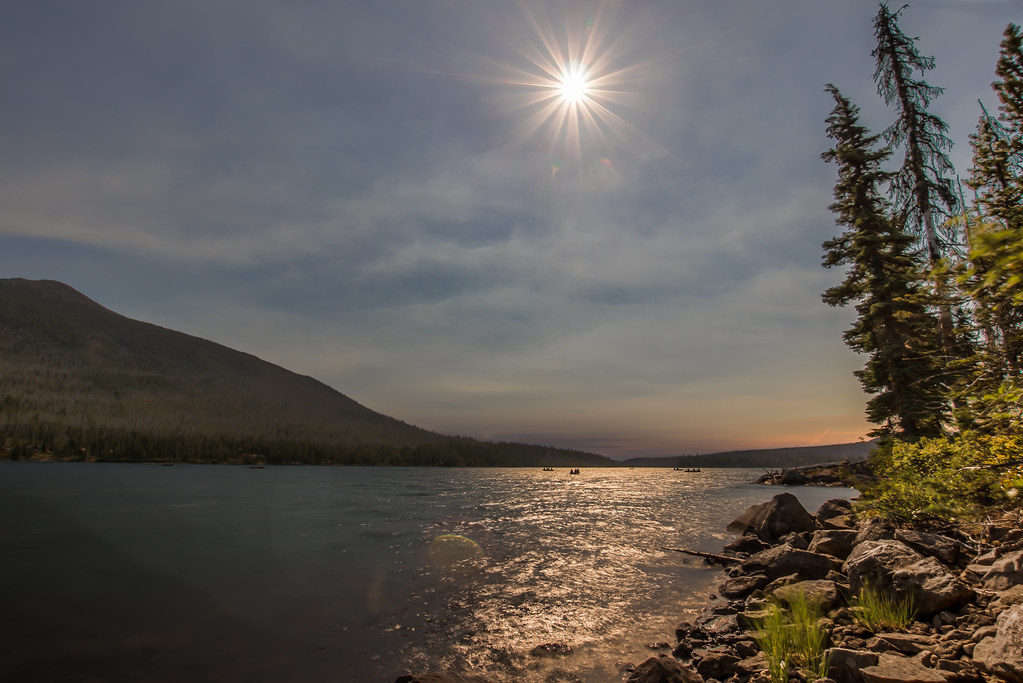 Red Lake Trail #719Hiking · ~14 min drivePhoto: Infinite Dust, CC BY-SA 2.0 (via Flickr)
 Pyramid ButteHiking · ~14 min drivePhoto: LukeDetwiler, CC BY 2.0 (via Flickr)
 Ruddy HillHiking · ~13 min drivePhoto: Forest Service Pacific Northwest Region, Public Domain Mark (via Flickr)
- CragHiking · ~7 min drive
- South Breitenbush GorgeHiking · ~2 min drive
Best time to visit Devil's Peak Trail
Best months: May–October. Best months have typical highs of 55–85 °F, lows of 30 °F or warmer (32 °F where the station doesn't record snow), at most one snowy day and no more than 12 wet days.
Jan
38° / 24°
Feb
41° / 24°
Mar
44° / 26°
Apr
49° / 29°
May
58° / 35°
Jun
65° / 38°
Jul
76° / 42°
Aug
76° / 42°
Sep
69° / 39°
Oct
56° / 33°
Nov
42° / 28°
Dec
36° / 23°
Typical high / low (°F) and days with rain or snow, 1991–2020. Measured at Santiam Junction, OR, 22.8 mi away at 3,750 ft. The station sits about 700 ft lower than this place, so expect it a little cooler here. This station doesn't record snowfall. Source: NOAA NCEI U.S. Climate Normals 1991–2020.
Route details
- Distance
- 1.5 mi round trip
- Climbing
- About 1,996 ft
- Summit
- 4,527 ft
- Difficulty
- Moderate
- Time
- About 1.5 hours
Questions about this route
How long is the Devil's Peak Trail on Devils Peak?
About 1.5 mi round trip.
How much elevation gain is on the Devil's Peak Trail?
About 1,996 ft of climbing round trip.
How hard is the Devil's Peak Trail?
It is rated moderate.
How long does the Devil's Peak Trail take?
About 1.5 hours round trip.
Map and trail data © OpenStreetMap contributors
