Castle Rock
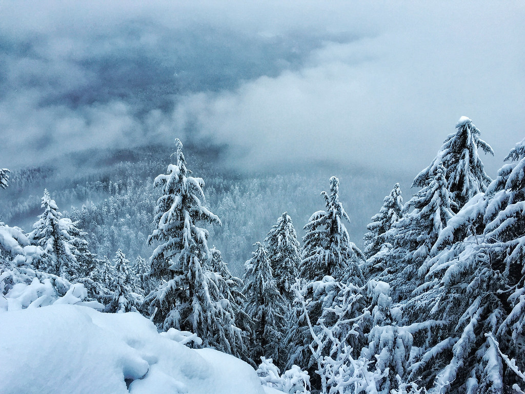 Photo: Forest Service Pacific Northwest Region, Public Domain Mark (via Flickr)
- 9.0 mi
- round trip
- 4,523 ft
- climb
- 3,800 ft
- high point
- Out and back
- route
- May–Oct
- best months
Is Castle Rock open right now?
Closure in the area
There's a closure order in Willamette National Forest. It doesn't name Castle Rock, so check the source for the area it covers.
Cedar Creek Fire Closure
Agency closure covering Willamette National Forest · Order 06-18-10-26-04 · USFS · Willamette National Forest
FIRE CLOSURES: Current wildfire closures on the Willamette National Forest
Agency alert covering Willamette National Forest · USFS · Willamette National Forest
As of · Source: USFS · Willamette National Forest. Agencies don't list every closure — check before you go.
Castle Rock is a 9-mile hike in the McKenzie River Ranger District of Oregon's Willamette National Forest. It is rated hard and follows a natural-surface trail that is also open to bikes. The route is an out-and-back with an unusual shape. It begins at about 3,700 feet, close to its high point of 3,800 feet, then drops to a low of about 2,200 feet before you turn and climb back out. The page's stats list about 1,580 feet of gain one way, but the ups and downs along the full round trip add up to roughly 4,500 feet of climbing and the same amount of descent. The steepest pitch comes early, about three-quarters of a mile in, where the grade reaches roughly 44 percent. Summer is the most comfortable season. A nearby weather station at a similar elevation records typical July and August averages of highs around 76°F and lows near 42°F. The trail sits close to other hikes, including King Castle about 1.3 miles away and O Leary Mountain at 1.7 miles. For an overnight stay, McKenzie Bridge campground is about 2.5 miles off, and Delta campground is about 3.6 miles away.
Local outfitters
- Patio RV Park2 mi away
- Horse Creek Lodge & Outfitters3 mi away
Not on Roamze yet. Their page has how to reach them.
Best time to go · May–Oct
Best time to visit Castle Rock
Best months: May–October. Best months have typical highs of 55–85 °F, lows of 30 °F or warmer (32 °F where the station doesn't record snow), at most one snowy day and no more than 12 wet days.
Jan
38° / 24°
Feb
41° / 24°
Mar
44° / 26°
Apr
49° / 29°
May
58° / 35°
Jun
65° / 38°
Jul
76° / 42°
Aug
76° / 42°
Sep
69° / 39°
Oct
56° / 33°
Nov
42° / 28°
Dec
36° / 23°
Typical high / low (°F) and days with rain or snow, 1991–2020. Measured at Santiam Junction, OR, 23.7 mi away at 3,750 ft. This station doesn't record snowfall. Source: NOAA NCEI U.S. Climate Normals 1991–2020.
Keep exploring — more trails worth the drive
 Photo: Robert Ashworth from Bellingham, WA., USA, CC BY 2.0 (via Wikimedia Commons)
O Leary Mountain
~3 min drive
18-mile out-and-back trail in Oregon with 4,258 ft gain.
Photo: Robert Ashworth from Bellingham, WA., USA, CC BY 2.0 (via Wikimedia Commons)Echo
~3 min drive
5.20-mile out-and-back trail in Oregon with 1,443 ft gain.
 Photo: Kane5187, CC BY-SA 4.0 (via Wikimedia Commons)
Lowder Mountain Trail #3329
~6 min drive
19.84-mile out-and-back trail in Oregon with 6,757 ft elevation gain and loss.
 Photo: Robert Ashworth from Bellingham, WA., USA, CC BY 2.0 (via Wikimedia Commons)
Delta Old Growth Nature Trail #3317
~6 min drive
0.47-mile loop trail in Oregon with 135 ft gain and 170 ft loss.
 Photo: theslowlane, CC BY 2.0 (via Flickr)
Frissel
~7 min drive
8.40-mile out-and-back trail in Oregon with 3,882 ft elevation gain.
Photo: Kane5187, CC BY-SA 4.0 (via Wikimedia Commons)Walker Creek
~7 min drive
4.00-mile out-and-back trail in Oregon with 2,105 ft gain
HIKE
WALKER CREEK
~7 min drive
8.7-mile out-and-back trail in Oregon with 5,675 ft elevation gain and loss.
Photo: Kane5187, CC BY-SA 4.0 (via Wikimedia Commons)Terwilliger Hot Springs Trail
~8 min drive
0.45-mile out-and-back hike to Terwilliger Hot Springs in Oregon.
 Photo: Robert Ashworth from Bellingham, WA., USA, CC BY 2.0 (via Wikimedia Commons)
Yankee Mountain Trail #3318
~13 min drive
2.48-mile out-and-back hike with 3,675 ft gain in Oregon
HIKE
Horsepasture Mtn
~10 min drive
2.60-mile out-and-back trail in Oregon with 1,369 ft elevation gain.
