 Photo: Public domain (via Wikimedia Commons)
Paddling · 154 spots
Featured spots
Photo: Public domain (via Wikimedia Commons)Canoeing
Blue River
Roff, Oklahoma
 Photo: Jphill19, CC BY-SA 4.0 (via Wikimedia Commons)
Canoeing
Cache Creek
Temple, Oklahoma
 Photo: Thomas & Dianne Jones, CC BY 2.0 (via Wikimedia Commons)
Canoeing
Deep Fork
Jones, Oklahoma
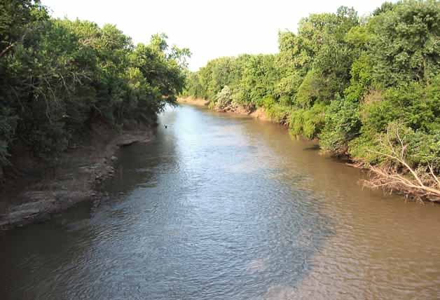 Photo: Public domain (via Wikimedia Commons)
Canoeing
Neosho River
Fort Gibson, Oklahoma
 Photo: unknown NOAA employee, Public domain (via Wikimedia Commons)
Canoeing
North Canadian River
Greenfield, Oklahoma
All spots · 154 spots

Canoeing
Arkansas River
Leadville, Oklahoma
Canoeing
Baron Fork
Stilwell, Oklahoma

Canoeing
Bayou Manard
Fort Gibson, Oklahoma

Canoeing
Beaver Creek
Comanche, Oklahoma
Canoeing
Beaver River
Guymon, Oklahoma

Canoeing
Big Creek
South Coffeyville, Oklahoma
Canoeing
Big Eagle Creek
Smithville, Oklahoma
Canoeing
Big Skin Bayou
Muldrow, Oklahoma
Canoeing
Big Wildhorse Creek
McAlester, Oklahoma
Canoeing
Bird Creek
Pawhuska, Oklahoma
Canoeing
Black Bear Creek
Perry, Oklahoma
Boat launch
Black Kettle Boating Site
Oklahoma
Boat launch
Bo2 Lp1
Oklahoma
Canoeing
Bois d'Arc Creek
Ponca City, Oklahoma

Canoeing
Brazil Creek
Red Oak, Oklahoma

Canoeing
Brushy Creek
Pittsburg, Oklahoma
Canoeing
Buffalo Creek
Talihina, Oklahoma
Canoeing
Buffalo Creek
Buffalo, Oklahoma
Canoeing
Caddo Creek
Bokchito, Oklahoma
Canoeing
Caddo Creek
Ardmore, Oklahoma
Canoeing
California Creek
Lenapah, Oklahoma
Canoeing
Camp Creek
Glencoe, Oklahoma
Canoeing
Canadian Sandy Creek
Ada, Oklahoma
Canoeing
Cane Creek
Boynton, Oklahoma
Keep exploring — more water worth the drive
Little Wewoka Creek
~10 min drive
Little Wewoka Creek is a 19-mile paddling stretch near Wetumka, Oklahoma. It is intermittent and may run dry in some seasons. USGS models an average flow of about 60 cfs and a gradient of about 7.6 feet per mile.
Nuyaka Creek
~28 min drive
Nuyaka Creek is a 20-mile paddling stretch near Okemah, Oklahoma. It is intermittent and may run dry in some seasons. USGS models an average flow of about 80 cfs and a gradient of about 6.1 feet per mile.
Wewoka Creek
~28 min drive
Wewoka Creek is a 17-mile paddling stretch near Seminole, Oklahoma. It is intermittent and may run dry in some seasons. USGS models an average flow of about 110 cfs and a gradient of about 7.4 feet per mile.
Montezuma Creek
~43 min drive
Montezuma Creek is a 23-mile paddling stretch near Henryetta, Oklahoma. It is intermittent and may run dry in some seasons. USGS models an average flow of about 67 cfs and a gradient of about 5.8 feet per mile.
Salt Creek
~48 min drive
Salt Creek is a 24-mile paddling stretch near Depew, Oklahoma. It is intermittent and may run dry in some seasons. USGS models an average flow of about 92 cfs and a gradient of about 6.7 feet per mile.
Wolf Creek
~49 min drive
Wolf Creek is a 9.7-mile paddling stretch near Henryetta, Oklahoma. It flows year-round. USGS models an average flow of about 68 cfs and a gradient of about 8.1 feet per mile.
Salt Creek
~51 min drive
Salt Creek is a 23-mile paddling stretch near Konawa, Oklahoma. It is intermittent and may run dry in some seasons. USGS models an average flow of about 160 cfs and a gradient of about 7.5 feet per mile.
Little River
~52 min drive
Little River is a 55-mile paddling stretch near Tecumseh, Oklahoma. It is intermittent and may run dry in some seasons. USGS models an average flow of about 413 cfs and a gradient of about 5.1 feet per mile.
Quapaw Creek
~52 min drive
Quapaw Creek is a 22-mile paddling stretch near Meeker, Oklahoma. It is intermittent and may run dry in some seasons. USGS models an average flow of about 100 cfs and a gradient of about 6.6 feet per mile.
Mill Creek
~54 min drive
Mill Creek is a 26-mile paddling stretch near Hanna, Oklahoma. It is intermittent and may run dry in some seasons. USGS models an average flow of about 94 cfs and a gradient of about 5.7 feet per mile.
Salt Creek
~56 min drive
Salt Creek is a 12-mile paddling stretch near Beggs, Oklahoma. It is intermittent and may run dry in some seasons. USGS models an average flow of about 43 cfs and a gradient of about 8.5 feet per mile.
Little Deep Fork Creek
~57 min drive
Little Deep Fork Creek is a 20-mile paddling stretch near Depew, Oklahoma. It is intermittent and may run dry in some seasons. USGS models an average flow of about 66 cfs and a gradient of about 5.8 feet per mile.
