Beehunter Trail
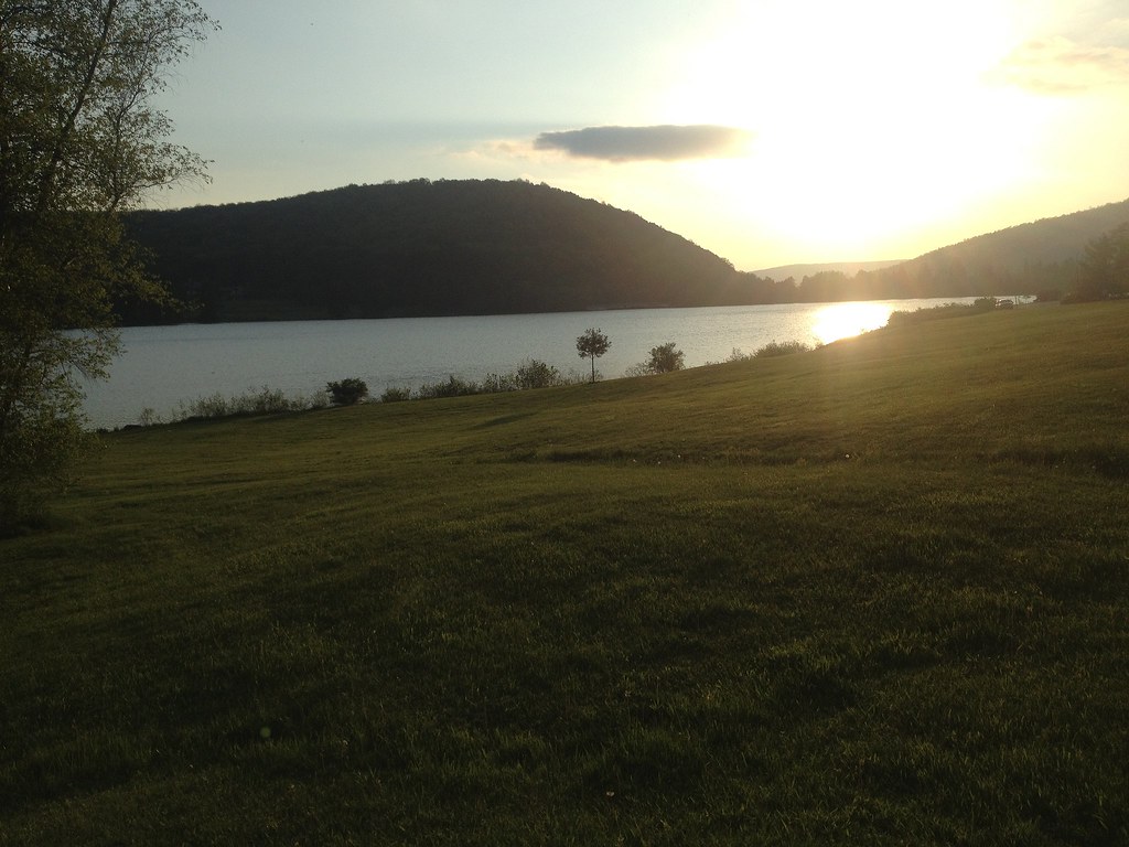 Photo: seabamirum, CC BY 2.0 (via Flickr)
- 5.1 mi
- one way
- 972 ft
- climb
- 2,215 ft
- high point
- Point to point
- route
- Jun–Sep
- best months
Clear at last check
Weather is good · OpenWeather · checked 12 h ago
Beehunter Trail is a 5.1-mile moderate hike in Allegany State Park in western New York, managed by State Park and Recreation. The route is a point-to-point trail with a rolling climb, rising from about 1,560 feet to a high point of 2,215 feet. The total elevation gain is 972 feet, and the trail also drops about 1,200 feet, so it works well as a loop or as a one-way outing with a return on another route. The steepest stretch comes early, with a 36% grade at about 0.07 miles from the start. Summer is the most comfortable time to go. Typical averages from a nearby weather station show July highs around 79°F and lows near 56°F, while temperatures on the higher ground run cooler than those figures. The hike takes about two hours. Osgood Trail lies about a mile away, and Patterson Trail and Snowsnake Run, both cross-country ski routes, are within about a mile and a half. Climbers can find Thunder Rocks about 4 miles off.
 Osgood TrailHikingPhoto: daveynin, CC BY 2.0 (via Flickr)1 mi
- Patterson TrailCross-country skiing1.2 mi
- Snowsnake RunCross-country skiing1.5 mi
- Ridge Run TrailHiking2.1 mi
 Thunder RocksRock climbingPhoto: daveynin, CC BY 2.0 (via Flickr)4 mi
- The Bear CavesRock climbing6.3 mi
- Welcome BoulderRock climbing6.5 mi
 Rock City State ForestRock climbingPhoto: andyarthur, CC BY 2.0 (via Flickr)8.1 mi
Source: Roamze catalog (indexable pages within 10 miles, PostGIS distance)
- Osgood TrailHiking · ~2 min drivePhoto: daveynin, CC BY 2.0 (via Flickr)
 Finger Lakes TrailHiking · ~4 min drivePhoto: javajoe6, CC BY-SA 3.0 (via Wikimedia Commons)
 Pat McGee TrailHiking · ~20 min drivePhoto: Russ Nelson, CC BY-SA 2.0 (via Flickr)
 GowangoHiking · ~23 min drivePhoto: daveynin, CC BY 2.0 (via Flickr)
 Patterson TrailHiking · ~5 min drivePhoto: andyarthur, CC BY 2.0 (via Flickr)
- Sugar RunHiking · ~27 min drive
- Finger Lakes TrailHiking · ~18 min drive
 Sams RocksHiking · ~34 min drivePhoto: U.S. Army Corps of Engineers, photographer not specified or unknown, Public domain (via Wikimedia Commons)
- Sweetwater TrailHiking · ~5 min drivePhoto: andyarthur, CC BY 2.0 (via Flickr)
- Robert Frost Interpretive - New YorkHiking · ~27 min drive
Best time to visit Beehunter Trail
Best months: June–September. Best months have typical highs of 55–85 °F, lows of 30 °F or warmer (32 °F where the station doesn't record snow), at most one snowy day and no more than 12 wet days.
Jan
32° / 15°
17 wet
Feb
34° / 15°
14 wet
Mar
42° / 21°
13 wet
Apr
56° / 32°
13 wet
May
68° / 43°
13 wet
Jun
76° / 52°
12 wet
Jul
79° / 56°
12 wet
Aug
77° / 55°
11 wet
Sep
71° / 48°
11 wet
Oct
59° / 38°
13 wet
Nov
47° / 30°
14 wet
Dec
36° / 22°
16 wet
Typical high / low (°F) and days with rain or snow, 1991–2020. Measured at Allegany Sp, NY, 0.9 mi away at 1,500 ft. The station sits about 700 ft lower than this place, so expect it a little cooler here. This station doesn't record snowfall. Source: NOAA NCEI U.S. Climate Normals 1991–2020.
Map and trail data © OpenStreetMap contributors
