Palo Quemador
- 7.8 mi
- round trip
- 585 ft
- climb
- 8,589 ft
- high point
- Out and back
- route
- May–Jun, Sep
- best months
Is Palo Quemador open right now?
Alert in the area
The Forest Service lists 2 alerts for Santa Fe National Forest.
Road Conditions
Agency alert covering Santa Fe National Forest · USFS · Santa Fe National Forest
Headquarters Well Area Closure on Española Ranger District
Agency alert covering Espanola Ranger District · Order 03-10-06-25-17 · USFS · Espanola Ranger District
As of · Source: USFS · Santa Fe National Forest. Agencies don't list every closure — check before you go.
Palo Quemador is a hard out-and-back hike of about 7.8 miles in the Espanola Ranger District of the Santa Fe National Forest in northern New Mexico, managed by the Forest Service. The trail starts at about 8,122 feet and climbs to a high point of 8,589 feet, with a total elevation gain of 585 feet over the course of the round trip. The route is natural-surfaced and allows both horses and bikes, so it works for riders and pack animals as well as hikers. It stays open year-round, and there is no set season for visiting, though late spring and early fall tend to be the most comfortable times. Typical averages from a nearby weather station at Los Alamos show June highs around 72°F and September highs around 66°F. July and August are the wettest months, with about 15 wet days each, while winter highs hover near freezing. Several other hikes lie within a few miles, including Ojitos Polvadera, Tsi'pin and Seco. Abiquiu Lake, about 8.4 miles away, offers fishing.
- Ojitos PolvaderaHiking3.1 mi
- Tsi'pinHiking3.5 mi
- SecoHiking3.8 mi
- VallecitosHiking4.5 mi
- Canada GonzalesHiking4.7 mi
- Mesa Del MedioHiking4.8 mi
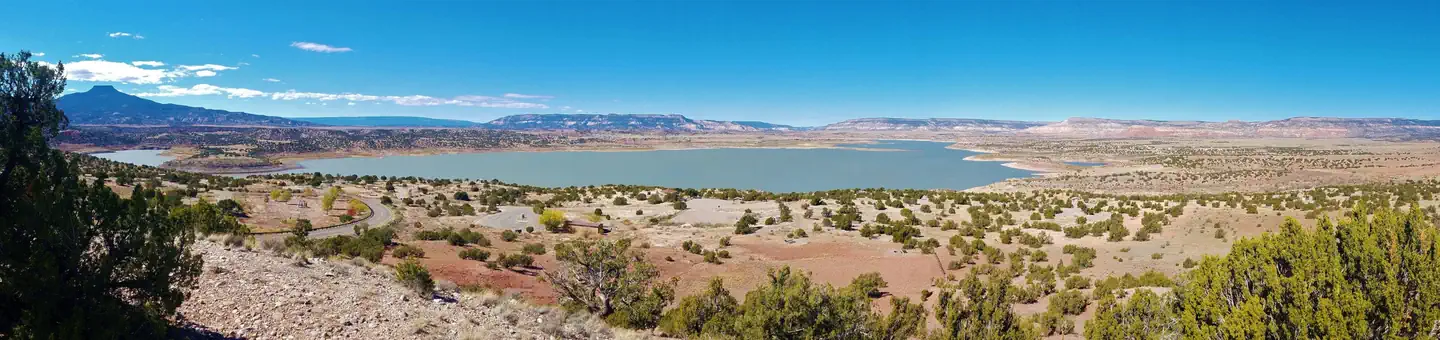 Riana - Abiquiu LakeLake fishing8.4 mi
- Eclipse ButtressRock climbing9.1 mi
Source: Roamze catalog (indexable pages within 10 miles, PostGIS distance)
 Redwash Canyon TrailHiking · ~14 min drivePhoto: BFS Man from Webster, TX, USA, CC BY 2.0 (via Wikimedia Commons)
- Bancos LoopHiking · ~4 min drive
- Ojitos PolvaderaHiking · ~5 min drive
- Tsi'pinHiking · ~6 min drive
- SecoHiking · ~6 min drive
- Canada GonzalesHiking · ~8 min drive
- Mesa Del MedioHiking · ~8 min drive
- VallecitosHiking · ~8 min drive
- ChihuahuenosHiking · ~10 min drive
- MogoteHiking · ~9 min drive
Best time to visit Palo Quemador
Best months: May–June and September. Best months have typical highs of 55–85 °F, lows of 30 °F or warmer (32 °F where the station doesn't record snow), at most one snowy day and no more than 12 wet days.
Jan
36° / 9°
9 wet
Feb
38° / 12°
9 wet
Mar
44° / 20°
9 wet
Apr
52° / 25°
8 wet
May
62° / 32°
8 wet
Jun
72° / 39°
8 wet
Jul
74° / 45°
15 wet
Aug
71° / 43°
15 wet
Sep
66° / 35°
11 wet
Oct
57° / 26°
7 wet
Nov
45° / 17°
6 wet
Dec
36° / 9°
9 wet
Typical high / low (°F) and days with rain or snow, 1991–2020. Measured at Los Alamos 13 W, NM, 18.7 mi away at 8,716 ft. This station doesn't record snowfall. Source: NOAA NCEI U.S. Climate Normals 1991–2020.

