Tahoe-Pyramid Trail
 Photo: Ken Lund, CC BY-SA 2.0 (via Flickr)
- 0.3 mi
- round trip
- 29 ft
- climb
- 4,582 ft
- high point
- Out and back
- route
- Apr–Jun, Sep–Nov
- best months
Is Tahoe-Pyramid Trail open right now?
Closure in the area
There's a closure order in Humboldt-Toiyabe National Forest. It doesn't name Tahoe-Pyramid Trail, so check the source for the area it covers.
Elephant Fire Closure
Agency closure covering Humboldt-Toiyabe National Forest · Order 04-17-26-01-04 · USFS · Humboldt-Toiyabe National Forest
Floriston Fire Closure
Agency alert covering Carson Ranger District · Order 17-26-24 · USFS · Carson Ranger District
Power line construction along SR 88, Alpine County, California (Carson Ranger District)
Agency alert covering Carson Ranger District · USFS · Carson Ranger District
Over-Snow Vehicle Closure (Carson Ranger District)
Agency alert covering Carson Ranger District · Order 04-17-25-12 · USFS · Carson Ranger District
Area, Road, and Trail Closures (Spring Mountains National Recreation Area)
Agency alert covering Humboldt-Toiyabe National Forest · Order 04-17-25-04 · USFS · Humboldt-Toiyabe National Forest
As of · Source: USFS · Humboldt-Toiyabe National Forest. Agencies don't list every closure — check before you go.
The Tahoe-Pyramid Trail is an easy, short out-and-back hike in Nevada's Carson Ranger District of the Humboldt-Toiyabe National Forest, starting and ending at about 4,580 feet. The trail is less than a third of a mile long and gains just 13 feet one way, with the high point at 4,582 feet. The climb is flat, and the steepest stretch comes within the first 0.05 miles at about 2%, making it an easy addition to a longer outing in the area. Spring and fall are the most comfortable times to go. Typical averages from a nearby weather station in Reno run to highs around 74°F in May and 70°F in October, while July highs average about 94°F. The trail sits close to several other outdoor spots. Alum Creek, a canoeing spot, is about 0.3 miles away. The Steamboat Ditch Trail is about 1.2 miles off, and the Chudo Area climbing area and the Hunter Creek hike are both within about 2.2 miles.
Local outfitters
- Alpenglow Expeditions29 mi away
Not on Roamze yet. Their page has how to reach them.
- Alum CreekCanoeing0.3 mi
 Steamboat Ditch TrailHikingPhoto: Ken Lund, CC BY-SA 2.0 (via Flickr)1.2 mi
- Chudo AreaRock climbing2.1 mi
 Hunter CreekHikingPhoto: Ken Lund, CC BY-SA 2.0 (via Flickr)2.2 mi
- Tom Cooke TrailMountain biking2.2 mi
- East Side - misc. problemsRock climbing2.5 mi
- Lower West Side (Broken Promises boulder)Rock climbing2.5 mi
- Steamboat CreekCanoeing8.9 mi
Source: Roamze catalog (indexable pages within 10 miles, PostGIS distance)
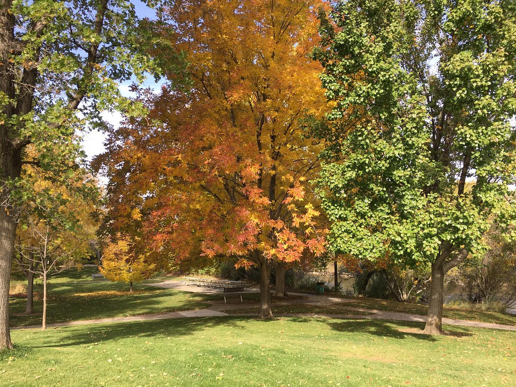 Steamboat Ditch TrailHiking · ~2 min drivePhoto: Ken Lund, CC BY-SA 2.0 (via Flickr)
- Hunter CreekHiking · ~4 min drivePhoto: Ken Lund, CC BY-SA 2.0 (via Flickr)
 Poedunk TrailHiking · ~5 min drivePhoto: Ken Lund, CC BY-SA 2.0 (via Flickr)
- Tom Cooke TrailHiking · ~4 min drivePhoto: Ken Lund, CC BY-SA 2.0 (via Flickr)
 Steamboat Ditch TrailHiking · ~5 min drivePhoto: Ken Lund, CC BY-SA 2.0 (via Flickr)
 Belli Front TrailHiking · ~5 min drivePhoto: theforestprimeval, CC BY-SA 2.0 (via Flickr)
- Keystone Bike TrailHiking · ~5 min drivePhoto: Ken Lund, CC BY-SA 2.0 (via Flickr)
- Halo TrailHiking · ~5 min drive
- Steamboat Ditch TrailHiking · ~2 min drivePhoto: Ken Lund, CC BY-SA 2.0 (via Flickr)
 Rancho Connector TrailHiking · ~5 min drivePhoto: Seth Tisue, CC BY-SA 2.0 (via Flickr)
Best time to visit Tahoe-Pyramid Trail
Best months: April–June and September–November. Best months have typical highs of 55–85 °F, lows of 30 °F or warmer (32 °F where the station doesn't record snow), at most one snowy day and no more than 12 wet days.
Jan
48° / 26°
7 wet · 3 snow
Feb
52° / 29°
7 wet · 3 snow
Mar
59° / 34°
6 wet · 2 snow
Apr
65° / 39°
5 wet · 1 snow
May
74° / 47°
4 wet
Jun
85° / 54°
3 wet
Jul
94° / 60°
2 wet
Aug
92° / 58°
2 wet
Sep
84° / 50°
2 wet
Oct
70° / 40°
3 wet
Nov
57° / 31°
4 wet · 1 snow
Dec
47° / 26°
6 wet · 3 snow
Typical high / low (°F) and days with rain or snow, 1991–2020. Measured at Reno Tahoe Intl Ap, NV, 5.2 mi away at 4,410 ft. Source: NOAA NCEI U.S. Climate Normals 1991–2020.
Map and trail data © OpenStreetMap contributors
