Jefferson Canyon Road
- 1.0 mi
- round trip
- 429 ft
- climb
- 6,821 ft
- high point
- Out and back
- route
- Apr–Jun, Sep–Oct
- best months
Is Jefferson Canyon Road open right now?
Closure in the area
There's a closure order in Humboldt-Toiyabe National Forest. It doesn't name Jefferson Canyon Road, so check the source for the area it covers.
Elephant Fire Closure
Agency closure covering Humboldt-Toiyabe National Forest · Order 04-17-26-01-04 · USFS · Humboldt-Toiyabe National Forest
Area, Road, and Trail Closures (Spring Mountains National Recreation Area)
Agency alert covering Humboldt-Toiyabe National Forest · Order 04-17-25-04 · USFS · Humboldt-Toiyabe National Forest
Year-Round Fire Restrictions (Spring Mountains National Recreation Area)
Agency alert covering Humboldt-Toiyabe National Forest · Order 04-17-24-01 · USFS · Humboldt-Toiyabe National Forest
Vehicle Snow Chain Requirements during Inclement Weather (Spring Mountains National Recreation Area)
Agency alert covering Humboldt-Toiyabe National Forest · Order 04-17-23-01 · USFS · Humboldt-Toiyabe National Forest
Rainbow Canyon Flood Diversion Structure Closure (Spring Mountains National Recreation Area)
Agency alert covering Humboldt-Toiyabe National Forest · Order 04-17-15-01 · USFS · Humboldt-Toiyabe National Forest
As of · Source: USFS · Humboldt-Toiyabe National Forest. Agencies don't list every closure — check before you go.
Jefferson Canyon Road is an easy out-and-back hike in Nevada's Humboldt-Toiyabe National Forest, within the Austin-Tonopah Ranger District. The route is about 2 miles long, with a total elevation gain of 429 feet, and it starts and ends at roughly 6,600 feet. The Forest Service manages the land. The climb is gentle, with the steepest stretch at about 0.6 miles in, where the grade reaches 8 percent. The high point is 6,821 feet, and the low point is 6,595 feet. The trip takes about an hour. Spring and fall are the most comfortable times to go. Typical averages from a nearby weather station at Smoky Valley run to highs around 72°F in May and 68°F in October, while July highs average about 91°F. That station sits roughly 1,200 feet lower than the route, so temperatures on the road run cooler. Nearby options include the Adt - Nevada - S - Seg 5 hike about 2 miles away, Mount Jefferson at about 5 miles, and Windy Pass and Lone Pine Springs, both within about 6 miles.
Best time to go · Apr–Jun, Sep–Oct
Best time to visit Jefferson Canyon Road
Best months: April–June and September–October. Best months have typical highs of 55–85 °F, lows of 30 °F or warmer (32 °F where the station doesn't record snow), at most one snowy day and no more than 12 wet days.
Jan
42° / 17°
4 wet
Feb
48° / 21°
4 wet
Mar
56° / 27°
4 wet
Apr
63° / 32°
4 wet
May
72° / 40°
4 wet
Jun
84° / 47°
3 wet
Jul
91° / 55°
3 wet
Aug
90° / 53°
2 wet
Sep
81° / 44°
2 wet
Oct
68° / 33°
3 wet
Nov
54° / 23°
3 wet
Dec
42° / 16°
4 wet
Typical high / low (°F) and days with rain or snow, 1991–2020. Measured at Smoky Valley - Carvers, NV, 9.6 mi away at 5,647 ft. The station sits about 1,200 ft lower than this place, so expect it a little cooler here. This station doesn't record snowfall. Source: NOAA NCEI U.S. Climate Normals 1991–2020.
Keep exploring — more trails worth the drive
HIKE
Mount Jefferson
~8 min drive
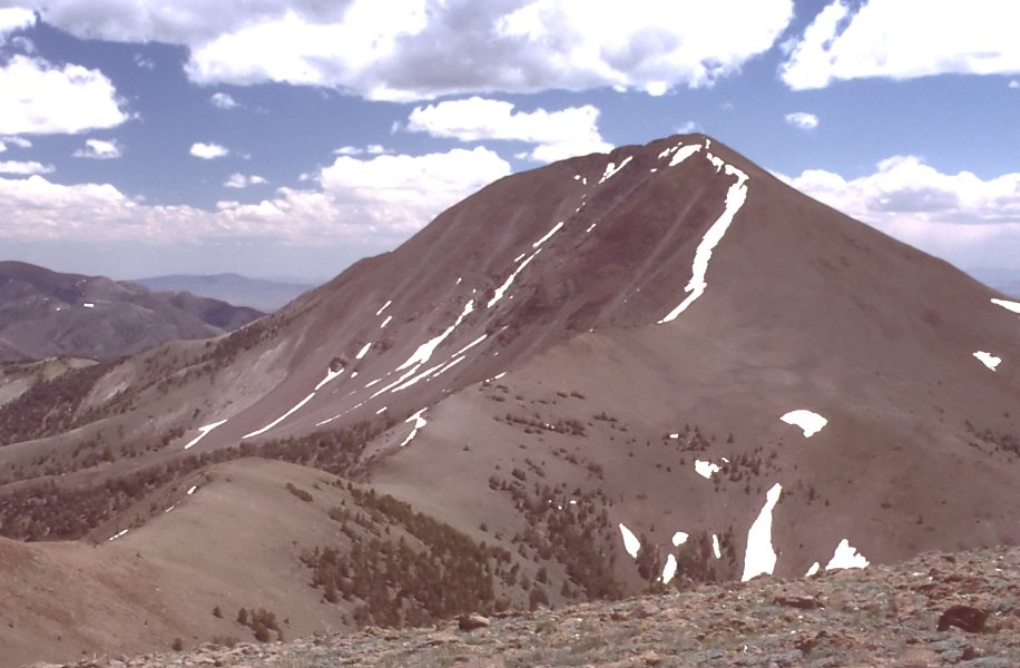
23.03-mile out-and-back trail in Nevada with 1,743 ft elevation gain.
 Photo: Ken Lund from Las Vegas, Nevada, USA, CC BY-SA 2.0 (via Wikimedia Commons)
Fishers Hayfarm Road
~13 min drive
1.94-mile out-and-back trail in Nevada with 144 ft elevation gain.
HIKE
Adt - Nevada - S - Seg 5
~3 min drive
3.90-mile out-and-back trail in Nevada with 2 ft gain and 662 ft loss.
HIKE
Adt - Nevada - S - Seg 4
~21 min drive
24.39-mile out-and-back trail in Nevada with 4,392 ft gain and 3,563 ft loss.
HIKE
Windy Pass Trail
~10 min drive
3.40-mile out-and-back trail in Nevada with 1,794 ft elevation gain.
Photo: Ken Lund from Las Vegas, Nevada, USA, CC BY-SA 2.0 (via Wikimedia Commons)Adt - Nevada - S - Seg 5
~13 min drive
0.37-mile out-and-back trail in Nevada with 15 ft of elevation gain.
HIKE
Windy Pass
~10 min drive
8.76-mile out-and-back trail in Nevada with 1,681 ft gain.
HIKE
Toiyabe Crest Trail
~29 min drive
16.23-mile out-and-back hike on Nevada's Toiyabe Crest Trail with 3,321 ft gain.
HIKE
Middle Summit Mt Jefferson
~11 min drive
4.00-mile out-and-back trail to Middle Summit on Mount Jefferson in Nevada with 1,637 ft of elevation gain.
HIKE
Jefferson Canyon Road
~2 min drive
1.05-mile out-and-back trail in Nevada with 382 ft elevation gain.
Map and trail data © OpenStreetMap contributors
