Gubler Canyon Trail
- 0.9 mi
- round trip
- 415 ft
- climb
- 7,360 ft
- high point
- Out and back
- route
- May–Sep
- best months
Is GUBLER CANYON TRAIL open right now?
Closure in the area
There's a closure order in Ely Ranger District. It doesn't name GUBLER CANYON TRAIL, so check the source for the area it covers (2 listed).
Ward Fire Closure (Ely Ranger District)
Agency closure covering Ely Ranger District · Order 04-17-26-09-02 · USFS · Ely Ranger District
Elephant Fire Closure
Agency closure covering Humboldt-Toiyabe National Forest · Order 04-17-26-01-04 · USFS · Humboldt-Toiyabe National Forest
Area, Road, and Trail Closures (Spring Mountains National Recreation Area)
Agency alert covering Humboldt-Toiyabe National Forest · Order 04-17-25-04 · USFS · Humboldt-Toiyabe National Forest
Year-Round Fire Restrictions (Spring Mountains National Recreation Area)
Agency alert covering Humboldt-Toiyabe National Forest · Order 04-17-24-01 · USFS · Humboldt-Toiyabe National Forest
Vehicle Snow Chain Requirements during Inclement Weather (Spring Mountains National Recreation Area)
Agency alert covering Humboldt-Toiyabe National Forest · Order 04-17-23-01 · USFS · Humboldt-Toiyabe National Forest
As of · Source: USFS · Ely Ranger District. Agencies don't list every closure — check before you go.
Gulber Canyon Trail is an easy out-and-back hike in the Ely Ranger District of the Humboldt-Toiyabe National Forest in eastern Nevada. The trail is managed by the Forest Service and covers about 1.8 miles round trip, with a total elevation gain of 415 feet. The climb is front-loaded, with the steepest section at about 0.8 miles into the hike, where the grade reaches 11 percent. The trail starts at 6,957 feet and reaches a high point of 7,360 feet before returning to the starting elevation. Late spring and early fall are the most comfortable times to go. Typical averages from a nearby weather station in Ruth, Nevada, run to highs around 64°F in May and 75°F in September. Snow is common in winter, with about five or six snow days in each of the coldest months. That station sits about 500 feet lower than the trail's high point, so temperatures on the ridge run cooler. The hike takes about an hour to complete. Pipeline Bypass Trail and Pipeline Canyon Trail both lie within about 2 miles. Ward Mountain Campground is roughly 5 miles away.
- PIPELINE BYPASS TRAILHiking1.5 mi
- PIPELINE CANYON TRAILHiking1.8 mi
- NEW SPRING TRAILHiking3.2 mi
- Iceplant ConnectorHiking4.9 mi
- Ward Loop HMountain biking5.1 mi
- Ward Loop G TrailHiking5.1 mi
- Ward Mountain CampgroundCamping5.3 mi
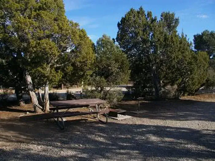 Ward Mtn. Campground (murray Summit)CampingPhoto: Recreation.gov (RIDB) / public domain5.6 mi
Source: Roamze catalog (indexable pages within 10 miles, PostGIS distance)
 Campground Ovens TrailHiking · ~17 min drivePhoto: Seth Tisue, CC BY-SA 2.0 (via Flickr)
- Ward Loop L TrailHiking · ~9 min drive
- Ice Plant CanyonHiking · ~14 min drive
- Ridgeline LoopHiking · ~17 min drivePhoto: Seth Tisue, CC BY-SA 2.0 (via Flickr)
- Ward Loop G TrailHiking · ~9 min drive
- Cave Valley RoadHiking · ~16 min drive
- Riparian LoopHiking · ~17 min drivePhoto: Seth Tisue, CC BY-SA 2.0 (via Flickr)
- Ward Loop GHiking · ~9 min drive
- PIPELINE BYPASS TRAILHiking · ~3 min drive
- Ward Mountain Recreation Area - BIRKIBEINER LOOPHiking · ~11 min drive
Also worth it near here
 Ward MountainSummit · ~8 min drivePhoto: G. Thomas at English Wikipedia, Public domain (via Wikimedia Commons)
 Ward Loop FMountain biking · ~9 min drivePhoto: Chris M Morris, CC BY 2.0 (via Wikimedia Commons)
- Ward Mtn. Campground (murray Summit)Camping · ~10 min drive
- Natural ArchNatural arch · ~14 min drive
Best time to visit GUBLER CANYON TRAIL
Best months: May–September. Best months have typical highs of 55–85 °F, lows of 30 °F or warmer (32 °F where the station doesn't record snow), at most one snowy day and no more than 12 wet days.
Jan
38° / 9°
6 wet · 6 snow
Feb
40° / 12°
6 wet · 5 snow
Mar
47° / 19°
7 wet · 5 snow
Apr
54° / 24°
7 wet · 3 snow
May
64° / 32°
7 wet · 1 snow
Jun
76° / 40°
5 wet
Jul
84° / 47°
5 wet
Aug
82° / 46°
6 wet
Sep
75° / 36°
5 wet
Oct
61° / 25°
4 wet · 1 snow
Nov
47° / 16°
5 wet · 3 snow
Dec
37° / 7°
6 wet · 5 snow
Typical high / low (°F) and days with rain or snow, 1991–2020. Measured at Ruth, NV, 9.8 mi away at 6,858 ft. The station sits about 500 ft lower than this place, so expect it a little cooler here. Source: NOAA NCEI U.S. Climate Normals 1991–2020.
