Ward Loop G Trail
- 2.0 mi
- round trip
- 1,195 ft
- climb
- 7,969 ft
- high point
- Out and back
- route
- May–Sep
- best months
Is Ward Loop G Trail open right now?
Closure in the area
There's a closure order in Ely Ranger District. It doesn't name Ward Loop G Trail, so check the source for the area it covers (2 listed).
Ward Fire Closure (Ely Ranger District)
Agency closure covering Ely Ranger District · Order 04-17-26-09-02 · USFS · Ely Ranger District
Elephant Fire Closure
Agency closure covering Humboldt-Toiyabe National Forest · Order 04-17-26-01-04 · USFS · Humboldt-Toiyabe National Forest
Area, Road, and Trail Closures (Spring Mountains National Recreation Area)
Agency alert covering Humboldt-Toiyabe National Forest · Order 04-17-25-04 · USFS · Humboldt-Toiyabe National Forest
Year-Round Fire Restrictions (Spring Mountains National Recreation Area)
Agency alert covering Humboldt-Toiyabe National Forest · Order 04-17-24-01 · USFS · Humboldt-Toiyabe National Forest
Vehicle Snow Chain Requirements during Inclement Weather (Spring Mountains National Recreation Area)
Agency alert covering Humboldt-Toiyabe National Forest · Order 04-17-23-01 · USFS · Humboldt-Toiyabe National Forest
As of · Source: USFS · Ely Ranger District. Agencies don't list every closure — check before you go.
Ward Loop G Trail is a 4.1-mile out-and-back hike on the Ely Ranger District of the Humboldt-Toiyabe National Forest in Nevada. It begins at about 7,390 feet and climbs to 7,969 feet, with a total elevation gain of 1,195 feet. The trail is rated moderate, and the steepest stretch comes around the 0.76-mile mark, where the grade reaches about 13%. For comfortable conditions, aim for late spring through early fall. Typical averages from the nearby Ruth weather station, which sits about 1,100 feet lower, run from highs near 64°F in May to about 84°F in July, with no snow from June through September. Winter brings highs in the upper 30s and regular snow days. The Ward Loop L Trail lies just 0.1 mile away, and the Ward Loop H mountain biking trail is 0.2 mile off. Ward Mountain Campground and the Ward Mtn. Campground (Murray Summit) site are each about a mile from the trail.
- Ward Loop L TrailHiking0.1 mi
- Ward Loop HMountain biking0.2 mi
- Ward Loop GMountain biking0.5 mi
- Ward Loop KMountain biking0.6 mi
- Rope Tow Flow TrailHiking0.7 mi
- Ward Loop IMountain biking0.9 mi
- Ward Mountain CampgroundCamping1 mi
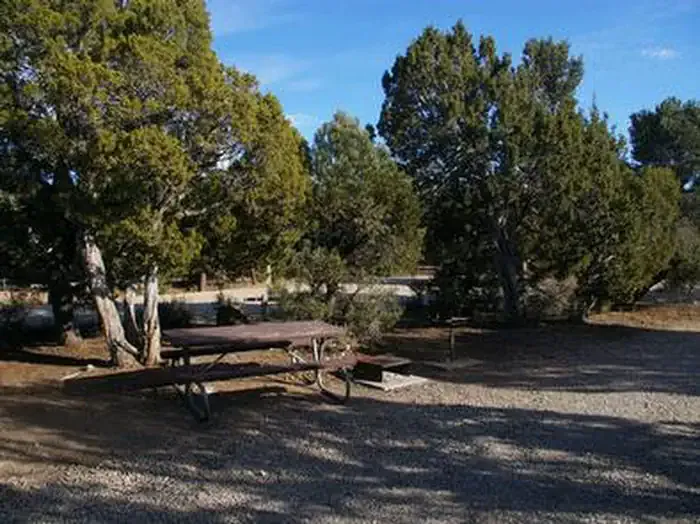 Ward Mtn. Campground (murray Summit)CampingPhoto: Recreation.gov (RIDB) / public domain1 mi
Source: Roamze catalog (indexable pages within 10 miles, PostGIS distance)
- Ward Loop GHiking · ~1 min drive
- Rope Tow Flow TrailHiking · ~1 min drive
- Ice Plant CanyonHiking · ~6 min drive
- Ward Mountain Recreation Area - BIRKIBEINER LOOPHiking · ~3 min drive
- Ward Loop KHiking · ~2 min drive
- Squaw Peak Hill ClimbHiking · ~9 min drive
- North GallagherHiking · ~9 min drive
- Ward Loop IHiking · ~2 min drive
- Cave Valley RoadHiking · ~13 min drive
- South GallagherHiking · ~9 min drive
Also worth it near here
- Ward Mtn. Campground (murray Summit)Camping · ~2 min drive
 Ward Loop FMountain biking · ~2 min drivePhoto: Chris M Morris, CC BY 2.0 (via Wikimedia Commons)
- Natural ArchNatural arch · ~5 min drive
 Ward MountainSummit · ~12 min drivePhoto: G. Thomas at English Wikipedia, Public domain (via Wikimedia Commons)
Best time to visit Ward Loop G Trail
Best months: May–September. Best months have typical highs of 55–85 °F, lows of 30 °F or warmer (32 °F where the station doesn't record snow), at most one snowy day and no more than 12 wet days.
Jan
38° / 9°
6 wet · 6 snow
Feb
40° / 12°
6 wet · 5 snow
Mar
47° / 19°
7 wet · 5 snow
Apr
54° / 24°
7 wet · 3 snow
May
64° / 32°
7 wet · 1 snow
Jun
76° / 40°
5 wet
Jul
84° / 47°
5 wet
Aug
82° / 46°
6 wet
Sep
75° / 36°
5 wet
Oct
61° / 25°
4 wet · 1 snow
Nov
47° / 16°
5 wet · 3 snow
Dec
37° / 7°
6 wet · 5 snow
Typical high / low (°F) and days with rain or snow, 1991–2020. Measured at Ruth, NV, 5.5 mi away at 6,858 ft. The station sits about 1,100 ft lower than this place, so expect it a little cooler here. Source: NOAA NCEI U.S. Climate Normals 1991–2020.
Map and trail data © OpenStreetMap contributors
