Cottonwood Creek
- 2.1 mi
- round trip
- 664 ft
- climb
- 6,901 ft
- high point
- Out and back
- route
- Apr–Jun, Aug–Oct
- best months
Is Cottonwood Creek open right now?
Closure in the area
There's a closure order in Humboldt-Toiyabe National Forest. It doesn't name Cottonwood Creek, so check the source for the area it covers.
Elephant Fire Closure
Agency closure covering Humboldt-Toiyabe National Forest · Order 04-17-26-01-04 · USFS · Humboldt-Toiyabe National Forest
Road Closure for Construction Work (Mountain City-Ruby Mountains-Jarbidge Ranger Districts)
Agency alert covering Mountain City-Ruby Mountains-Jarbidge Ranger District · Order 04-17-26-06-04 · USFS · Mountain City-Ruby Mountains-Jarbidge Ranger District
Area, Road, and Trail Closures (Spring Mountains National Recreation Area)
Agency alert covering Humboldt-Toiyabe National Forest · Order 04-17-25-04 · USFS · Humboldt-Toiyabe National Forest
Year-Round Fire Restrictions (Spring Mountains National Recreation Area)
Agency alert covering Humboldt-Toiyabe National Forest · Order 04-17-24-01 · USFS · Humboldt-Toiyabe National Forest
Vehicle Snow Chain Requirements during Inclement Weather (Spring Mountains National Recreation Area)
Agency alert covering Humboldt-Toiyabe National Forest · Order 04-17-23-01 · USFS · Humboldt-Toiyabe National Forest
As of · Source: USFS · Humboldt-Toiyabe National Forest. Agencies don't list every closure — check before you go.
Cottonwood Creek is an easy, short hike in northern Nevada on Bureau of Land Management land, set in the Wells Field Office within the Humboldt-Toiyabe National Forest's Mountain City-Ruby Mountains-Jarbidge Ranger District. It's a natural-surface out-and-back that climbs about 426 feet over a 2.08-mile round trip, reaching a high point of 6,901 feet from a starting elevation of about 6,513 feet. The trail is open roughly from mid-June through October 30, and the estimated time to complete it is about an hour. The most comfortable stretch is typically late spring through early fall. At a nearby weather station, typical averages run from highs around 65°F in May to 86°F in July, with September easing back to about 76°F. That station sits roughly 940 feet lower than the hike's high point, so expect it to run cooler up top. Horses are allowed, but bikes are not. The closest neighbors are Camp Creek, about 2 miles away, and North Fork Camp Creek, roughly 3 miles off. Gods Pocket Peak and Wildcat Creek lie within about 6 miles.
Best time to go · Apr–Jun, Aug–Oct
Best time to visit Cottonwood Creek
Best months: April–June and August–October. Best months have typical highs of 55–85 °F, lows of 30 °F or warmer (32 °F where the station doesn't record snow), at most one snowy day and no more than 12 wet days.
Jan
37° / 16°
5 wet · 2 snow
Feb
39° / 18°
4 wet · 1 snow
Mar
48° / 26°
4 wet · 1 snow
Apr
55° / 30°
6 wet · 1 snow
May
65° / 37°
7 wet
Jun
75° / 43°
5 wet
Jul
86° / 49°
4 wet
Aug
85° / 47°
3 wet
Sep
76° / 39°
3 wet
Oct
62° / 30°
3 wet
Nov
47° / 22°
4 wet · 1 snow
Dec
37° / 16°
5 wet · 2 snow
Typical high / low (°F) and days with rain or snow, 1991–2020. Measured at Gibbs Rch - Jarbidge 24se, NV, 11.9 mi away at 5,960 ft. The station sits about 900 ft lower than this place, so expect it a little cooler here. Source: NOAA NCEI U.S. Climate Normals 1991–2020.
Keep exploring — more trails worth the drive
 Photo: Matt Lavin, CC BY-SA 2.0 (via Flickr)
Slide Creek
~14 min drive
11.74-mile out-and-back trail in Nevada with 2,234 ft elevation gain.
 Photo: simonov, CC BY-SA 2.0 (via Flickr)
West Marys River to Camp Draw
~20 min drive
5.77-mile out-and-back trail from West Marys River to Camp Draw in Nevada with 1,944 ft gain.
 Photo: Matt Lavin, CC BY-SA 2.0 (via Flickr)
Altitude Trail
~22 min drive
3.45-mile out-and-back trail in Nevada with 753 ft elevation gain
HIKE
Slide 1
~15 min drive
Slide 1 is a 1.75-mile out-and-back trail in Nevada with 218 feet of elevation gain.
 Photo: Matt Lavin, CC BY-SA 2.0 (via Flickr)
Jenny Creek
~23 min drive
8.06-mile out-and-back trail in Nevada with 2,862 ft elevation gain.
 Photo: Matt Lavin, CC BY-SA 2.0 (via Flickr)
Three Day Creek
~21 min drive
9.32-mile out-and-back trail in Nevada with 1,851 ft elevation gain.
HIKE
Emerald Basin
~14 min drive
4.58-mile out-and-back trail in Nevada with 322 ft gain.
HIKE
Marys River
~15 min drive
A 2.08-mile out-and-back trail in Nevada that connects to the Jarbidge River Trail system.
HIKE
West Marys River - Camp Draw Trail
~14 min drive
7.70-mile out-and-back hike in Nevada with 1,002 ft gain and 2,808 ft loss.
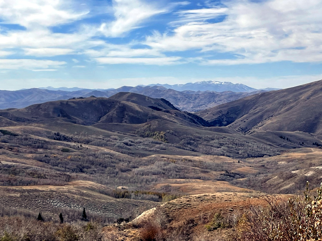 Photo: simonov, CC BY-SA 2.0 (via Flickr)
Pine Creek
~23 min drive
2.23-mile out-and-back trail in Nevada with 670 ft gain

