Concours Parts & Accessories
Campground
Campground · 2.9 mi from the trail
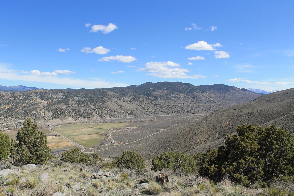 Photo: Nouhailler, CC BY-SA 2.0 (via Flickr)
Bitterbrush Loop is a short, easy loop hike of about 0.4 miles on land within the Nevada State Maximum Security Prison, managed by the State Department of Natural Resources. The trail is a low-elevation outing, with a high point of about 4,810 feet and a total climb of 116 feet, and it makes a quick addition to a visit to the prison grounds. The route is front-loaded, with the steepest stretch at about 0.17 miles in, and the climb is roughly balanced by a similar descent. The loop starts at about 4,771 feet and ends at about 4,768 feet, so the whole trip is nearly flat. Spring and fall are the most comfortable times to go. Typical averages from a nearby weather station in Carson City show May highs around 70°F and October highs around 68°F, while July averages about 90°F. Sagebrush Loop lies just 0.1 mile away, and the Mexican Ditch Trail and Eagle Valley Trail are each about 0.4 miles off. For climbing, Prison Hill is about 1.5 miles away.
Concours Parts & Accessories
Campground
Places © OpenStreetMap contributors, Places © Overture Maps Foundation
More in Sunnyside-Tahoe CityNot on Roamze yet. Their page has how to reach them.
Sagebrush LoopHikingPhoto: Nouhailler, CC BY-SA 2.0 (via Flickr)0.1 mi Prison HillRock climbingPhoto: Nouhailler, CC BY-SA 2.0 (via Flickr)1.5 mi
 Dinosaur RockRock climbingPhoto: Famartin, CC BY-SA 4.0 (via Wikimedia Commons)4.6 mi
Source: Roamze catalog (indexable pages within 10 miles, PostGIS distance)
 Odyssey TrailHiking · ~3 min drivePhoto: jfdervin, CC BY-SA 2.0 (via Flickr)
 Rocky TrailHiking · ~6 min drivePhoto: Nouhailler, CC BY-SA 2.0 (via Flickr)
 Lincoln BypassHiking · ~6 min drivePhoto: Wheeler Cowperthwaite, CC BY 2.0 (via Flickr)Prison Hill TrailHiking · ~3 min drivePhoto: jfdervin, CC BY-SA 2.0 (via Flickr)
 EZ TrailHiking · ~7 min drivePhoto: jfdervin, CC BY-SA 2.0 (via Flickr)
 Ash to Kings TrailHiking · ~9 min drivePhoto: jfdervin, CC BY-SA 2.0 (via Flickr)C Hill Foothill TrailHiking · ~4 min drivePhoto: Wheeler Cowperthwaite, CC BY 2.0 (via Flickr)
 Centennial LoopHiking · ~8 min drivePhoto: Nouhailler, CC BY-SA 2.0 (via Flickr)
 Capital to TahoeHiking · ~9 min drivePhoto: jfdervin, CC BY-SA 2.0 (via Flickr)
 C Mountain Foothill TrailHiking · ~4 min drivePhoto: jfdervin, CC BY-SA 2.0 (via Flickr)
Best months: March–June and September–October. Best months have typical highs of 55–85 °F, lows of 30 °F or warmer (32 °F where the station doesn't record snow), at most one snowy day and no more than 12 wet days.
Jan
45° / 24°
6 wet · 2 snow
Feb
50° / 27°
6 wet · 1 snow
Mar
56° / 32°
5 wet · 1 snow
Apr
62° / 36°
3 wet
May
70° / 43°
3 wet
Jun
81° / 49°
2 wet
Jul
90° / 55°
1 wet
Aug
88° / 53°
1 wet
Sep
81° / 46°
1 wet
Oct
68° / 36°
2 wet
Nov
55° / 28°
3 wet · 1 snow
Dec
45° / 24°
5 wet · 1 snow
Typical high / low (°F) and days with rain or snow, 1991–2020. Measured at Carson City, NV, 2.9 mi away at 4,761 ft. Source: NOAA NCEI U.S. Climate Normals 1991–2020.
Map and trail data © OpenStreetMap contributors
