Shaw Mountain
- 8,126 ft
- summit
- 1
- way up
Is Shaw Mountain open right now?
Alert in the area
The Forest Service lists 6 alerts for Flathead National Forest.
Ashley Lake North Campground Closure
Agency alert covering Flathead National Forest · Order 01-10- · USFS · Flathead National Forest
Camp Creek Fire Updated Trail Closure
Agency alert covering Flathead National Forest · Order 01-10- · USFS · Flathead National Forest
FK&L Area Closed to Public Access Starting July 22, 2026
Agency alert covering Flathead National Forest · Order 01-10- · USFS · Flathead National Forest
Trail 800 Tally-Ashely Closure
Agency alert covering Flathead National Forest · Order 01-10- · USFS · Flathead National Forest
Ryan Creek Occupancy and Use Order
Agency alert covering Flathead National Forest · Order 1-10- · USFS · Flathead National Forest
As of · Source: USFS · Flathead National Forest. Agencies don't list every closure — check before you go.
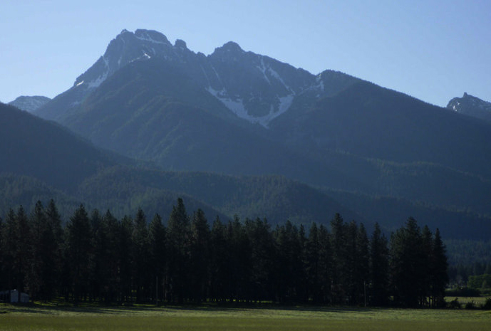
Shaw Mountain is a summit in the Bob Marshall Wilderness of northwest Montana, within the Spotted Bear Ranger District of Flathead National Forest. The closest town is Condon, about 13 miles away. The peak sits inside designated wilderness, so trips here start from the surrounding trail network rather than a road to the top. Several trails lie close to the mountain. Holland-Gordon passes within a mile, and Doctor Creek is under 2 miles off. The Shaw Mtn trail and the Holbrook-Shaw Connect both run about 2 miles away, which makes them the obvious names to look at when planning an approach. For an overnight base, Owl Creek Cabin is about 5 miles away. Holland Lake Campground and the Holland Lake Boating Site sit roughly 6 to 7 miles out, so a summit attempt pairs easily with a stay at the lake.
Conditions and forecast
Daily highs and lows, wind and the chance of precipitation at the summit and route start for the next 7 days, from the Open-Meteo model.
- Summit elevation
- 8,126 ft
Elevation from USGS 3D Elevation Program terrain data (about 10 m resolution).
Map © Mapbox © OpenStreetMap contributors Questions about Shaw Mountain
How tall is Shaw Mountain?
8,126 ft (2,477 m).
How many routes go to the summit of Shaw Mountain?
One: Shaw Mtn.
When is the best time to climb Shaw Mountain?
Year-round.
- Holland-GordonHiking0.8 mi
- Doctor CreekHiking1.7 mi
- Shaw MtnHiking1.9 mi
- Holbrook-Shaw ConnectHiking2 mi
- Owl Creek CabinCamping4.7 mi
- Holland Lake CampgroundCamping6.5 mi
- Owl Creek CorralCamping6.7 mi
- Holland Lake Boating SiteLake fishing7 mi
Source: Roamze catalog (indexable pages within 10 miles, PostGIS distance)
 Turtlehead MountainSummit · ~30 min drivePhoto: Stan Shebs, CC BY-SA 3.0 (via Wikimedia Commons)
 Mount CalowahcanSummit · ~38 min drivePhoto: Run shane run Shane Thomas McMillan, CC BY-SA 3.0 (via Wikimedia Commons)
 Gray Wolf PeakSummit · ~38 min drivePhoto: Thad Lowary, US Forest Service, Public domain (via Wikimedia Commons)
- Lena PeakSummit · ~5 min drive
- Cardinal PeakSummit · ~12 min drive
- Bartlett MountainSummit · ~12 min drive
- Tango PointSummit · ~12 min drive
- Richmond PeakSummit · ~15 min drive
- Kid MountainSummit · ~16 min drive
- Butcher MountainSummit · ~16 min drive

