Meadow Creek Gorge
- 0.4 mi
- distance
- 88 ft
- climb
- May–Oct
- best months
Is Meadow Creek Gorge open right now?
Alert in the area
The Forest Service lists 5 alerts for Flathead National Forest.
Camp Creek Fire Updated Trail Closure
Agency alert covering Flathead National Forest · Order 01-10- · USFS · Flathead National Forest
FK&L Area Closed to Public Access Starting July 22, 2026
Agency alert covering Flathead National Forest · Order 01-10- · USFS · Flathead National Forest
Trail 800 Tally-Ashely Closure
Agency alert covering Flathead National Forest · Order 01-10- · USFS · Flathead National Forest
Ryan Creek Occupancy and Use Order
Agency alert covering Flathead National Forest · Order 1-10- · USFS · Flathead National Forest
Logan Creek Hoke Creek Closure
Agency alert covering Flathead National Forest · Order 01-10- · USFS · Flathead National Forest
As of · Source: USFS · Flathead National Forest. Agencies don't list every closure — check before you go.
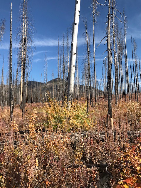
Meadow Creek Gorge is a short, low-elevation mountain biking route in the Spotted Bear Ranger District of Flathead National Forest in western Montana. It runs about 0.44 miles, with a total climb of 88 feet from a starting point around 3,984 feet to a high of 4,018 feet. The trail is a brief ride, and the climb is light, with the steepest stretch at about 10% grade near the start. Summer is the most comfortable time to go. Typical July and August highs reach about 82°F with lows in the upper 40s, based on averages from a nearby weather station at Swan Lake. Winter is cold, with typical January highs around 31°F and lows near 18°F. The Wagon Trail AT Meadow sits about 0.1 mile away, and the Meadow Cr Airstrip Shortcut is about 0.2 mile off. Paddlers can reach the South Fork Flathead River within a short distance, and the Main South Fork hike is about 0.8 mile away.
Local outfitters
- Montana Basecamp46 mi away
Not on Roamze yet. Their page has how to reach them.
Best time to go · May–Oct
Best time to visit Meadow Creek Gorge
Best months: May–October. Best months have typical highs of 55–85 °F, lows of 30 °F or warmer (32 °F where the station doesn't record snow), at most one snowy day and no more than 12 wet days.
Jan
31° / 18°
Feb
36° / 18°
Mar
45° / 26°
Apr
54° / 31°
May
64° / 38°
Jun
71° / 44°
Jul
82° / 48°
Aug
82° / 46°
Sep
70° / 39°
Oct
55° / 32°
Nov
39° / 25°
Dec
30° / 20°
Typical high / low (°F) and days with rain or snow, 1991–2020. Measured at Swan Lake, MT, 20.5 mi away at 3,100 ft. The station sits about 900 ft lower than this place, so expect it a little cooler here. This station doesn't record snowfall. Source: NOAA NCEI U.S. Climate Normals 1991–2020.
Keep exploring — more rides worth the drive
 Photo: Kirk Olson from Jacksonville, FL, USA, CC BY 2.0 (via Wikimedia Commons)
Cabin Creek
~48 min drive
Cabin Creek is a 6.09-mile trail at Elk Hill, Montana with 398 ft of elevation gain.
RIDE
Wagon Trail AT Meadow
Next door
0.25-mile trail at Meadow Creek Trail Head with 98 ft elevation gain
RIDE
Meadow Cr Airstrip Shortcut
Next door
0.16-mile trail at Meadow Creek Trail Head with 10 ft elevation gain
RIDE
Lost Jack Creek
~2 min drive
1.56-mile trail at Meadow Creek Trail Head with 778 ft elevation gain.
RIDE
Cliff By-Pass
~2 min drive
0.24-mile by-pass trail near cliffs in Montana's Meadow Creek Trail Head system.
RIDE
Meadow Mtn.
~4 min drive
3.34-mile trail in Montana's Meadow Creek Trail Head system, 3,321 ft elevation gain
RIDE
Mid Creek Take-Out
~4 min drive
0.05-mile trail in Meadow Creek Trail Head, Montana
RIDE
Main South Fork
~18 min drive
22.89-mile trail at Meadow Creek Trail Head with 2,357 ft of elevation gain
RIDE
Gildart Flats
~35 min drive
Gildart Flats is a 4.2-mile mountain bike trail in Montana.
RIDE
Cabin Creek Admin Spur
~45 min drive
0.25-mile trail in Elk Hill with 37 ft elevation gain

Map and trail data © OpenStreetMap contributors
