Sears Flat Loop a
- 1.7 mi
- loop
- 349 ft
- climb
- 2,083 ft
- high point
- Loop
- route
- Apr–Jun, Sep–Oct
- best months
Is SEARS FLAT LOOP A open right now?
Closure in the area
There's a closure order in Three Rivers Ranger District. It doesn't name SEARS FLAT LOOP A, so check the source for the area it covers (2 listed).
Ross Creek Cedars Road Closure & Storm Damage Update
Agency closure covering Three Rivers Ranger District · Order 01-14-04-26-08 · USFS · Three Rivers Ranger District
Kootenai Flood Event & Inaccessible Areas
Agency closure covering Kootenai National Forest · USFS · Kootenai National Forest
Updated Skillet Fire Area, Road, Trail Closure
Agency alert covering Kootenai National Forest · Order 01-10- · USFS · Kootenai National Forest
Spar Lake Road #384 Road Closed to Motorized Vehicles
Agency alert covering Three Rivers Ranger District · Order 01-14-04-26-04 · USFS · Three Rivers Ranger District
As of · Source: USFS · Three Rivers Ranger District. Agencies don't list every closure — check before you go.
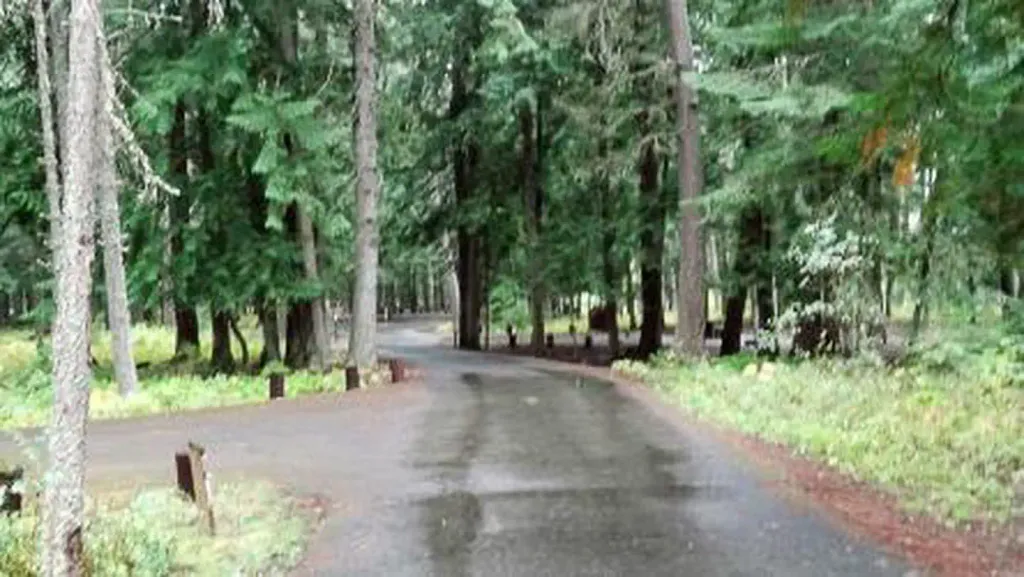
Loop A is a 1.65-mile hike in the Three Rivers Ranger District of Kootenai National Forest in northwest Montana. The Forest Service manages the land, and the route starts and ends at about 1,890 feet, with a one-way climb of 349 feet to a high point around 2,080 feet. The trail is rated easy. The steepest stretch comes early, with a 12% grade about a fifth of the way in. The climb is gentle enough that you can expect a short walk with a little elevation gain rather than a serious effort. Summer is the most comfortable time to go. Typical averages from a nearby weather station at Troy put July highs around 87°F with lows near 49°F, while September cools to about 75°F by day and 42°F at night. Loop B lies just 0.2 miles away, and Yaak River Campground and the Yaak River campground are both about 1.3 miles off. Cougar Ridge X-C Ski is roughly 4 miles away.
Local outfitters
- Kootenai River Campground3 mi away
- Nordman Resort46 mi away
Not on Roamze yet. Their page has how to reach them.
- SEARS FLAT LOOP BHiking0.2 mi
 Yaak River Campground (MT)CampingPhoto: Recreation.gov (RIDB) / public domain1.3 mi
- Yaak RiverCamping1.4 mi
- Yaak Mtn. Lookout RentalCamping2 mi
- COUGAR RIDGE X-C SKIHiking4 mi
- Alvord LakeHiking4.4 mi
 Feeder CreekHikingPhoto: Forest Service - Northern Region, Public Domain Mark (via Flickr)4.6 mi
- Callahan CreekCanoeing7.2 mi
Source: Roamze catalog (indexable pages within 10 miles, PostGIS distance)
- Feeder CreekHiking · ~8 min drivePhoto: Forest Service - Northern Region, Public Domain Mark (via Flickr)
 Tepee MountainHiking · ~12 min drivePhoto: Tony Webster, CC BY-SA 2.0 (via Flickr)
- SEARS FLAT LOOP BHiking · Next door
- Pulpit Mountain SpurHiking · ~14 min drive
 Kootenai CreekHiking · ~18 min drivePhoto: waterarchives, CC BY-SA 2.0 (via Flickr)
 Kootenai River WalkHiking · ~13 min drivePhoto: waterarchives, CC BY-SA 2.0 (via Flickr)
- Alvord LakeHiking · ~8 min drive
- COUGAR RIDGE X-C SKIHiking · ~7 min drive
 GrambauerHiking · ~19 min drivePhoto: Arbron, CC BY 2.0 (via Flickr)
- Wee LakeHiking · ~15 min drive
Best time to visit SEARS FLAT LOOP A
Best months: April–June and September–October. Best months have typical highs of 55–85 °F, lows of 30 °F or warmer (32 °F where the station doesn't record snow), at most one snowy day and no more than 12 wet days.
Jan
33° / 23°
13 wet
Feb
39° / 24°
10 wet
Mar
50° / 28°
11 wet
Apr
59° / 33°
9 wet
May
70° / 40°
10 wet
Jun
76° / 46°
10 wet
Jul
87° / 49°
6 wet
Aug
86° / 48°
5 wet
Sep
75° / 42°
6 wet
Oct
57° / 35°
9 wet
Nov
41° / 29°
13 wet
Dec
32° / 23°
13 wet
Typical high / low (°F) and days with rain or snow, 1991–2020. Measured at Troy, MT, 4.9 mi away at 1,929 ft. This station doesn't record snowfall. Source: NOAA NCEI U.S. Climate Normals 1991–2020.
