Rim Trail
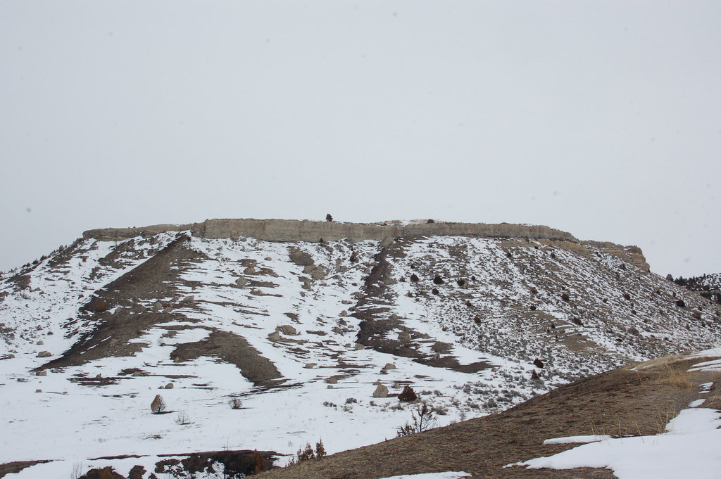 Photo: Don Henise, CC BY 2.0 (via Flickr)
- 1.6 mi
- round trip
- 1,334 ft
- climb
- 4,710 ft
- high point
- Out and back
- route
- May–Sep
- best months
Caution at last check
Weather is marginal · OpenWeather · checked 13 h ago
Rim Trail is a 1.55-mile, moderate hike in Madison Buffalo Jump State Park in southwestern Montana. The trail is an out-and-back route that starts at 4,288 feet and climbs to 4,710 feet, with a total gain of 1,334 feet for the round trip. The steepest stretch comes at about 0.77 miles in, where the grade reaches 23%. The trail lies within Madison Buffalo Jump State Park, managed by State Fish and Wildlife. It pairs easily with other short routes in the park, including Buffalo Trail and Connector Trail, both about 0.1 mile away. North Ridge Trail and The Loop are each about 0.9 mile off. Summer is the most comfortable time to go. Typical July averages from a nearby weather station run around 84°F for highs and 49°F for lows, though that station sits about 470 feet lower, so temperatures on the trail run cooler. The trail is open year-round, and a round trip takes about 1.5 hours.
Local outfitters
- Yellowstone Safari Company23 mi away
Not on Roamze yet. Their page has how to reach them.
- Buffalo TrailHikingPhoto: Don Henise, CC BY 2.0 (via Flickr)0.1 mi
 Connector TrailHikingPhoto: Tim Evanson, CC BY-SA 2.0 (via Flickr)0.1 mi
- North Ridge TrailHikingPhoto: Tim Evanson, CC BY-SA 2.0 (via Flickr)0.9 mi
- The LoopHikingPhoto: Tim Evanson, CC BY-SA 2.0 (via Flickr)0.9 mi
- Willow CreekCanoeing9.6 mi
- Missouri Headwaters State Park TrailHiking9.7 mi
Source: Roamze catalog (indexable pages within 10 miles, PostGIS distance)
- Buffalo TrailHiking · Next doorPhoto: Don Henise, CC BY 2.0 (via Flickr)
 Middle View TrailHiking · ~33 min drivePhoto: Matt Lavin, CC BY-SA 2.0 (via Flickr)
 North CottonwoodHiking · ~38 min drivePhoto: Matt Lavin, CC BY-SA 2.0 (via Flickr)
- Bear Trap Canyon TrailHiking · ~39 min drive
- Connector TrailHiking · Next doorPhoto: Tim Evanson, CC BY-SA 2.0 (via Flickr)
 Nya-Nuki Trail SystemHiking · ~34 min drivePhoto: Matt Lavin, CC BY-SA 2.0 (via Flickr)
- Cherry LakeHiking · ~39 min drive
- Corbly Gulch TrailHiking · ~39 min drive
- North Ridge TrailHiking · ~2 min drivePhoto: Tim Evanson, CC BY-SA 2.0 (via Flickr)
 Sypes CanyonHiking · ~40 min drivePhoto: Carly Lesser & Art Drauglis from Washington, DC, CC BY-SA 2.0 (via Wikimedia Commons)
Best time to visit Rim Trail
Best months: May–September. Best months have typical highs of 55–85 °F, lows of 30 °F or warmer (32 °F where the station doesn't record snow), at most one snowy day and no more than 12 wet days.
Jan
33° / 9°
Feb
37° / 13°
Mar
46° / 21°
Apr
55° / 29°
May
64° / 36°
Jun
73° / 44°
Jul
84° / 49°
Aug
83° / 46°
Sep
73° / 39°
Oct
58° / 28°
Nov
42° / 19°
Dec
32° / 11°
Typical high / low (°F) and days with rain or snow, 1991–2020. Measured at Logan Landfill, MT, 6.4 mi away at 4,243 ft. This station doesn't record snowfall. Source: NOAA NCEI U.S. Climate Normals 1991–2020.
Map and trail data © OpenStreetMap contributors
