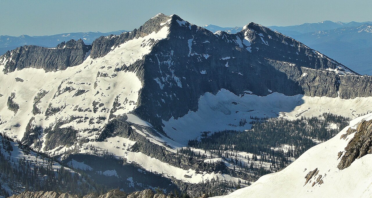
Mill
- 3.8 mi
- round trip
- 738 ft
- climb
- 4,932 ft
- high point
- Out and back
- route
- May–Sep
- best months
Is Mill open right now?
Closure in the area
There's a closure order in Kootenai National Forest. It doesn't name Mill, so check the source for the area it covers.
Kootenai Flood Event & Inaccessible Areas
Agency closure covering Kootenai National Forest · USFS · Kootenai National Forest
Updated Skillet Fire Area, Road, Trail Closure
Agency alert covering Kootenai National Forest · Order 01-10- · USFS · Kootenai National Forest
Trail Advisory-Alexander Mountain Trail near Timber Harvest Activities
Agency alert covering Libby Ranger District · USFS · Libby Ranger District
Timberlane Campground Closure
Agency alert covering Libby Ranger District · Order 01-14-05-26-03 · USFS · Libby Ranger District
As of · Source: USFS · Kootenai National Forest. Agencies don't list every closure — check before you go.
Mill is a moderate out-and-back hike in the Libby Ranger District of Montana's Kootenai National Forest, about 3.8 miles long with a one-way climb of 738 feet from a low point of 3,870 feet to a high of 4,932 feet. The trail is natural-surfaced, and the Forest Service manages the land. Summer is the most comfortable time to go. Typical averages from a nearby weather station in Libby show July and August highs around 78°F with lows near 40°F and only about six wet days a month. That station sits roughly 1,500 feet lower than the trail's high point, so temperatures on the summit run cooler. The trail is open from June 1 to October 31, and the Mill/Ozette trailhead (TH 302) is the parking for the route. Gloria Mine and Wayup Mine are both within a mile, and Lake Creek Campground is about 3.3 miles away.
Local outfitters
- Kootenai River Campground35 mi away
Not on Roamze yet. Their page has how to reach them.
Best time to go · May–Sep
Best time to visit Mill
Best months: May–September. Best months have typical highs of 55–85 °F, lows of 30 °F or warmer (32 °F where the station doesn't record snow), at most one snowy day and no more than 12 wet days.
Jan
30° / 15°
14 wet · 12 snow
Feb
35° / 15°
12 wet · 10 snow
Mar
43° / 22°
13 wet · 10 snow
Apr
52° / 28°
12 wet · 5 snow
May
62° / 34°
12 wet · 1 snow
Jun
69° / 39°
10 wet
Jul
78° / 42°
6 wet
Aug
78° / 40°
6 wet
Sep
67° / 34°
7 wet
Oct
52° / 27°
11 wet · 3 snow
Nov
37° / 22°
14 wet · 9 snow
Dec
29° / 15°
15 wet · 13 snow
Typical high / low (°F) and days with rain or snow, 1991–2020. Measured at Libby 32 Sse, MT, 17.3 mi away at 3,440 ft. The station sits about 1,500 ft lower than this place, so expect it a little cooler here. Source: NOAA NCEI U.S. Climate Normals 1991–2020.
Keep exploring — more trails worth the drive
HIKE
Gloria Mine
~1 min drive
2.78-mile out-and-back trail in Montana with 1,167 ft elevation gain.
HIKE
Upper Geiger Lake
~4 min drive
0.40-mile out-and-back trail to Upper Geiger Lake in Montana.
HIKE
Standard Creek
~4 min drive
8.80-mile out-and-back trail in Montana with 1,906 ft gain.
HIKE
Wayup Mine
~2 min drive
2.38-mile out-and-back trail at Wayup Mine in Montana with 993 ft gain
HIKE
Libby Creek
~5 min drive
4.42-mile out-and-back trail in Montana with 382 ft gain.
HIKE
Lake Creek
~5 min drive
7.40-mile out-and-back trail in Montana with 2,263 ft elevation gain.
HIKE
Bramlet Creek
~2 min drive
3.81-mile out-and-back trail in Montana with 772 ft elevation gain.
HIKE
Teeters Peak
~6 min drive
4.27-mile out-and-back trail to Teeters Peak in Montana with 968 ft of elevation gain.
HIKE
Great Northern Mountain
~6 min drive
6.28-mile out-and-back trail in Montana with 539 ft gain.
HIKE
Fourth of July
~4 min drive
5.38-mile out-and-back trail in Montana with 1,059 ft elevation gain.