Fish Creek Ridge
- 4.0 mi
- round trip
- 1,128 ft
- climb
- 8,024 ft
- high point
- Out and back
- route
- May–Sep
- best months
Is FISH CREEK RIDGE open right now?
Closure in the area
There's a closure order in Beaverhead-Deerlodge National Forest. It doesn't name FISH CREEK RIDGE, so check the source for the area it covers (2 listed).
Annual Food Storage Order
Agency closure covering Beaverhead-Deerlodge National Forest · Order 02-00-22-02 · USFS · Beaverhead-Deerlodge National Forest
Pallet Prohibition Order Butte Ranger District
Agency closure covering Beaverhead-Deerlodge National Forest · Order 01020425-01 · USFS · Beaverhead-Deerlodge National Forest
Lost Creek Area - Road Closure
Agency alert covering Beaverhead-Deerlodge National Forest · USFS · Beaverhead-Deerlodge National Forest
Montana BDR Alternative Route
Agency alert covering Beaverhead-Deerlodge National Forest · USFS · Beaverhead-Deerlodge National Forest
Lost Creek Area - Road Closure
Agency alert covering Beaverhead-Deerlodge National Forest · Order 01020826-02 · USFS · Beaverhead-Deerlodge National Forest
As of · Source: USFS · Beaverhead-Deerlodge National Forest. Agencies don't list every closure — check before you go.
Fish Creek Ridge is a moderate out-and-back hike of about 8 miles in the Madison Ranger District of Montana's Beaverhead-Deerlodge National Forest. The trail starts at roughly 7,860 feet and climbs to a high point of 8,024 feet, with a total gain of about 1,128 feet for the round trip. The steepest stretch comes at about 3.5 miles in, where the grade reaches 16%. Summer is the most comfortable time to go. Typical averages from the Lakeview weather station, about 15 miles away, show July and August highs near 77°F with lows around 40°F. That station sits well below the ridge, so temperatures on the ridge run cooler. The trip takes about 3 hours. West Fork Cabin, about 2.6 miles from the trail, offers camping. Coal Creek, Corral Creek and Pole Creek are all within about 5 miles.
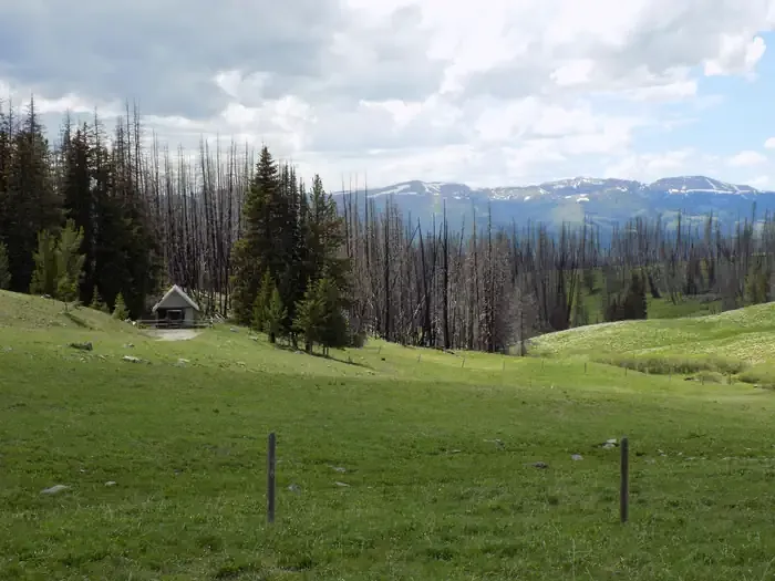 West Fork Cabin (s of Ennis)CampingPhoto: Recreation.gov (RIDB) / public domain2.6 mi
- COAL CREEKHiking4.3 mi
- CORRAL CREEKHiking4.9 mi
- POLE CREEKHiking5.1 mi
- DIVIDE CREEKHiking5.2 mi
- CASCADE MOUNTAINHiking5.2 mi
- BASIN CREEKHiking5.2 mi
- West Fork Madison RiverCanoeing8.5 mi
Source: Roamze catalog (indexable pages within 10 miles, PostGIS distance)
- COAL CREEKHiking · ~7 min drive
- DIVIDE CREEKHiking · ~9 min drive
- POISON CREEKHiking · ~10 min drive
- REBISH CUTOFFHiking · ~13 min drive
- BARNETT TRAILHiking · ~10 min drive
- CASCADE MOUNTAINHiking · ~9 min drive
- FREEZEOUT MOUNTAINHiking · ~19 min drive
- WEST CREEK RIDGEHiking · ~16 min drive
- PORTAL CREEKHiking · ~13 min drive
- FISH CREEK LAKEHiking · ~10 min drive
Best time to visit FISH CREEK RIDGE
Best months: May–September. Best months have typical highs of 55–85 °F, lows of 30 °F or warmer (32 °F where the station doesn't record snow), at most one snowy day and no more than 12 wet days.
Jan
24° / 4°
Feb
27° / 5°
Mar
36° / 14°
Apr
47° / 24°
May
59° / 32°
Jun
67° / 38°
Jul
77° / 43°
Aug
77° / 41°
Sep
67° / 35°
Oct
51° / 25°
Nov
36° / 15°
Dec
24° / 5°
Typical high / low (°F) and days with rain or snow, 1991–2020. Measured at Lakeview, MT, 14.9 mi away at 6,710 ft. The station sits about 1,300 ft lower than this place, so expect it a little cooler here. This station doesn't record snowfall. Source: NOAA NCEI U.S. Climate Normals 1991–2020.

