Freezeout Mountain
- 7.8 mi
- round trip
- 3,961 ft
- climb
- 9,497 ft
- high point
- Out and back
- route
Is FREEZEOUT MOUNTAIN open right now?
Closure in the area
There's a closure order in Beaverhead-Deerlodge National Forest. It doesn't name FREEZEOUT MOUNTAIN, so check the source for the area it covers (2 listed).
Annual Food Storage Order
Agency closure covering Beaverhead-Deerlodge National Forest · Order 02-00-22-02 · USFS · Beaverhead-Deerlodge National Forest
Pallet Prohibition Order Butte Ranger District
Agency closure covering Beaverhead-Deerlodge National Forest · Order 01020425-01 · USFS · Beaverhead-Deerlodge National Forest
Lost Creek Area - Road Closure
Agency alert covering Beaverhead-Deerlodge National Forest · USFS · Beaverhead-Deerlodge National Forest
Montana BDR Alternative Route
Agency alert covering Beaverhead-Deerlodge National Forest · USFS · Beaverhead-Deerlodge National Forest
Lost Creek Area - Road Closure
Agency alert covering Beaverhead-Deerlodge National Forest · Order 01020826-02 · USFS · Beaverhead-Deerlodge National Forest
As of · Source: USFS · Beaverhead-Deerlodge National Forest. Agencies don't list every closure — check before you go.
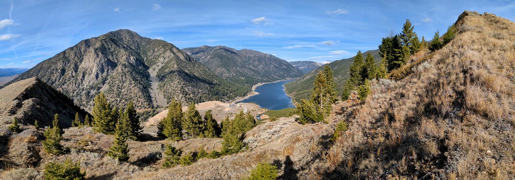
Freezeout Mountain is a 15.7-mile out-and-back hike in Montana's Beaverhead-Deerlodge National Forest, within the Madison Ranger District. The route is rated expert, and the climb is steep, with a 30% grade at mile 3. The total round-trip gain is 3,961 feet, and the high point reaches 9,497 feet. The trip starts at 8,932 feet and climbs to the summit before descending back. The steepest stretch comes early, and the entire route is rolling rather than a single, continuous ascent. Plan on about seven hours to complete the round trip. The nearest towns are in the surrounding Madison area. For another day on foot, Cave Mountain and Standard Creek are both within about 2.5 miles. Black Butte Cabin, about 5.5 miles away, offers a place to stay. West Fork Madison Campground lies about 8 miles out.
- CAVE MOUNTAINHiking2.4 mi
- STANDARD CREEKHiking2.5 mi
- TEEPEE CREEKHiking4.2 mi
- Black Butte CabinCamping5.5 mi
- West Fork Madison RiverCanoeing7.3 mi
- West Fork Madison CampgroundCamping8 mi
- West Fork Corridor/Smith Lake & Soap CreekCamping8 mi
- Windy Point Boat LaunchRiver fishing8.7 mi
Source: Roamze catalog (indexable pages within 10 miles, PostGIS distance)
 Papoose Creek TrailHiking · ~15 min drivePhoto: Jon Roanhaus, CC BY-SA 4.0 (via Wikimedia Commons)
 Sheep LakeHiking · ~28 min drivePhoto: Forest Service - Northern Region, Public Domain Mark (via Flickr)
- CAVE MOUNTAINHiking · ~4 min drive
- STANDARD CREEKHiking · ~4 min drive
- HORSE CREEKHiking · ~13 min drive
- NORTH FORK WALL CREEKHiking · ~11 min drive
- TEEPEE CREEKHiking · ~7 min drive
- REBISH CUTOFFHiking · ~10 min drive
- HYDE CREEKHiking · ~18 min drive
- CLIFF LAKE BENCHHiking · ~16 min drive

