Rd 3026 Site 1
Campground
Campground · 2.4 mi from the trail
 Photo: Robert Ashworth from Bellingham, WA., USA, CC BY 2.0 (via Wikimedia Commons)
Alert in the area
The Forest Service lists an alert for Lolo National Forest.
East Fork Big Creek Road & Trail Closure- Superior Ranger District
Agency alert covering Lolo National Forest · Order 26-003- · USFS · Lolo National Forest
As of · Source: USFS · Lolo National Forest. Agencies don't list every closure — check before you go.
Copper Lake is an easy out-and-back hike in the Superior Ranger District of Montana's Lolo National Forest, about 2 miles long with a one-way climb of 625 feet from a low point of 4,374 feet to a high of 5,003 feet. The trail is on natural surface and bikes are allowed, and it is not an accessible route. Summer is the most comfortable time to go. Typical averages from a nearby weather station at Mullan Pass, Idaho, show July and August highs around 70°F with only about six wet days a month, while winter highs stay near 28°F. The hike is open year-round. Saint Regis Lakes is about 1.5 miles away, and Shoshone Park Kitchen campground is about 2.6 miles off. Paddlers can reach the Saint Regis River, about 4.8 miles away, and the North Fork Saint Joe River, about 5.7 miles away.
Rd 3026 Site 1
Campground
Places © OpenStreetMap contributors
More in KelloggNot on Roamze yet. Their page has how to reach them.
Best months: July–September. Best months have typical highs of 55–85 °F, lows of 30 °F or warmer (32 °F where the station doesn't record snow), at most one snowy day and no more than 12 wet days.
Jan
28° / 19°
19 wet
Feb
28° / 19°
17 wet
Mar
34° / 22°
19 wet
Apr
40° / 27°
17 wet
May
50° / 36°
15 wet
Jun
58° / 42°
13 wet
Jul
70° / 52°
6 wet
Aug
69° / 51°
6 wet
Sep
59° / 44°
8 wet
Oct
44° / 32°
13 wet
Nov
32° / 23°
17 wet
Dec
27° / 18°
18 wet
Typical high / low (°F) and days with rain or snow, 1991–2020. Measured at Mullan Pass Vor/Dme, ID, 2.8 mi away at 6,028 ft. The station sits about 1,000 ft higher than this place, so expect it a little warmer here. This station doesn't record snowfall. Source: NOAA NCEI U.S. Climate Normals 1991–2020.
Photo: Robert Ashworth from Bellingham, WA., USA, CC BY 2.0 (via Wikimedia Commons)Saint Regis Lakes
~3 min drive
2.93-mile out-and-back trail to Saint Regis Lakes in Idaho with 838 ft of elevation gain.
 Photo: Jon Roanhaus, CC BY-SA 3.0 (via Wikimedia Commons)
Clear Creek
~11 min drive
3.18-mile out-and-back trail in Idaho with 456 ft elevation gain.
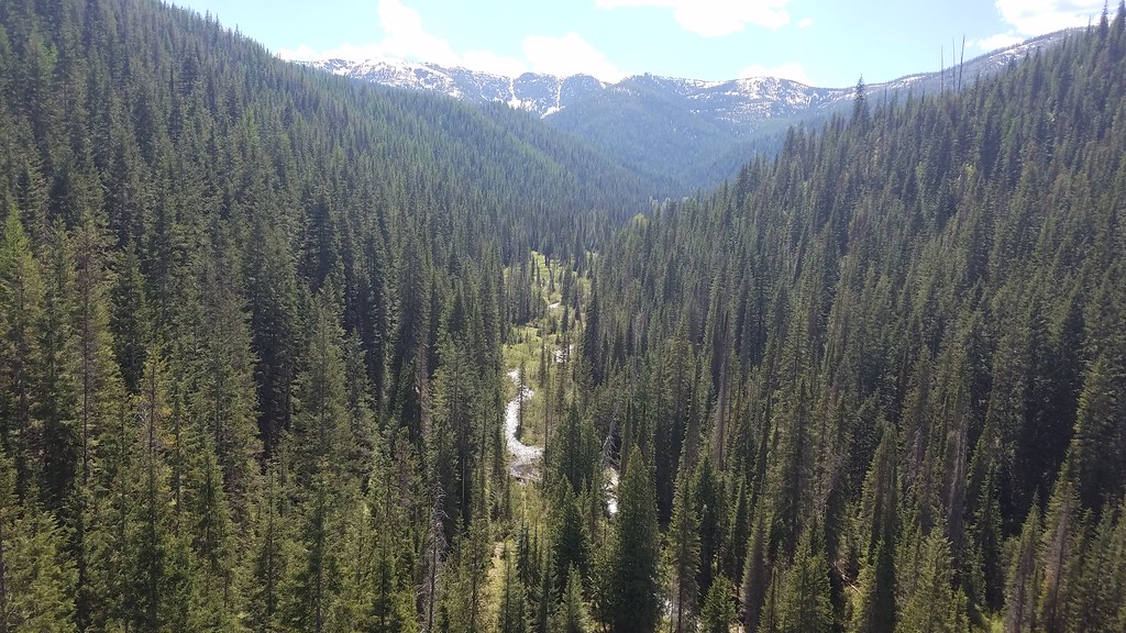 Photo: Forest Service - Northern Region, Public Domain Mark (via Flickr)
BEAR CREEK
~12 min drive
9.38-mile out-and-back trail in Idaho with 3,378 ft elevation gain
HIKE
RAINY/DOMINION LOOP
~8 min drive
32.58-mile out-and-back trail in Montana with 5,132 ft elevation gain/loss
HIKE
Upper Glidden
~10 min drive
Upper Glidden is a 2.25-mile out-and-back trail in Montana with 181 feet of elevation gain.
HIKE
E. Fk Willow Ck-Stevens Lakes
~6 min drive
4.09-mile out-and-back trail in Idaho with 1,792 ft elevation gain.
HIKE
WEST WILLOW (LONE LAKE)
~6 min drive
4.22-mile out-and-back trail in Idaho with 2,743 ft elevation gain
HIKE
DOMINION PEAK
~12 min drive
9.8-mile out-and-back trail in Montana with 4,541 ft gain/loss and 5,833 ft max elevation.
HIKE
Arid Peak
~12 min drive
2.68-mile out-and-back trail to Arid Peak in Idaho with 165 ft of elevation gain.
HIKE
RAINY/DOMINION LOOP CUTOFF
~8 min drive
2.84-mile out-and-back trail in Montana with 1,331 ft elevation gain
