Rainy/Dominion Loop
- 16.3 mi
- round trip
- 5,132 ft
- climb
- 5,702 ft
- high point
- Out and back
- route
- Jul–Sep
- best months
The RAINY/DOMINION LOOP is a long, steep out-and-back hike in Montana, starting and ending within a quarter mile of the town of Taft. The route is about 16 miles long, and the round trip covers roughly 32.6 miles with a total elevation gain and loss of about 5,132 feet. The high point on the loop reaches about 5,702 feet, and the steepest stretch comes at about 3.3 miles in, where the grade reaches 17 percent. Summer is the most comfortable time to go. Typical averages from a nearby weather station at Mullan Pass show July and August highs around 70°F with only about six wet days a month, while winter highs stay near 28°F. The trip takes about 13.5 hours. The Saint Regis River, a canoeing route, lies just 0.3 miles away, and Dominion Creek is about a mile off. Dominion Peak and the Hiawatha Rail Trail are both within about 3.5 miles.
Local outfitters
- CDA River RV35 mi away
- Lost Moose Campground40 mi away
Not on Roamze yet. Their page has how to reach them.
 Saint Regis RiverCanoeingPhoto: Ken Gallager, CC BY-SA 4.0 (via Wikimedia Commons)0.3 mi
- DOMINION CREEKHiking1 mi
- Hiawatha Rail TrailHiking3 mi
- DOMINION PEAKHiking3.5 mi
- SILVER/DOMINION CREEK CUTOFFHiking4 mi
- Shoshone Park KitchenCamping6.9 mi
- Arid Peak LookoutCamping8.7 mi
- North Fork Saint Joe RiverCanoeing8.8 mi
Source: Roamze catalog (indexable pages within 10 miles, PostGIS distance)
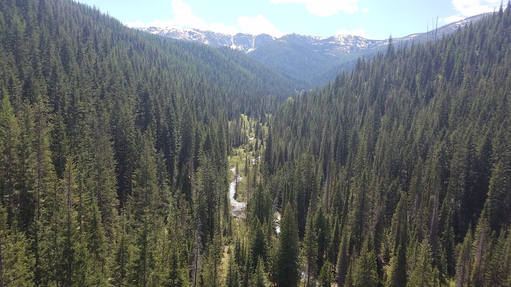 BEAR CREEKHiking · ~9 min drivePhoto: Forest Service - Northern Region, Public Domain Mark (via Flickr)
 Clear CreekHiking · ~9 min drivePhoto: Jon Roanhaus, CC BY-SA 3.0 (via Wikimedia Commons)
 Copper LakeHiking · ~8 min drivePhoto: Robert Ashworth from Bellingham, WA., USA, CC BY 2.0 (via Wikimedia Commons)
- DOMINION PEAKHiking · ~6 min drive
- Gilt Edge CreekHiking · ~10 min drive
- RAINY/DOMINION LOOP CUTOFFHiking · ~5 min drive
- Saint Regis LakesHiking · ~10 min drivePhoto: Robert Ashworth from Bellingham, WA., USA, CC BY 2.0 (via Wikimedia Commons)
- SILVER/DOMINION CREEKHiking · ~8 min drive
- MOZIER PEAKHiking · ~13 min drive
- SILVER/DOMINION CREEK CUTOFFHiking · ~7 min drive
Best time to visit RAINY/DOMINION LOOP
Best months: July–September. Best months have typical highs of 55–85 °F, lows of 30 °F or warmer (32 °F where the station doesn't record snow), at most one snowy day and no more than 12 wet days.
Jan
28° / 19°
19 wet
Feb
28° / 19°
17 wet
Mar
34° / 22°
19 wet
Apr
40° / 27°
17 wet
May
50° / 36°
15 wet
Jun
58° / 42°
13 wet
Jul
70° / 52°
6 wet
Aug
69° / 51°
6 wet
Sep
59° / 44°
8 wet
Oct
44° / 32°
13 wet
Nov
32° / 23°
17 wet
Dec
27° / 18°
18 wet
Typical high / low (°F) and days with rain or snow, 1991–2020. Measured at Mullan Pass Vor/Dme, ID, 3.2 mi away at 6,028 ft. This station doesn't record snowfall. Source: NOAA NCEI U.S. Climate Normals 1991–2020.
