Anderson Ridge
- 7.6 mi
- round trip
- 2,232 ft
- climb
- 9,109 ft
- high point
- Out and back
- route
- Jul–Aug
- best months
Is Anderson Ridge open right now?
Closure in the area
There's a closure order in Custer Gallatin National Forest. It doesn't name Anderson Ridge, so check the source for the area it covers (14 listed).
NFSR #1700 South Plateau Road Closure
Agency closure covering Custer Gallatin National Forest · USFS · Custer Gallatin National Forest
Tom Miner Campground Closure
Agency closure covering Gardiner Ranger District · Order 01-11-03-26-02 · USFS · Gardiner Ranger District
Hyalite Porcupine Buffalo Horn Summer Interim Travel Order and Map and Order # 01-11-00-26-02
Agency closure covering Custer Gallatin National Forest · Order 01-11-00-26-02 · USFS · Custer Gallatin National Forest
Hyalite Porcupine Buffalo Horn Winter Interim Travel Order and Map Order Number: #01-11-00-26-01
Agency closure covering Custer Gallatin National Forest · USFS · Custer Gallatin National Forest
Glacier Lake Road #2421 Closure Order Number: # 01-11-82-26- 01
Agency closure covering Custer Gallatin National Forest · Order 01-11-82-26- · USFS · Custer Gallatin National Forest
As of · Source: USFS · Custer Gallatin National Forest. Agencies don't list every closure — check before you go.
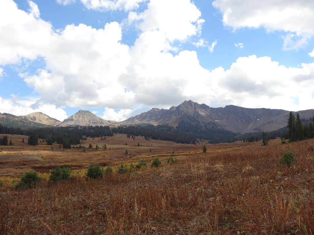
Anderson Ridge is a 7.6-mile out-and-back hike in the Absaroka-Beartooth Wilderness, part of the Gardiner Ranger District of Custer Gallatin National Forest in Montana. The trail climbs from a low point of 6,672 feet to a high of 9,109 feet, with a total elevation gain of 2,232 feet. The Forest Service manages the land, and the route is natural-surfaced and open year-round. Summer is the most comfortable time to go. Typical averages from a nearby weather station at Cooke City, which sits about 1,600 feet lower, show July highs around 74°F with lows near 39°F, while winter highs there stay in the 20s. Horses are allowed, and bikes are not. The closest trail is Tucker Creek, under a mile away, and Anderson Ridge Trail is about 3 miles off. Across the line in Wyoming, Slough Creek Trail and Bliss Pass Trail are both within about 4 miles.
- Tucker CreekHiking0.8 mi
- Anderson Ridge TrailHiking2.9 mi
- Slough Creek TrailHiking3.2 mi
- Bliss Pass TrailHiking4.2 mi
- Slough CreekHiking4.6 mi
- Bull CreekHiking5.5 mi
- 2S1 Campsite Spur TrailHiking5.6 mi
 Hidden LakeHikingPhoto: Forest Service - Northern Region, Public Domain Mark (via Flickr)5.7 mi
Source: Roamze catalog (indexable pages within 10 miles, PostGIS distance)
- Hidden LakeHiking · ~10 min drivePhoto: Forest Service - Northern Region, Public Domain Mark (via Flickr)
- Buffalo ForkHiking · ~11 min drivePhoto: Forest Service - Northern Region, Public Domain Mark (via Flickr)
- Warm Creek Trailhead (3K4)Hiking · ~13 min drive
 Wolverine Pass CutoffHiking · ~16 min drivePhoto: Forest Service - Northern Region, Public Domain Mark (via Flickr)
- Slough Creek TrailHiking · ~5 min drive
- Telephone BasinHiking · ~11 min drivePhoto: Forest Service - Northern Region, Public Domain Mark (via Flickr)
 Pebble Creek TrailHiking · ~14 min drivePhoto: Greg Willis from Denver, CO, usa, CC BY-SA 2.0 (via Wikimedia Commons)
- Lamar Valley - Predators and PreyHiking · ~16 min drive
- Trout Lake TrailheadHiking · ~17 min drive
- Bliss Pass TrailHiking · ~7 min drive
Also worth it near here
 Barronette PeakSummit · ~10 min drivePhoto: J Schmidt, Public domain (via Wikimedia Commons)
- Barronette Ski TrailSki touring · ~13 min drive
 Slough Creek CampgroundCamping · ~15 min drivePhoto: Yellowstone National Park from Yellowstone NP, USA, Public domain (via Wikimedia Commons)
- Lost WolverineMountain biking · ~15 min drive
Best time to visit Anderson Ridge
Best months: July–August. Best months have typical highs of 55–85 °F, lows of 30 °F or warmer (32 °F where the station doesn't record snow), at most one snowy day and no more than 12 wet days.
Jan
24° / 6°
17 wet
Feb
29° / 7°
13 wet
Mar
37° / 14°
13 wet
Apr
43° / 21°
13 wet
May
54° / 28°
14 wet
Jun
64° / 34°
14 wet
Jul
74° / 39°
11 wet
Aug
71° / 38°
11 wet
Sep
62° / 31°
10 wet
Oct
47° / 24°
11 wet
Nov
31° / 13°
14 wet
Dec
22° / 6°
17 wet
Typical high / low (°F) and days with rain or snow, 1991–2020. Measured at Cooke City 2 W, MT, 9.9 mi away at 7,483 ft. The station sits about 1,600 ft lower than this place, so expect it a little cooler here. This station doesn't record snowfall. Source: NOAA NCEI U.S. Climate Normals 1991–2020.
