Black Swamp Trail
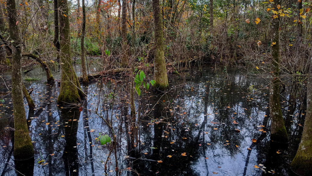 Photo: Paul Lowry, CC BY 2.0 (via Flickr)
- 0.6 mi
- one way
- 35 ft
- high point
- Point to point
- route
- Easy
- difficulty
- Oct–May
- best months
Black Swamp Trail is a 0.59-mile point-to-point trail in Louisiana with 72 feet of elevation gain and 79 feet of elevation loss. The trail is managed by the State Department of Natural Resources.
 Old Oak Forest TrailHiking · ~8 min drivePhoto: ClayJar.com, CC BY 2.0 (via Flickr)
 Semita Trail MajorHiking · ~9 min drivePhoto: ClayJar.com, CC BY 2.0 (via Flickr)
 Poplar-Pine LoopHiking · ~9 min drivePhoto: ClayJar.com, CC BY 2.0 (via Flickr)
 Levee TrailHiking · ~1h 25m drivePhoto: Alexander Hatley, CC BY 2.0 (via Flickr)
 Scotlandville Parkway PathHiking · ~13 min drivePhoto: ClayJar.com, CC BY 2.0 (via Flickr)
- Hardwood Forest LoopHiking · ~15 min drive
 Great Bamboo LoopHiking · ~14 min drivePhoto: ClayJar.com, CC BY 2.0 (via Flickr)
- Bayou Des Ourses ATV TrailHiking · ~58 min drive
 Beginner LoopHiking · ~14 min drivePhoto: ClayJar.com, CC BY 2.0 (via Flickr)
- Intermediate LoopHiking · ~14 min drivePhoto: ClayJar.com, CC BY 2.0 (via Flickr)
Best time to visit Black Swamp Trail
Best months: October–May. Best months have typical highs of 55–85 °F, lows of 30 °F or warmer (32 °F where the station doesn't record snow), at most one snowy day and no more than 12 wet days.
Jan
61° / 40°
11 wet
Feb
65° / 44°
9 wet
Mar
71° / 50°
9 wet
Apr
78° / 56°
8 wet
May
84° / 65°
9 wet
Jun
89° / 71°
12 wet
Jul
91° / 73°
14 wet
Aug
91° / 72°
13 wet
Sep
88° / 68°
9 wet
Oct
80° / 57°
8 wet
Nov
70° / 47°
8 wet
Dec
63° / 42°
10 wet
Typical high / low (°F) and days with rain or snow, 1991–2020. Measured at Lsu Ben-Hur Farm, LA, 4.7 mi away at 21 ft. This station doesn't record snowfall. Source: NOAA NCEI U.S. Climate Normals 1991–2020.
Map and trail data © OpenStreetMap contributors
