Packsaddle Mountain
- 6,405 ft
- summit
- 1
- way up
Is Packsaddle Mountain open right now?
Closure in the area
There's a closure order in Idaho Panhandle National Forests. It doesn't name Packsaddle Mountain, so check the source for the area it covers (3 listed).
Emergency Road Closure Lightning Creek / Forest Road 419
Agency closure covering Idaho Panhandle National Forests · Order 0104-06-26-002 · USFS · Idaho Panhandle National Forests
Abandoned Mines Area Closure
Agency closure covering Idaho Panhandle National Forests · Order 1-04-00-25-001 · USFS · Idaho Panhandle National Forests
Idaho Panhandle Seasonal Food Storage Order
Agency closure covering Idaho Panhandle National Forests · Order 01-04-00-24-001 · USFS · Idaho Panhandle National Forests
Beehive Lake Trail #279 Closure
Agency alert covering Sandpoint Ranger District · Order 01-04-06-26-007 · USFS · Sandpoint Ranger District
Heavy Truck Traffic on FS Road 209
Agency alert covering Idaho Panhandle National Forests · USFS · Idaho Panhandle National Forests
As of · Source: USFS · Idaho Panhandle National Forests. Agencies don't list every closure — check before you go.
Packsaddle Mountain is a summit in the Sandpoint Ranger District of the Idaho Panhandle National Forests. The nearest town is Clark Fork, about 12 miles away. Several hikes start close by, including Granite Creek about 2.5 miles away and Falls Creek about 3 miles away. For an overnight stay, Whiskey Rock Bay campground is within 5 miles. The North Fork Coeur d'Alene River, about 7 miles off, offers canoeing.
Conditions and forecast
Daily highs and lows, wind and the chance of precipitation at the summit and route start for the next 7 days, from the Open-Meteo model.
- Summit elevation
- 6,405 ft
Elevation from USGS 3D Elevation Program terrain data (about 10 m resolution).
Map © Mapbox © OpenStreetMap contributors Questions about Packsaddle Mountain
How tall is Packsaddle Mountain?
6,405 ft (1,952 m).
How many routes go to the summit of Packsaddle Mountain?
One: PACKSADDLE MOUNTAIN.
- GRANITE CREEKHiking2.5 mi
- FALLS CREEKHiking3 mi
- BRANCH NORTH GOLD CREEKHiking3.2 mi
- GREEN MOUNTAINHiking4.3 mi
- Whiskey Rock BayCamping4.7 mi
- North Fork Coeur d'Alene RiverCanoeing7.3 mi
- Maiden RockCamping8.5 mi
- Independence CreekCanoeing9.4 mi
Source: Roamze catalog (indexable pages within 10 miles, PostGIS distance)
 Scotchman PeakSummit · ~29 min drivePhoto: U.S. Army Corps of Engineers, photographer not specified or unknown, Public domain (via Wikimedia Commons)
 Saint Paul PeakSummit · ~54 min drivePhoto: Jared Shear, CC BY 2.0 (via Wikimedia Commons)
 Tubbs HillSummit · ~55 min drivePhoto: Mkennedystudios, CC BY-SA 4.0 (via Wikimedia Commons)
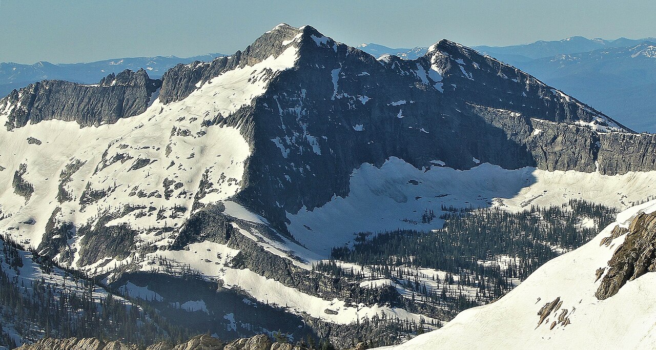 Rock PeakSummit · ~56 min drivePhoto: Jared Shear, CC BY 2.0 (via Wikimedia Commons)
- Minerva PeakSummit · ~5 min drive
- Schafer PeakSummit · ~9 min drive
- Magee PeakSummit · ~18 min drive
- Chilco MountainSummit · ~22 min drive
- Lamb PeakSummit · ~25 min drive
- Boundary PeakSummit · ~26 min drive
