Redfish Inlet Trail
 Photo: WaterArchives.org from Sacramento, California, USA, CC BY-SA 2.0 (via Wikimedia Commons)
- 1.1 mi
- round trip
- 329 ft
- climb
- 6,882 ft
- high point
- Out and back
- route
- Jun–Aug
- best months
Caution at last check
Agency alerts are in effect for this area; weather is good · USFS, OpenWeather · checked 17 h ago
Is Redfish Inlet Trail open right now?
Alert in the area
The Forest Service lists 4 alerts for Sawtooth National Forest.
Paradise Prescribed Burn Restricted Access
Agency alert covering Sawtooth National Forest · USFS · Sawtooth National Forest
Grandjean Area, Road, and Trail Closure
Agency alert covering Sawtooth National Forest · Order 0414-04-165 · USFS · Sawtooth National Forest
Over-Snow Vehicle and Bicycle Prohibitions
Agency alert covering Sawtooth National Forest · Order 0414-00-028 · USFS · Sawtooth National Forest
Occupancy and Use - Food Storage
Agency alert covering Sawtooth National Forest · Order 0414-04-143 · USFS · Sawtooth National Forest
As of · Source: USFS · Sawtooth National Forest. Agencies don't list every closure — check before you go.
Redfish Inlet Trail is a short, easy hike in Idaho's Sawtooth National Recreation Area, part of the Sawtooth National Forest managed by the Forest Service. The trail is about 1.1 miles long and rises roughly 330 feet from a low point of 6,552 feet to a high of 6,882 feet, making it an out-and-back route that fits easily into a day spent exploring the surrounding area. Summer is the most comfortable time to go. Typical averages from a nearby weather station in Stanley show July and August highs around 80°F with lows near 39°F and only five or six wet days a month, while winter highs stay in the 20s. The trailhead sits right next to Redfish Inlet Campground and the Grand Mogul Trail, both about 0.1 mile away. Bench Lakes is about 1.2 miles off, and Redfish Lake, a fishing spot, is about 1.8 miles away.
Local outfitters
- Camp Perkins13 mi away
- The Sawmill Station26 mi away
Not on Roamze yet. Their page has how to reach them.
Best time to go · Jun–Aug
Best time to visit Redfish Inlet Trail
Best months: June–August. Best months have typical highs of 55–85 °F, lows of 30 °F or warmer (32 °F where the station doesn't record snow), at most one snowy day and no more than 12 wet days.
Jan
29° / 4°
12 wet
Feb
35° / 7°
12 wet
Mar
42° / 14°
14 wet
Apr
49° / 21°
12 wet
May
60° / 30°
12 wet
Jun
69° / 35°
10 wet
Jul
80° / 39°
6 wet
Aug
80° / 37°
5 wet
Sep
70° / 31°
7 wet
Oct
55° / 24°
9 wet
Nov
39° / 14°
12 wet
Dec
28° / 6°
14 wet
Typical high / low (°F) and days with rain or snow, 1991–2020. Measured at Stanley Rs, ID, 5 mi away at 6,495 ft. This station doesn't record snowfall. Source: NOAA NCEI U.S. Climate Normals 1991–2020.
Keep exploring — more trails worth the drive
Photo: WaterArchives.org from Sacramento, California, USA, CC BY-SA 2.0 (via Wikimedia Commons)Grand Mogul Trail
Next door
14.76-mile out-and-back trail in Idaho with 941 ft elevation gain.
 Photo: U.S. Forest Service employees, Public domain (via Wikimedia Commons)
Bench Lakes
~2 min drive
1.88-mile out-and-back trail in Idaho with 278 ft elevation gain.
 Photo: treegrow, CC BY 2.0 (via Flickr)
Marshall Lake Cutoff
~6 min drive
1.17-mile loop with 577 ft gain and loss, max elevation 7,159 ft.
 Photo: Argyleist from Sugarhood, Utah, USA, CC BY 2.0 (via Wikimedia Commons)
Redfish Creek - Baron Creek Trail
~6 min drive
42.35-mile out-and-back trail in Idaho with 1,444 ft elevation gain.
 Photo: bgwashburn, CC BY 2.0 (via Flickr)
Fishhook Trail
~5 min drive
1.17-mile out-and-back trail in Idaho with 63 ft of elevation gain.
 Photo: U.S. Forest Service employees, Public domain (via Wikimedia Commons)
Bull Moose
~6 min drive
5-mile loop trail in Idaho with 893 ft elevation gain.
 Photo: Observer12, Public domain (via Wikimedia Commons)
Alice Lake-Redfish Lake
~7 min drive
6.32-mile out-and-back trail to Alice Lake-Redfish Lake in Idaho with 888 ft gain.
Photo: bgwashburn, CC BY 2.0 (via Flickr)Fishhook Trail
~5 min drive
2.55-mile lollipop trail in Idaho with 66 ft elevation gain.
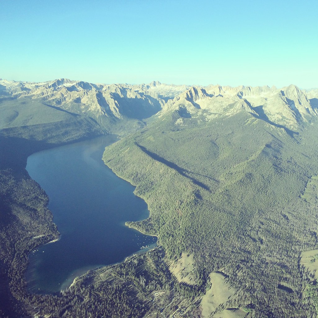 Photo: Sam Beebe, CC BY 2.0 (via Flickr)
REDFISH LAKE
~9 min drive
5.26-mile out-and-back trail at Redfish Lake in Idaho with 565 ft elevation gain.
Photo: U.S. Forest Service employees, Public domain (via Wikimedia Commons)Huckleberry
~9 min drive
5.60-mile out-and-back trail in Idaho with 896 ft gain.
Also worth it near here


Map and trail data © OpenStreetMap contributors
