Cougar Cg
Campground
Campground · 1.2 mi from the trail
Alert in the area
The Forest Service lists 4 alerts for Sawtooth National Forest.
Paradise Prescribed Burn Restricted Access
Agency alert covering Sawtooth National Forest · USFS · Sawtooth National Forest
Grandjean Area, Road, and Trail Closure
Agency alert covering Sawtooth National Forest · Order 0414-04-165 · USFS · Sawtooth National Forest
Over-Snow Vehicle and Bicycle Prohibitions
Agency alert covering Sawtooth National Forest · Order 0414-00-028 · USFS · Sawtooth National Forest
Occupancy and Use - Food Storage
Agency alert covering Sawtooth National Forest · Order 0414-04-143 · USFS · Sawtooth National Forest
As of · Source: USFS · Sawtooth National Forest. Agencies don't list every closure — check before you go.
Murdock Creek is a hard hike of about 6.8 miles in the Hemingway-Boulders Wilderness, part of the Sawtooth National Recreation Area in Idaho's Sawtooth National Forest. The trail is managed by the Forest Service and runs on natural surface, and horses are allowed. The route is an out-and-back that climbs from about 6,447 feet to about 7,624 feet. Summer is the most comfortable time to go. Typical averages from a nearby weather station show July highs around 82°F with lows near 47°F, and the station sits roughly 1,360 feet lower than the trail's high point, so temperatures on the ridge run cooler. Caribou Campground and Murdock Campground both sit about 1.3 miles away, and the Murdock Loop Ski and East Fork hikes are within about 2 miles.
Cougar Cg
Campground
The Sun Valley Club
Restaurant
Sun Valley Museum of Art
Museum
Places © OpenStreetMap contributors
More in KetchumNot on Roamze yet. Their page has how to reach them.
Best months: May–September. Best months have typical highs of 55–85 °F, lows of 30 °F or warmer (32 °F where the station doesn't record snow), at most one snowy day and no more than 12 wet days.
Jan
31° / 7°
4 wet · 4 snow
Feb
34° / 11°
4 wet · 3 snow
Mar
44° / 21°
5 wet · 2 snow
Apr
53° / 28°
7 wet · 1 snow
May
63° / 35°
9 wet
Jun
72° / 41°
7 wet
Jul
82° / 47°
6 wet
Aug
80° / 45°
5 wet
Sep
72° / 37°
5 wet
Oct
57° / 28°
5 wet · 1 snow
Nov
41° / 18°
5 wet · 2 snow
Dec
30° / 9°
5 wet · 4 snow
Typical high / low (°F) and days with rain or snow, 1991–2020. Measured at Chilly Barton Flat, ID, 30.6 mi away at 6,260 ft. The station sits about 1,400 ft lower than this place, so expect it a little cooler here. Source: NOAA NCEI U.S. Climate Normals 1991–2020.
 Photo: DieselDemon, CC BY 2.0 (via Flickr)
SOUTH BOULDER LOOP
~10 min drive
2.27-mile loop trail in Idaho with 249 ft gain and 274 ft loss.
 Photo: Matt Lavin, CC BY-SA 2.0 (via Flickr)
Easley Gulch Aka Curlies
~13 min drive
6.16-mile out-and-back trail in Idaho with 1,518 ft elevation gain.
 Photo: U.S. Forest Service employees, Public domain (via Wikimedia Commons)
SILVER CREEK LOOP
~15 min drive
15.1-mile out-and-back trail in Idaho with 3,909 ft elevation gain
HIKE
East Fork
~3 min drive
6.73-mile out-and-back trail in Idaho with 1,929 ft elevation gain.
 Photo: ArtBrom, CC BY-SA 2.0 (via Flickr)
Trail Creek
~13 min drive
2.11-mile out-and-back trail at Trail Creek in Idaho with 65 ft of elevation gain.
Photo: ArtBrom, CC BY-SA 2.0 (via Flickr)Corral Creek
~14 min drive
8.65-mile out-and-back trail in Idaho with 350 ft gain.
HIKE
Saddle Trail
~5 min drive
3.80-mile out-and-back trail in Idaho with 419 ft of elevation gain.
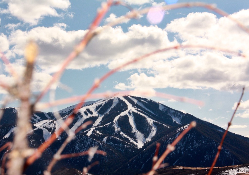 Photo: Chloé François, CC BY 2.0 (via Flickr)
Aspen Loop
~14 min drive
2.60-mile out-and-back trail in Idaho with 637 ft elevation gain.
Photo: ArtBrom, CC BY-SA 2.0 (via Flickr)Proctor Mountain
~14 min drive
8.80-mile out-and-back hike to Proctor Mountain summit in Idaho with 1,097 ft gain.
HIKE
Chocolate Gulch
~6 min drive
5.60-mile out-and-back trail in Idaho with 557 ft elevation gain.

