Lead Draw Trail
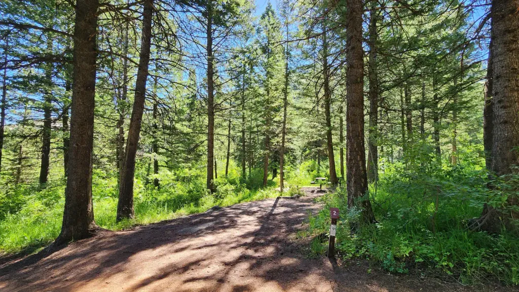
 Photo: JF Hobbs, CC BY 3.0 (via Wikimedia Commons)
- 3.6 mi
- round trip
- 2,505 ft
- climb
- 6,689 ft
- high point
- Out and back
- route
Is Lead Draw Trail open right now?
No closures listed
The Forest Service lists no closures for Caribou-Targhee National Forest.
As of · Source: USFS · Caribou-Targhee National Forest. Agencies don't list every closure — check before you go.
Lead Draw Trail is a hard hike in Idaho's Caribou-Targhee National Forest, within the Westside Ranger District. The trail is an out-and-back route of about 7 miles, with a total elevation gain of about 2,500 feet. The climb is front-loaded, and the steepest stretch comes at about 1.8 miles in, where the grade reaches 30 percent. The trail starts at roughly 5,590 feet and reaches a high point of about 6,689 feet. The Forest Service manages the land, and the trip takes about 3.5 hours. Plan for a long day with a significant climb, and expect the route to feel most demanding in the first half. The Cherry Springs North and Cherry Springs South hikes both sit about 1.9 miles away, and the Crestline Trail is about 2 miles off. For an overnight base, Scout Mountain Campground is about 3.1 miles away.
- Cherry Springs NorthHiking1.9 mi
- Cherry Springs SouthHikingPhoto: JF Hobbs, CC BY 3.0 (via Wikimedia Commons)1.9 mi
 CRESTLINE TRAILHikingPhoto: JF Hobbs, CC BY 3.0 (via Wikimedia Commons)2 mi
- Mink Creek Group Use SiteCamping2.9 mi
- Mink Creek Group Site CampgroundCamping2.9 mi
 Scout Mountain CampgroundCampingPhoto: Recreation.gov (RIDB) / public domain3.1 mi
- WaveWallRock climbing4.5 mi
- Main CorridorRock climbing6.8 mi
Source: Roamze catalog (indexable pages within 10 miles, PostGIS distance)
- Cherry Springs SouthHiking · ~3 min drivePhoto: JF Hobbs, CC BY 3.0 (via Wikimedia Commons)
 OverlookHiking · ~5 min drivePhoto: JF Hobbs, CC BY 3.0 (via Wikimedia Commons)
- CRESTLINE TRAILHiking · ~3 min drivePhoto: JF Hobbs, CC BY 3.0 (via Wikimedia Commons)
 Scout Mtn RidgeHiking · ~7 min drivePhoto: JF Hobbs, CC BY 3.0 (via Wikimedia Commons)
 EAST FORK MINK CREEKHiking · ~6 min drivePhoto: JF Hobbs, CC BY 3.0 (via Wikimedia Commons)
- SLATE MOUNTAINHiking · ~9 min drive
- Upper Box CanyonHiking · ~9 min drivePhoto: JF Hobbs, CC BY 3.0 (via Wikimedia Commons)
 Clifton CreekHiking · ~9 min drivePhoto: JF Hobbs, CC BY 3.0 (via Wikimedia Commons)
- North Fork Gibson Jack--JohnHiking · ~9 min drive
- BOX CANYONHiking · ~9 min drivePhoto: JF Hobbs, CC BY 3.0 (via Wikimedia Commons)

Map and trail data © OpenStreetMap contributors
