Hells Canyon Reservoir Trail
- 2.3 mi
- round trip
- 2,897 ft
- climb
- 1,862 ft
- high point
- Out and back
- route
- Mar–Jun, Sep–Oct
- best months
Hells Canyon Reservoir Trail is a hard out-and-back hike on Bureau of Land Management land in eastern Idaho, within the Vale Baker Field Office. The trail is about 4.6 miles long, with a total elevation gain of 2,897 feet. That makes for a steep climb of roughly 1,486 feet one way, and the steepest stretch comes at about 2.1 miles in, with a 14% grade. The hike starts at about 1,726 feet and climbs to a high point of 1,862 feet. The route is a steady, continuous climb with no long flat stretches, and the return trip mirrors the ascent. The most comfortable months for a visit are May and September. Typical averages from the Brownlee Dam weather station, 17.6 miles away, put May highs around 74°F and September highs around 83°F, while July and August average highs near 95°F. Winter is cold, with January highs typically around 39°F. Copper Creek Campground sits just 0.1 mile from the trail, and Lime Point Creek is about 1.9 miles away. Hells Canyon Reservoir Viewpt is about 3.3 miles off, and the Hells Canyon climbing area is roughly 4.5 miles away.
Local outfitters
- Cornucopia Lodge & Packstation21 mi away
- Oregon Backcountry Outfitting29 mi away
Not on Roamze yet. Their page has how to reach them.
- Copper Creek CampgroundCamping0.1 mi
- Lime Point CreekHiking1.9 mi
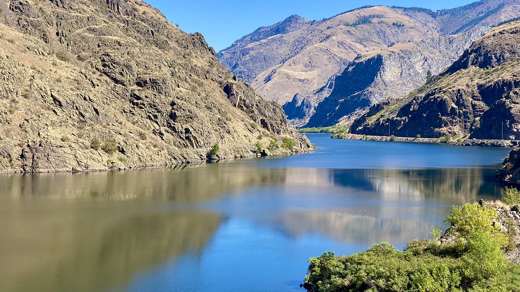 Reservoir Bench TrailHikingPhoto: lamblukas, CC BY 2.0 (via Flickr)2 mi
 Hells Canyon Reservoir ViewptHikingPhoto: WaterArchives.org from Sacramento, California, USA, CC BY-SA 2.0 (via Wikimedia Commons)3.3 mi
- Big BarCamping4.1 mi
 Hells CanyonRock climbingPhoto: lamblukas, CC BY 2.0 (via Flickr)4.5 mi
- North Pine CreekCanoeing8.7 mi
- Gumboot CreekCanoeing9.2 mi
Source: Roamze catalog (indexable pages within 10 miles, PostGIS distance)
- Reservoir Bench TrailHiking · ~3 min drivePhoto: lamblukas, CC BY 2.0 (via Flickr)
- Hells Canyon Reservoir TrailHiking · ~3 min drivePhoto: lamblukas, CC BY 2.0 (via Flickr)
- Hells Canyon Reservoir ViewptHiking · ~6 min drivePhoto: WaterArchives.org from Sacramento, California, USA, CC BY-SA 2.0 (via Wikimedia Commons)
- Allison CreekHiking · ~7 min drivePhoto: WaterArchives.org from Sacramento, California, USA, CC BY-SA 2.0 (via Wikimedia Commons)
 32 Point Creek TrailHiking · ~12 min drivePhoto: U.S. Forest Service- Pacific Northwest Region, Public domain (via Wikimedia Commons)
- Eckels CreekHiking · ~10 min drivePhoto: WaterArchives.org from Sacramento, California, USA, CC BY-SA 2.0 (via Wikimedia Commons)
- Lime Point CreekHiking · ~3 min drive
- Buck Creek TrailHiking · ~14 min drivePhoto: U.S. Forest Service- Pacific Northwest Region, Public domain (via Wikimedia Commons)
 Haley Ridge TrailHiking · ~18 min drivePhoto: U.S. Forest Service- Pacific Northwest Region, Public domain (via Wikimedia Commons)
- Deep CreekHiking · ~18 min drivePhoto: U.S. Forest Service- Pacific Northwest Region, Public domain (via Wikimedia Commons)
Best time to visit Hells Canyon Reservoir Trail
Best months: March–June and September–October. Best months have typical highs of 55–85 °F, lows of 30 °F or warmer (32 °F where the station doesn't record snow), at most one snowy day and no more than 12 wet days.
Jan
39° / 28°
12 wet
Feb
45° / 30°
10 wet
Mar
55° / 35°
11 wet
Apr
64° / 42°
10 wet
May
74° / 50°
10 wet
Jun
83° / 56°
7 wet
Jul
95° / 64°
3 wet
Aug
94° / 63°
3 wet
Sep
83° / 55°
3 wet
Oct
66° / 45°
7 wet
Nov
50° / 35°
10 wet
Dec
40° / 29°
13 wet
Typical high / low (°F) and days with rain or snow, 1991–2020. Measured at Brownlee Dam, ID, 17.6 mi away at 1,844 ft. This station doesn't record snowfall. Source: NOAA NCEI U.S. Climate Normals 1991–2020.
Map and trail data © OpenStreetMap contributors
