Lime Point Creek
- 2.8 mi
- round trip
- 197 ft
- climb
- 3,961 ft
- high point
- Out and back
- route
- May–Sep
- best months
Is Lime Point Creek open right now?
Alert in the area
The Forest Service lists 5 alerts for Payette National Forest.
Over Snow Vehicle Closure
Agency alert covering Payette National Forest · Order 0412-638 · USFS · Payette National Forest
Brundage Mountain Resort Snowcat Route Closure
Agency alert covering Payette National Forest · Order 0412-637 · USFS · Payette National Forest
Lost Valley Log Hauling
Agency alert covering Payette National Forest · USFS · Payette National Forest
Granite Mountain Over Snow Vehicle Closure
Agency alert covering Payette National Forest · Order 0412-635 · USFS · Payette National Forest
Gordon Titus Upper Elevation Parking Lot Winter Restrictions
Agency alert covering Payette National Forest · Order 0412-543 · USFS · Payette National Forest
As of · Source: USFS · Payette National Forest. Agencies don't list every closure — check before you go.
Lime Point Creek is an easy out-and-back hike in Idaho's Payette National Forest, within the Council Ranger District. The trail is about 2.8 miles long, with a total elevation gain of 197 feet, and it rises from a low point of about 3,460 feet to a high of about 3,960 feet. The route is on natural surface, and it is open to both horses and bikes. The Forest Service manages the land, and the trail is open year-round. Summer is the most comfortable time to go. Typical averages from a nearby weather station at New Meadows put July and August highs around 85°F with lows in the low 40s, while winter highs stay near freezing. Copper Creek Campground and the Hells Canyon Reservoir Trail are both about 1.9 miles away. The Hells Canyon climbing area is about 4.7 miles off, and the Reservoir Bench Trail is about 3.1 miles away.
Local outfitters
- Cornucopia Lodge & Packstation22 mi away
- Oregon Backcountry Outfitting31 mi away
Not on Roamze yet. Their page has how to reach them.
Best time to go · May–Sep
Best time to visit Lime Point Creek
Best months: May–September. Best months have typical highs of 55–85 °F, lows of 30 °F or warmer (32 °F where the station doesn't record snow), at most one snowy day and no more than 12 wet days.
Jan
30° / 9°
Feb
36° / 12°
Mar
45° / 21°
Apr
55° / 27°
May
64° / 33°
Jun
72° / 39°
Jul
85° / 43°
Aug
85° / 41°
Sep
75° / 33°
Oct
59° / 25°
Nov
42° / 19°
Dec
31° / 13°
Typical high / low (°F) and days with rain or snow, 1991–2020. Measured at New Meadows Rs, ID, 23.4 mi away at 3,862 ft. This station doesn't record snowfall. Source: NOAA NCEI U.S. Climate Normals 1991–2020.
Keep exploring — more trails worth the drive
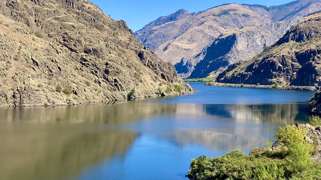 Photo: lamblukas, CC BY 2.0 (via Flickr)
Reservoir Bench Trail
~5 min drive
17.46-mile out-and-back hike in Oregon with 6,012 ft gain and 6,070 ft max elevation.
Photo: lamblukas, CC BY 2.0 (via Flickr)Hells Canyon Reservoir Trail
~5 min drive
3.76-mile out-and-back trail in Oregon with 2,579 ft elevation gain and loss.
 Photo: WaterArchives.org from Sacramento, California, USA, CC BY-SA 2.0 (via Wikimedia Commons)
Hells Canyon Reservoir Viewpt
~6 min drive
1.34-mile out-and-back trail to Hells Canyon Reservoir Viewpt in Idaho, 327 ft gain.
 Photo: U.S. Forest Service- Pacific Northwest Region, Public domain (via Wikimedia Commons)
Buck Creek Trail
~16 min drive
3.04-mile out-and-back hike in Oregon with 1,805 ft elevation gain and loss.
Photo: U.S. Forest Service- Pacific Northwest Region, Public domain (via Wikimedia Commons)32 Point Creek Trail
~13 min drive
14.28-mile out-and-back trail in Oregon with 5,759 ft elevation gain and loss.
Photo: WaterArchives.org from Sacramento, California, USA, CC BY-SA 2.0 (via Wikimedia Commons)Eckels Creek
~10 min drive
17.56-mile out-and-back trail in Idaho with 2,269 ft elevation gain.
HIKE
Sheep Rock
~16 min drive
0.39-mile loop trail with 96 ft elevation gain in Idaho.
Photo: WaterArchives.org from Sacramento, California, USA, CC BY-SA 2.0 (via Wikimedia Commons)Allison Creek
~8 min drive
4.07-mile out-and-back trail in Idaho with 1,901 ft elevation gain.
 Photo: U.S. Forest Service- Pacific Northwest Region, Public domain (via Wikimedia Commons)
Haley Ridge Trail
~19 min drive
8.92-mile out-and-back trail in Idaho with 5,691 ft elevation gain.
Photo: U.S. Forest Service- Pacific Northwest Region, Public domain (via Wikimedia Commons)Deep Creek
~19 min drive
14-mile out-and-back trail in Oregon with 4,814 ft elevation gain

