Goldbug Hot Springs Trail
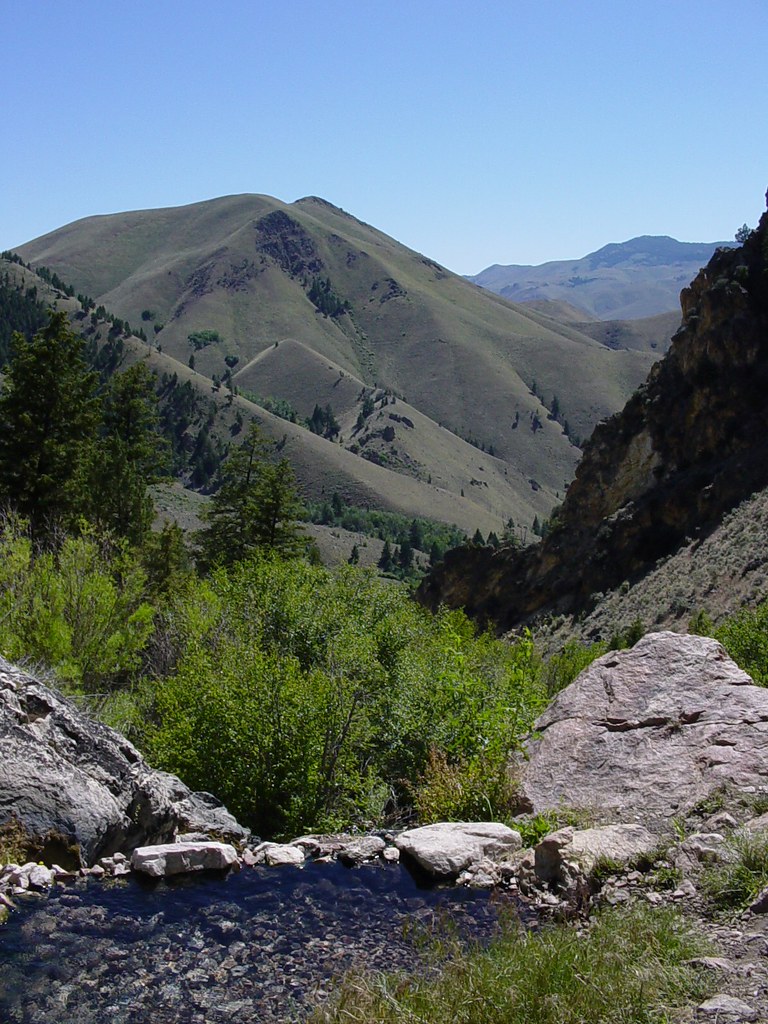 Photo: Ben B Miller, CC BY-SA 2.0 (via Flickr)
- 1.4 mi
- round trip
- 1,151 ft
- climb
- 5,375 ft
- high point
- Out and back
- route
- May–Jun, Aug–Sep
- best months
The Goldbug Hot Springs Trail is a moderate out-and-back hike of about 2.7 miles on Bureau of Land Management land within the Salmon Field Office in Idaho. It starts at about 4,500 feet and climbs to roughly 5,375 feet, with a total elevation gain of about 1,150 feet, making it a hike that gains and loses the same amount on the way up and down. The steepest stretch comes at about 1.3 miles into the route, where the grade reaches 30 percent. The hike's most comfortable window runs from June through September, when typical averages from a nearby weather station at a similar elevation show highs between about 76 and 87 degrees and lows between about 34 and 45 degrees. July is the warmest month, with typical highs near 87 degrees. Warm Springs, a cross-country ski area, sits just 0.3 miles away, and the Lime Creek hike is about 1.5 miles off. Williams Lake Campground, roughly 8.5 miles away, is the closest place to camp.
- Warm SpringsCross-country skiing0.3 mi
 Lime CreekHikingPhoto: waterarchives, CC BY-SA 2.0 (via Flickr)1.5 mi
- Mckim StockHiking4.6 mi
- Badger BasinHiking4.7 mi
 Mckim CreekHikingPhoto: User:akampfer, CC BY-SA 3.0 (via Wikimedia Commons)6.2 mi
- BASIN CREEKHiking6.6 mi
- RattlesnakeHiking6.8 mi
- Williams Lake CampgroundCamping8.5 mi
Source: Roamze catalog (indexable pages within 10 miles, PostGIS distance)
- Lime CreekHiking · ~3 min drivePhoto: waterarchives, CC BY-SA 2.0 (via Flickr)
- Mckim CreekHiking · ~11 min drivePhoto: User:akampfer, CC BY-SA 3.0 (via Wikimedia Commons)
- LIME CREEKHiking · ~5 min drive
- HAYDEN CREEKHiking · ~22 min drive
- RattlesnakeHiking · ~12 min drive
- Mckim StockHiking · ~8 min drive
- Badger BasinHiking · ~8 min drive
- Thunder Mountain HistoricHiking · ~24 min drive
- North BasinHiking · ~12 min drive
- UPPER BEAR VALLEY LAKESHiking · ~14 min drive
Best time to visit Goldbug Hot Springs Trail
Best months: May–June and August–September. Best months have typical highs of 55–85 °F, lows of 30 °F or warmer (32 °F where the station doesn't record snow), at most one snowy day and no more than 12 wet days.
Jan
32° / 6°
3 wet
Feb
39° / 13°
3 wet
Mar
51° / 19°
4 wet
Apr
58° / 25°
5 wet
May
68° / 34°
7 wet
Jun
76° / 41°
6 wet
Jul
87° / 45°
4 wet
Aug
85° / 42°
4 wet
Sep
76° / 35°
5 wet
Oct
60° / 25°
5 wet
Nov
44° / 17°
4 wet
Dec
32° / 9°
3 wet
Typical high / low (°F) and days with rain or snow, 1991–2020. Measured at May 2sse, ID, 23.1 mi away at 5,050 ft. This station doesn't record snowfall. Source: NOAA NCEI U.S. Climate Normals 1991–2020.

Map and trail data © OpenStreetMap contributors
