Whoop-De-Dos
- 2.1 mi
- round trip
- 523 ft
- climb
- 2,180 ft
- high point
- Out and back
- route
- Mar–May, Aug–Nov
- best months
Is Whoop-De-Dos open right now?
Closure in the area
There's a closure order in Chattahoochee-Oconee National Forests. It doesn't name Whoop-De-Dos, so check the source for the area it covers (4 listed).
Road Maintenance: West Cowpen Road (FSR 17)
Agency closure covering Chattahoochee-Oconee National Forests · USFS · Chattahoochee-Oconee National Forests
Prescribed fire on Oconee Ranger District at Jasper County
Agency closure covering Chattahoochee-Oconee National Forests · USFS · Chattahoochee-Oconee National Forests
Muskrat Road, FS 218, Temporarily Closed
Agency closure covering Chattahoochee-Oconee National Forests · USFS · Chattahoochee-Oconee National Forests
Flash Flood Awareness
Agency closure covering Chattahoochee-Oconee National Forests · USFS · Chattahoochee-Oconee National Forests
Lake Winfield Scott closed except fishing pier
Agency alert covering Chattahoochee-Oconee National Forests · USFS · Chattahoochee-Oconee National Forests
As of · Source: USFS · Chattahoochee-Oconee National Forests. Agencies don't list every closure — check before you go.
Whoop-De-Dos is an easy out-and-back hike on the Blue Ridge Ranger District of the Chattahoochee-Oconee National Forests in northeast Georgia, managed by the Forest Service. The trail is about 2 miles long, with a total climb of about 520 feet. It starts near the 1,868-foot mark and rises to a high point of 2,180 feet, with the steepest stretch at about 0.5 miles in. The trail is natural-surfaced and allows both horses and bikes, which makes it a flexible option for riders and riders on horseback. It's also easy to string together with other trails in the area, since Lance Creek Trail lies about 0.1 mile away and Bare Hare Trail about 0.2 mile away. For comfortable weather, aim for fall. Typical averages from a nearby weather station show October highs around 70°F with lows near 40°F. September and October are the most comfortable months for a visit. Spring runs a little cooler, with April highs near 69°F. Cochran Falls, a climbing area about 4 miles away, and Frank Gross campground, about 7 miles away, round out the options nearby.
Best time to go · Mar–May, Aug–Nov
Best time to visit Whoop-De-Dos
Best months: March–May and August–November. Best months have typical highs of 55–85 °F, lows of 30 °F or warmer (32 °F where the station doesn't record snow), at most one snowy day and no more than 12 wet days.
Jan
49° / 25°
12 wet
Feb
53° / 28°
12 wet
Mar
60° / 34°
12 wet
Apr
69° / 41°
11 wet
May
76° / 50°
12 wet
Jun
82° / 58°
13 wet
Jul
85° / 62°
13 wet
Aug
84° / 61°
12 wet
Sep
80° / 55°
9 wet
Oct
70° / 43°
10 wet
Nov
61° / 33°
10 wet
Dec
52° / 29°
12 wet
Typical high / low (°F) and days with rain or snow, 1991–2020. Measured at Blairsville Exp Stn, GA, 21.1 mi away at 1,949 ft. This station doesn't record snowfall. Source: NOAA NCEI U.S. Climate Normals 1991–2020.
Closures we've recorded since August 2026
Spring 2026 Forest-wide Fire Restrictions
Chattahoochee-Oconee National Forests · Order dated April 23, 2026; seen Aug 23, 2026 → lifted Oct 13, 2026 · Forest Service
Keep exploring — more trails worth the drive
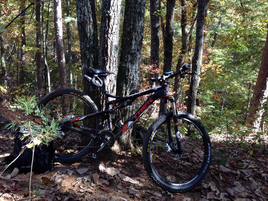 Photo: jsnyng, CC BY 2.0 (via Flickr)
Fdr-872 Jones Creek Dam Trail
~2 min drive
6.30-mile out-and-back hike to Jones Creek Dam in Georgia
Photo: jsnyng, CC BY 2.0 (via Flickr)JAKE/BULL CONNECTOR TRAIL
~2 min drive
6.96-mile out-and-back trail in Georgia with 1,309 ft elevation gain
 Photo: jsnyng, CC BY 2.0 (via Flickr)
FDR-83 Bull Mountain Trail
~4 min drive
2.28-mile out-and-back hike in Georgia with 537 ft elevation gain and loss.
 Photo: Thomson20192, Public Domain Dedication (CC0) (via Flickr)
Appalachian Trail
~6 min drive
120-mile point-to-point section of the iconic Appalachian Trail through Georgia mountains.
 Photo: jsnyng, CC BY 2.0 (via Flickr)
Jake Mountain Trail
~5 min drive
4.00-mile out-and-back hike in Georgia with 801 ft gain
 Photo: Thomson20192, Public Domain Dedication (CC0) (via Flickr)
Anderson Creek
~10 min drive
6.58-mile out-and-back trail in Georgia with 2,085 ft elevation gain.
 Photo: Bas van Oorschot, CC BY-SA 3.0 (via Wikimedia Commons)
Creek Trail
~10 min drive
1.02-mile out-and-back trail in Georgia with 813 ft elevation gain.
 Photo: Bas van Oorschot, CC BY-SA 3.0 (via Wikimedia Commons)
Hike Inn Lodge
~10 min drive
10.96-mile out-and-back hike in Georgia with 1,704 ft gain.
HIKE
No- Tell Trail
~2 min drive
4.24-mile out-and-back trail in Georgia with 455 ft gain.
Photo: Bas van Oorschot, CC BY-SA 3.0 (via Wikimedia Commons)Spring Trail
~11 min drive
0.62-mile out-and-back hike in Georgia with 221 ft of elevation gain


Route details
- Distance
- 2.1 mi round trip
- Climbing
- About 523 ft
- Summit
- 2,335 ft
- Difficulty
- Easy
- Time
- About 1 hour
Season
Season: Year-round.
Other routes up Bull Mountain
Questions about this route
How long is the Whoop-De-Dos on Bull Mountain?
About 2.1 mi round trip.
How much elevation gain is on the Whoop-De-Dos?
About 523 ft of climbing round trip.
How hard is the Whoop-De-Dos?
It is rated easy.
How long does the Whoop-De-Dos take?
About 1 hour round trip.
When is the best time for the Whoop-De-Dos?
Year-round.
How many routes go up Bull Mountain?
2: Whoop-De-Dos and Bull Mountain.
Conditions and forecast on Bull Mountain
Daily highs and lows, wind and the chance of precipitation at the summit and route start for the next 7 days, from the Open-Meteo model.
