Rabun Beach
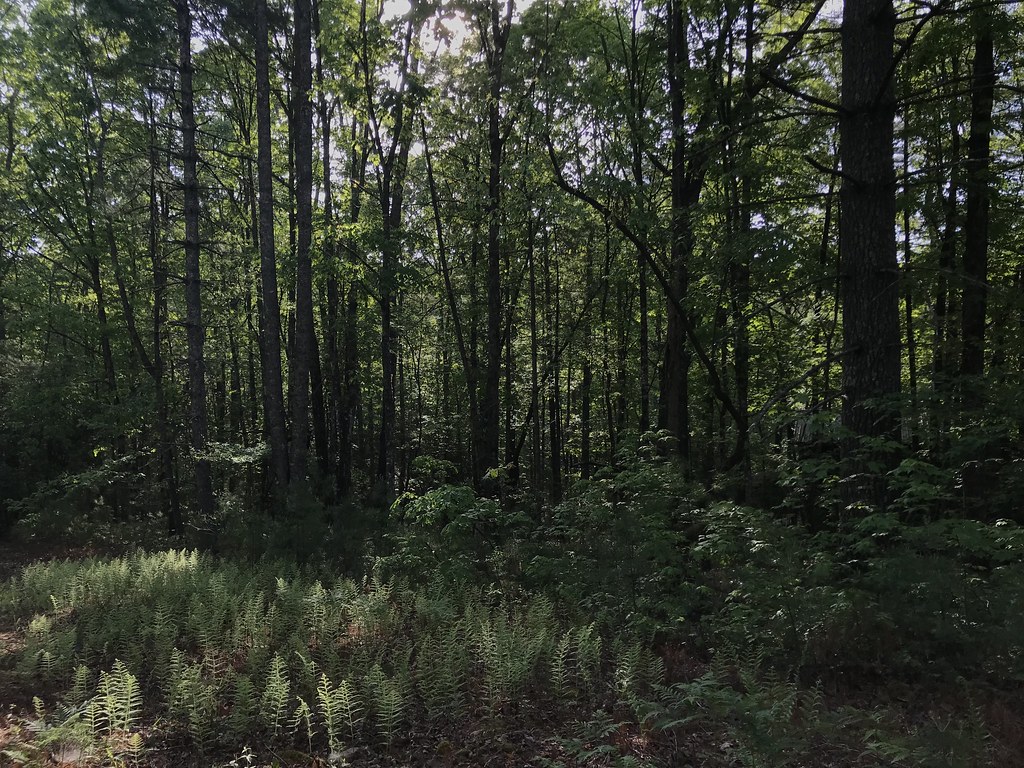 Photo: KW Baker, CC BY-SA 2.0 (via Flickr)
- 0.5 mi
- round trip
- 278 ft
- climb
- 1,790 ft
- high point
- Out and back
- route
- Mar–Jun, Aug–Nov
- best months
Is Rabun Beach open right now?
Closure in the area
There's a closure order in Chattahoochee-Oconee National Forests. It doesn't name Rabun Beach, so check the source for the area it covers (4 listed).
Road Maintenance: West Cowpen Road (FSR 17)
Agency closure covering Chattahoochee-Oconee National Forests · USFS · Chattahoochee-Oconee National Forests
Prescribed fire on Oconee Ranger District at Jasper County
Agency closure covering Chattahoochee-Oconee National Forests · USFS · Chattahoochee-Oconee National Forests
Muskrat Road, FS 218, Temporarily Closed
Agency closure covering Chattahoochee-Oconee National Forests · USFS · Chattahoochee-Oconee National Forests
Flash Flood Awareness
Agency closure covering Chattahoochee-Oconee National Forests · USFS · Chattahoochee-Oconee National Forests
Lake Winfield Scott closed except fishing pier
Agency alert covering Chattahoochee-Oconee National Forests · USFS · Chattahoochee-Oconee National Forests
As of · Source: USFS · Chattahoochee-Oconee National Forests. Agencies don't list every closure — check before you go.
Rabun Beach is an easy out-and-back hike of about a mile in the Chattooga River Ranger District of the Chattahoochee-Oconee National Forests in north Georgia, managed by the Forest Service. The trail rises about 77 feet from its low point of 1,688 feet to a high of 1,790 feet, with the steepest stretch at about 0.36 miles in, where the grade reaches 7 percent. Spring and fall are the most comfortable times to go. Typical averages from a nearby weather station show October highs around 71°F with lows near 47°F, and April highs around 70°F. Summer runs hotter, with July highs near 85°F. Rabun Beach Recreation Area, a campground about 0.1 mile away, sits right next to the trail. Angel Falls, another hike about 0.3 mile off, and Lake Rabun Beach Recreation Area, a campground about 0.4 mile away, are also close by. Paddlers can reach the Soquee River about 6.6 miles away.
Local outfitters
- Wildwater White Water Rafting & Zipline Canopy Tours13 mi away
- Headwaters Outfitters45 mi away
Not on Roamze yet. Their page has how to reach them.
Best time to go · Mar–Jun, Aug–Nov
Best time to visit Rabun Beach
Best months: March–June and August–November. Best months have typical highs of 55–85 °F, lows of 30 °F or warmer (32 °F where the station doesn't record snow), at most one snowy day and no more than 12 wet days.
Jan
50° / 30°
11 wet
Feb
54° / 31°
10 wet
Mar
61° / 37°
11 wet
Apr
70° / 44°
10 wet
May
76° / 53°
11 wet
Jun
83° / 61°
12 wet
Jul
85° / 65°
13 wet
Aug
84° / 64°
12 wet
Sep
79° / 59°
10 wet
Oct
71° / 47°
9 wet
Nov
61° / 37°
9 wet
Dec
53° / 32°
11 wet
Typical high / low (°F) and days with rain or snow, 1991–2020. Measured at Clayton 1 Ssw, GA, 10 mi away at 1,965 ft. This station doesn't record snowfall. Source: NOAA NCEI U.S. Climate Normals 1991–2020.
Closures we've recorded since August 2026
Spring 2026 Forest-wide Fire Restrictions
Chattahoochee-Oconee National Forests · Order dated April 23, 2026; seen Aug 23, 2026 → lifted Oct 13, 2026 · Forest Service
Keep exploring — more trails worth the drive
Photo: KW Baker, CC BY-SA 2.0 (via Flickr)Angel Falls
Next door
2.20-mile out-and-back trail in Georgia with 576 ft elevation gain.
 Photo: Bas van Oorschot, CC BY-SA 3.0 (via Wikimedia Commons)
Stone Place Trail
~12 min drive
4.98-mile out-and-back hike in Georgia with 1,237 ft elevation gain
HIKE
OAKEY MOUNTAIN ORV TRAIL
~5 min drive
12.82-mile out-and-back ORV trail in Georgia with 3,425 ft elevation gain/loss
 Photo: pseabolt, CC BY 3.0 (via Wikimedia Commons)
Upper Terrora Natura Trail
~7 min drive
0.56-mile loop with 49 ft elevation gain in Georgia
 Photo: lns1122, CC BY 2.0 (via Flickr)
Tennessee Rock Trail
~19 min drive
2.08-mile loop in Georgia with 911 ft elevation gain and loss.
HIKE
Stonewall Falls Mountain Bike
~9 min drive
11.43-mile loop mountain bike trail in Georgia with 1,356 ft elevation gain.
Photo: pseabolt, CC BY 3.0 (via Wikimedia Commons)Terrora Lake Loop Trail
~7 min drive
0.54-mile loop around Terrora Lake in Georgia with 193 ft of elevation gain.
HIKE
White Twister Mountain Bike Tr
~8 min drive
4.06-mile loop mountain bike trail in Georgia with 741 ft elevation gain.
HIKE
Panther Creek Trail
~13 min drive
11.5-mile out-and-back creek hike in Georgia with mixed forest terrain.
Photo: pseabolt, CC BY 3.0 (via Wikimedia Commons)Stone Place Trail
~9 min drive
1.08-mile out-and-back trail in Georgia with 304 ft elevation gain.

Map and trail data © OpenStreetMap contributors
