Wekiwa East-West
 Photo: gary_leavens, CC BY-SA 2.0 (via Wikimedia Commons)
- 1.1 mi
- one way
- 10 ft
- climb
- 42 ft
- high point
- Point to point
- route
- Oct–Apr
- best months
Wekiwa East-West is a short, easy hike in Wekiwa Springs State Park in Florida, a state park managed by State Park and Recreation. The route is a point-to-point walk of about 1.1 miles, with a total elevation gain of about 10 feet. It is a low-effort outing, and the trail is rated easy. The hike is a flat, low-lying walk. The highest point is about 42 feet, and the lowest is about 22 feet, with the steepest stretch at about 0.54 miles in, where the grade reaches about 3 percent. Bikes and horses are not allowed on this route. The most comfortable months for a visit are typically winter and early spring. Typical averages from a nearby weather station show January highs around 71°F and lows near 44°F, while July highs average about 93°F. The Wekiwa Volksmarch Trail starts just 0.1 mile away, and the Wekiwa Main Hiking Trail is about 0.7 mile off. The Wekiwa Mill Creek Loop is roughly 1.4 miles away, and the Bella Vista Park Tree Climbing area is about 4.1 miles away.
Local outfitters
Not on Roamze yet. Their page has how to reach them.
Best time to go · Oct–Apr
Best time to visit Wekiwa East-West
Best months: October–April. Best months have typical highs of 55–85 °F, lows of 30 °F or warmer (32 °F where the station doesn't record snow), at most one snowy day and no more than 12 wet days.
Jan
71° / 44°
Feb
74° / 47°
Mar
79° / 50°
Apr
83° / 56°
May
89° / 64°
Jun
91° / 71°
Jul
93° / 73°
Aug
92° / 73°
Sep
90° / 70°
Oct
84° / 62°
Nov
78° / 55°
Dec
73° / 49°
Typical high / low (°F) and days with rain or snow, 1991–2020. Measured at Mt Plymouth 1ssw, FL, 6.1 mi away at 90 ft. This station doesn't record snowfall. Source: NOAA NCEI U.S. Climate Normals 1991–2020.
Keep exploring — more trails worth the drive
Photo: gary_leavens, CC BY-SA 2.0 (via Wikimedia Commons)Wekiwa Volksmarch Trail
Next door
5-mile point-to-point trail in Florida with 343 ft elevation gain.
Photo: gary_leavens, CC BY-SA 2.0 (via Wikimedia Commons)Wekiwa Main Hiking Trail
~1 min drive
8.2-mile point-to-point trail through Wekiwa Springs State Park's diverse ecosystems.
HIKE
Paisley Woods Mtn Bike
~31 min drive
44-mile out-and-back mountain bike trail through Florida woodland terrain.
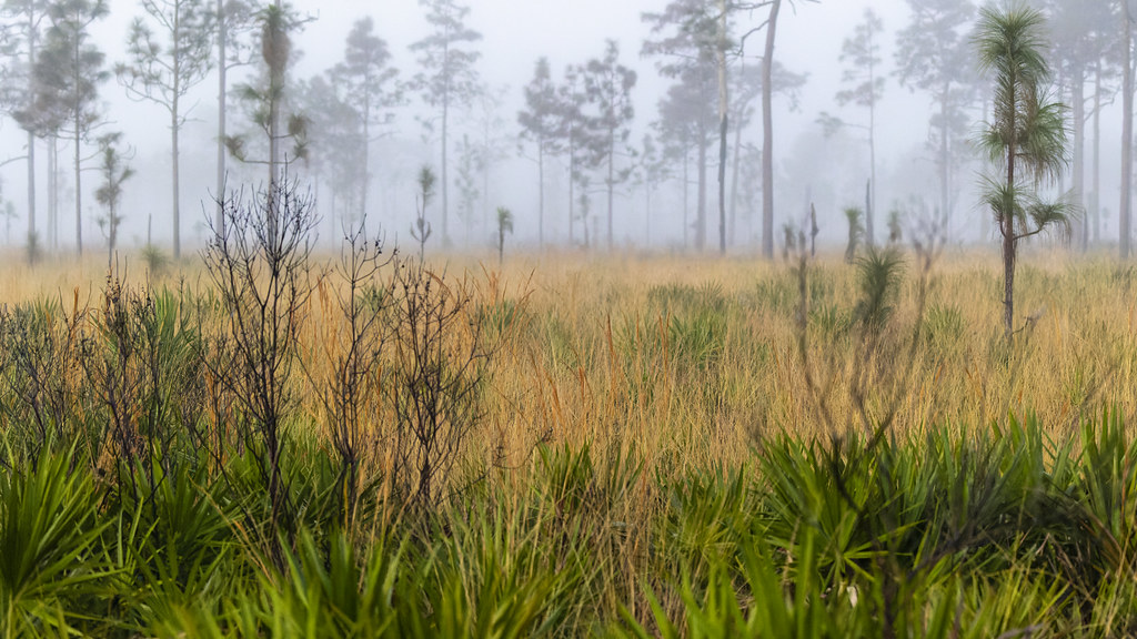 Photo: gary_leavens, CC BY-SA 2.0 (via Flickr)
Red Blaze Trail
~46 min drive
6.07-mile loop in Florida with 100 ft elevation gain.
 Photo: gary_leavens, CC BY-SA 2.0 (via Flickr)
Lower Wekiva River Preserve State Park Trail
~13 min drive
0.65-mile out-and-back trail on the Wekiva River in Florida.
HIKE
Prairie Riding Loop
~36 min drive
80-mile loop trail in Florida with 907 ft elevation gain
HIKE
Lower Wekiva Loop - Outer 11Mi
~14 min drive
6.10-mile point-to-point trail in Florida with 262 ft gain.
 Photo: k7hpn, CC BY 2.0 (via Flickr)
Longhorn Steakhouse Loop
~37 min drive
0.48-mile out-and-back trail in Florida with 13 ft of elevation gain.
HIKE
Flatwoods Riding Loop
~43 min drive
28-mile out-and-back trail in Florida with 488 ft elevation gain
HIKE
Baptist Riding Loop
~40 min drive
5.47-mile out-and-back trail in Florida with 161 ft elevation gain.

Map and trail data © OpenStreetMap contributors
