Longhorn Steakhouse Loop
 Photo: k7hpn, CC BY 2.0 (via Flickr)
- 0.5 mi
- round trip
- 13 ft
- climb
- 110 ft
- high point
- Out and back
- route
- Oct–Apr
- best months
Longhorn Steakhouse Loop is a short, easy loop hike in Florida, about 1.3 miles from the town of Vineland. The route is 0.48 miles long and sits almost entirely flat, with a high point of 110 feet and a low of 103 feet. The climb is flat, and the total elevation gain is zero, making it a simple walk for anyone looking to spend a few minutes outdoors close to town. The most comfortable months for a visit are typically winter and early spring. Typical averages from a nearby weather station in Orlando show January highs around 71°F and lows near 49°F, while summer highs climb into the low 90s. Other outings lie within a short drive. Walking Path is about 4.7 miles away, and Lion King Boulders, a climbing area, is about 5.3 miles off. Countyline and Pioneer Village Trail are both within about 7 miles.
Local outfitters
Not on Roamze yet. Their page has how to reach them.
Best time to go · Oct–Apr
Best time to visit Longhorn Steakhouse Loop
Best months: October–April. Best months have typical highs of 55–85 °F, lows of 30 °F or warmer (32 °F where the station doesn't record snow), at most one snowy day and no more than 12 wet days.
Jan
71° / 49°
Feb
75° / 51°
Mar
79° / 55°
Apr
84° / 59°
May
89° / 66°
Jun
92° / 71°
Jul
93° / 73°
Aug
92° / 73°
Sep
91° / 72°
Oct
85° / 65°
Nov
79° / 57°
Dec
73° / 52°
Typical high / low (°F) and days with rain or snow, 1991–2020. Measured at Orlando W, FL, 7.5 mi away at 150 ft. This station doesn't record snowfall. Source: NOAA NCEI U.S. Climate Normals 1991–2020.
Keep exploring — more trails worth the drive
 Photo: mededeler, CC BY 2.0 (via Flickr)
Pioneer Village Trail
~12 min drive
0.47-mile out-and-back trail in Florida with 17 ft of elevation gain.
 Photo: gary_leavens, CC BY-SA 2.0 (via Wikimedia Commons)
Wekiwa Volksmarch Trail
~37 min drive
5-mile point-to-point trail in Florida with 343 ft elevation gain.
Photo: gary_leavens, CC BY-SA 2.0 (via Wikimedia Commons)Wekiwa Main Hiking Trail
~36 min drive
8.2-mile point-to-point trail through Wekiwa Springs State Park's diverse ecosystems.
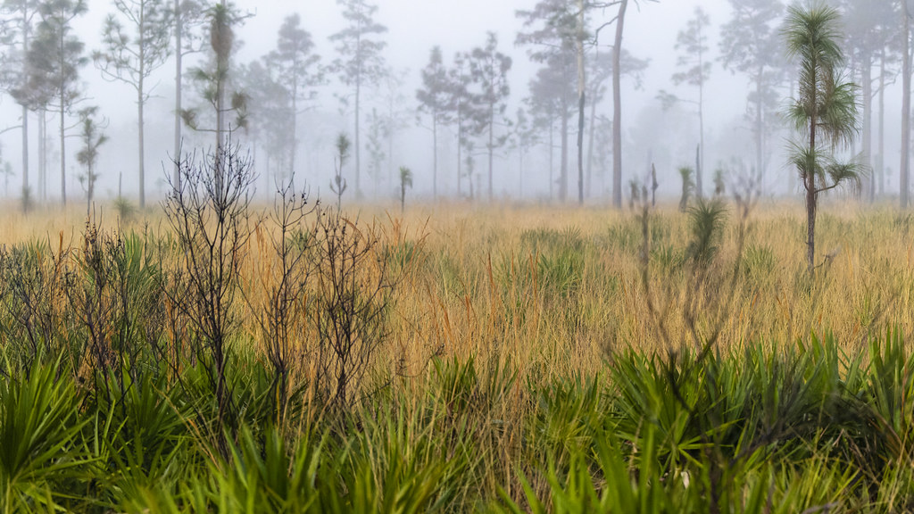 Photo: gary_leavens, CC BY-SA 2.0 (via Flickr)
Red Blaze Trail
~40 min drive
6.07-mile loop in Florida with 100 ft elevation gain.
Photo: gary_leavens, CC BY-SA 2.0 (via Wikimedia Commons)Wekiwa East-West
~37 min drive
1.12-mile point-to-point trail in Florida with 61 ft gain.
HIKE
Yellow Blaze Trail
~39 min drive
5.84-mile loop trail in Florida with 102 ft gain.
 Photo: gary_leavens, CC BY-SA 2.0 (via Flickr)
Lower Wekiva River Preserve State Park Trail
~48 min drive
0.65-mile out-and-back trail on the Wekiva River in Florida.
HIKE
White Blaze Trail
~40 min drive
A 4.60-mile point-to-point Florida trail with clear white blaze markings.
 Photo: FartyBoi, CC BY-SA 4.0 (via Wikimedia Commons)
Tosohatchee Wildlife Management Area Trail
~59 min drive
25.78-mile point-to-point trail in Florida with 512 ft elevation gain
HIKE
Lower Wekiva Loop - Outer 11Mi
~50 min drive
6.10-mile point-to-point trail in Florida with 262 ft gain.

Map and trail data © OpenStreetMap contributors
