YMCA Camp Mountain Laurel
Campground
Campground · 2.8 mi from the trail
High Rock is a summit in Connecticut, rising to 706 feet. It sits about 2.6 miles from Quinnipiac University, which makes it an easy addition to a day spent around campus. Late spring and early fall are the most comfortable times to visit. Typical averages from a nearby weather station at Mt Carmel show May highs around 71°F and September highs around 76°F, with July peaking near 85°F. That station sits well below the summit, so temperatures on top run cooler. The High Rock Jumble climbing area is just 0.1 mile away, and the Hermit Boulders are 0.3 mile off. Hikers can pick up the Sanford Feeder at 0.4 mile or the Red Trail at 0.6 mile.
YMCA Camp Mountain Laurel
Campground
 If it rainsMConradWard, CC0 · Wikimedia Commons
Meriden Historical Society Museum & History Center
Museum
Places © OpenStreetMap contributors, Places © Overture Maps Foundation · Photos: MConradWard, CC0 (commons)
More in MiddletownDaily highs and lows, wind and the chance of precipitation at the summit for the next 7 days, from the Open-Meteo model.
Elevation from USGS 3D Elevation Program terrain data (about 10 m resolution).
We don't know of a mapped trail or route to the summit of High Rock. Plan the approach with local maps, a guidebook or a local guide, and check conditions before you go.
706 ft (215 m).
We don't know of a mapped trail or route to the summit. Plan the approach with local maps, a guidebook or a local guide.

 Red TrailHikingPhoto: ethan.long, CC BY-SA 2.0 (via Flickr)0.6 mi
 Hop Brook Lake Recreation AreaCampingPhoto: Recreation.gov (RIDB) / public domain9.5 mi
Source: Roamze catalog (indexable pages within 10 miles, PostGIS distance)
Mount CarmelSummit · ~5 min drivePhoto: Ken Gallager at English Wikipedia, Public domain (via Wikimedia Commons) Fowler MountainSummit · ~18 min drivePhoto: 5ju989nfhs50 at English Wikipedia, CC BY 3.0 (via Wikimedia Commons)Pistapaug MountainSummit · ~19 min drivePhoto: 5ju989nfhs50 at English Wikipedia, CC BY 3.0 (via Wikimedia Commons)
 Beseck MountainSummit · ~20 min drivePhoto: 5ju989nfhs50 at English Wikipedia, CC BY 3.0 (via Wikimedia Commons)
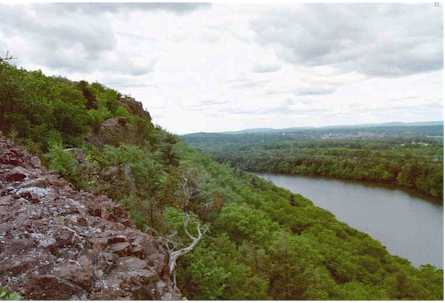 Chauncey PeakSummit · ~24 min drivePhoto: 5ju989nfhs50 at English Wikipedia, CC BY 3.0 (via Wikimedia Commons)
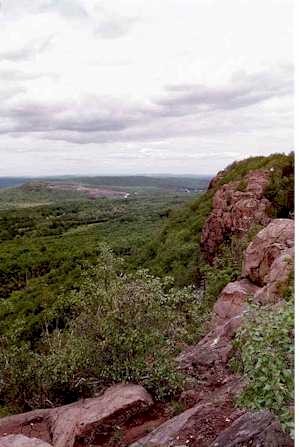 Higby MountainSummit · ~24 min drivePhoto: 5ju989nfhs50 at English Wikipedia, CC BY 3.0 (via Wikimedia Commons)
 Short MountainSummit · ~25 min drivePhoto: 5ju989nfhs50 at English Wikipedia, CC BY 3.0 (via Wikimedia Commons)
 Lamentation MountainSummit · ~25 min drivePhoto: Morrowlong, CC BY-SA 3.0 (via Wikimedia Commons)Ragged MountainSummit · ~27 min drivePhoto: 5ju989nfhs50 at English Wikipedia, CC BY 3.0 (via Wikimedia Commons)
 Bradley MountainSummit · ~31 min drivePhoto: Morrowlong, CC BY-SA 3.0 (via Wikimedia Commons)
Best months: April–October. Best months have typical highs of 55–85 °F, lows of 30 °F or warmer (32 °F where the station doesn't record snow), at most one snowy day and no more than 12 wet days.
Jan
38° / 20°
10 wet
Feb
41° / 22°
9 wet
Mar
48° / 28°
11 wet
Apr
60° / 38°
12 wet
May
71° / 48°
11 wet
Jun
79° / 58°
10 wet
Jul
85° / 64°
10 wet
Aug
84° / 62°
9 wet
Sep
76° / 55°
9 wet
Oct
64° / 43°
9 wet
Nov
52° / 34°
9 wet
Dec
42° / 26°
11 wet
Typical high / low (°F) and days with rain or snow, 1991–2020. Measured at Mt Carmel, CT, 2.1 mi away at 180 ft. The station sits about 500 ft lower than this place, so expect it a little cooler here. This station doesn't record snowfall. Source: NOAA NCEI U.S. Climate Normals 1991–2020.

