YMCA Camp Mountain Laurel
Campground
Campground · 4.2 mi from the trail
Bluff Head is a summit in Connecticut, about 2.8 miles from Cheshire Village. It sits in a cluster of hiking trails and climbing spots, so a visit can easily take in more than one destination. For comfortable weather, aim for late spring or early fall. Typical averages from a nearby weather station in Meriden run highs around 70°F in May and 75°F in September, and the summit stands several hundred feet higher than the station, so expect it to be a bit cooler. The closest neighbors are Roaring Brook Falls Trail and Yellow Trail, both about 2.2 miles away. CT Bouldering lies about 3 miles out for climbers, and Hop Brook Lake Recreation Area, about 6 miles away, offers camping.
YMCA Camp Mountain Laurel
Campground
 If it rainsMConradWard, CC0 · Wikimedia Commons
Meriden Historical Society Museum & History Center
Museum
Places © OpenStreetMap contributors, Places © Overture Maps Foundation · Photos: MConradWard, CC0 (commons)
More in MiddletownDaily highs and lows, wind and the chance of precipitation at the summit and route start for the next 7 days, from the Open-Meteo model.
Elevation from USGS 3D Elevation Program terrain data (about 10 m resolution).
580 ft (177 m).
One: Quinnipiac Trail.


 Hop Brook Lake Recreation AreaCampingPhoto: Recreation.gov (RIDB) / public domain6 mi
 Quinnipiac RiverCanoeingPhoto: Arthur Dutra IV, CC BY-SA 2.5 (via Wikimedia Commons)7.3 mi
Source: Roamze catalog (indexable pages within 10 miles, PostGIS distance)
Mount CarmelSummit · ~11 min drivePhoto: Ken Gallager at English Wikipedia, Public domain (via Wikimedia Commons) Short MountainSummit · ~15 min drivePhoto: 5ju989nfhs50 at English Wikipedia, CC BY 3.0 (via Wikimedia Commons)Ragged MountainSummit · ~17 min drivePhoto: 5ju989nfhs50 at English Wikipedia, CC BY 3.0 (via Wikimedia Commons)
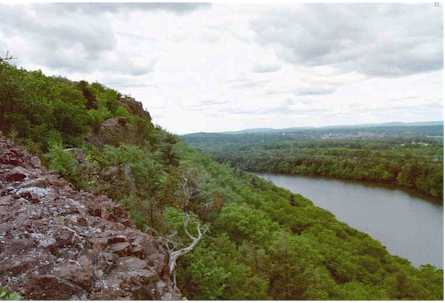 Chauncey PeakSummit · ~18 min drivePhoto: 5ju989nfhs50 at English Wikipedia, CC BY 3.0 (via Wikimedia Commons)Beseck MountainSummit · ~18 min drivePhoto: 5ju989nfhs50 at English Wikipedia, CC BY 3.0 (via Wikimedia Commons)
 Lamentation MountainSummit · ~18 min drivePhoto: Morrowlong, CC BY-SA 3.0 (via Wikimedia Commons)
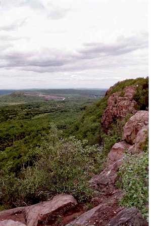 Higby MountainSummit · ~19 min drivePhoto: 5ju989nfhs50 at English Wikipedia, CC BY 3.0 (via Wikimedia Commons)
 Bradley MountainSummit · ~20 min drivePhoto: Morrowlong, CC BY-SA 3.0 (via Wikimedia Commons)
 Fowler MountainSummit · ~20 min drivePhoto: 5ju989nfhs50 at English Wikipedia, CC BY 3.0 (via Wikimedia Commons)Pistapaug MountainSummit · ~21 min drivePhoto: 5ju989nfhs50 at English Wikipedia, CC BY 3.0 (via Wikimedia Commons)
Best months: April and June–October. Best months have typical highs of 55–85 °F, lows of 30 °F or warmer (32 °F where the station doesn't record snow), at most one snowy day and no more than 12 wet days.
Jan
37° / 19°
10 wet
Feb
39° / 20°
9 wet
Mar
47° / 28°
10 wet
Apr
60° / 38°
11 wet
May
70° / 48°
13 wet
Jun
79° / 57°
12 wet
Jul
84° / 63°
12 wet
Aug
82° / 61°
12 wet
Sep
75° / 54°
11 wet
Oct
64° / 42°
12 wet
Nov
52° / 32°
10 wet
Dec
42° / 24°
11 wet
Typical high / low (°F) and days with rain or snow, 1991–2020. Measured at Meriden Markham Muni Ap, CT, 6.3 mi away at 103 ft. This station doesn't record snowfall. Source: NOAA NCEI U.S. Climate Normals 1991–2020.