Pikes Peak
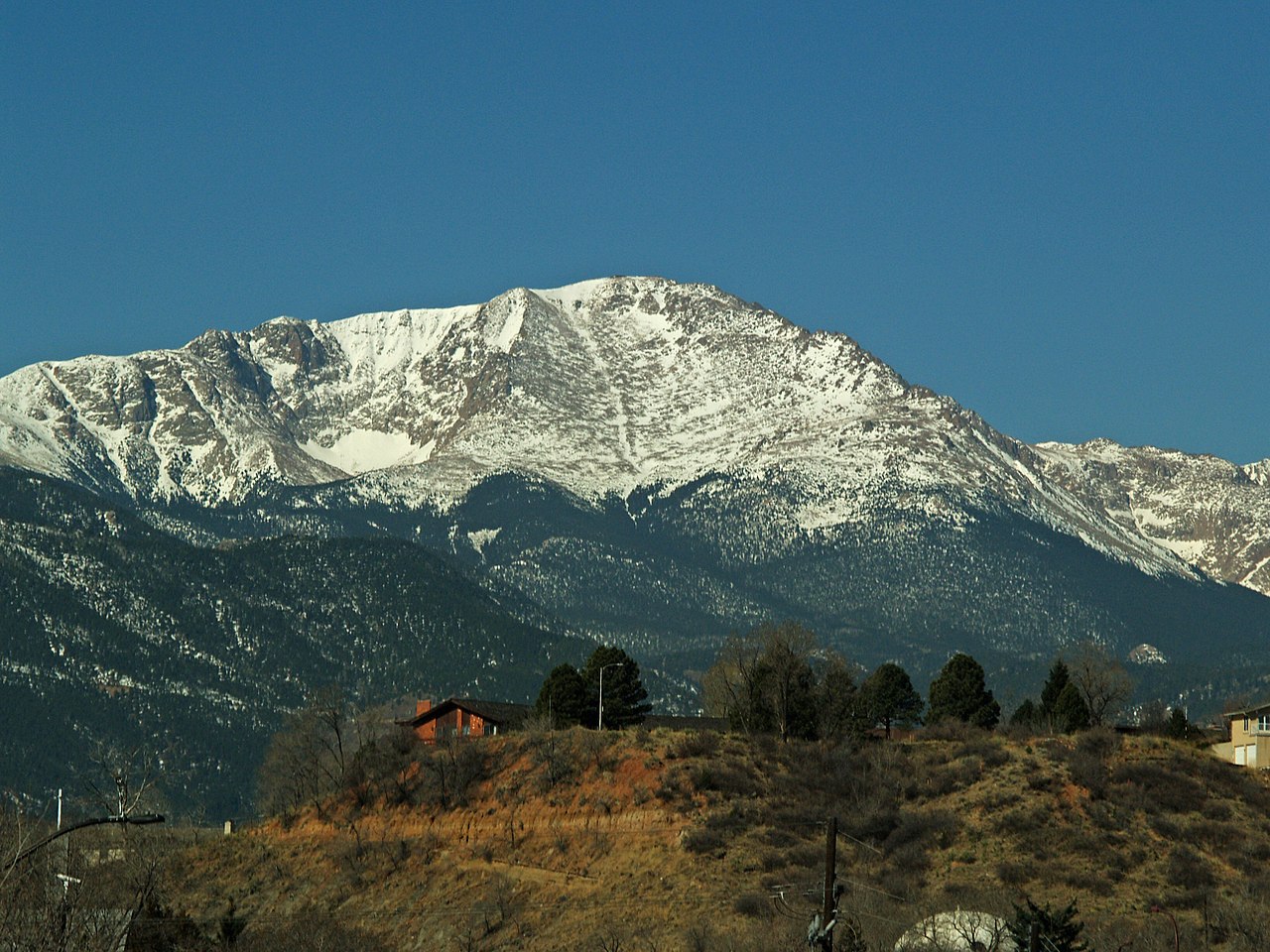 Photo: David Shankbone, CC BY-SA 3.0 (via Wikimedia Commons)
- 14,107 ft
- summit
- 3
- ways up
- Forest Service
- managed by
Is Pikes Peak open right now?
Alert in the area
The Forest Service lists 11 alerts for Pike and San Isabel National Forests.
FSR 286, Radical Hill, is closed due to washouts and unsafe conditions
Agency alert covering Pike and San Isabel National Forests · USFS · Pike and San Isabel National Forests
Interlaken Hotel Tree Hazards
Agency alert covering Pike and San Isabel National Forests · USFS · Pike and San Isabel National Forests
Sharpe Fire Update
Agency alert covering Pike and San Isabel National Forests · USFS · Pike and San Isabel National Forests
Turquoise Lake Road (County Road 4) Closure
Agency alert covering Pike and San Isabel National Forests · USFS · Pike and San Isabel National Forests
Waldo Canyon Burn Area Closure
Agency alert covering Pikes Peak Ranger District · Order 02-12-09-24-07 · USFS · Pikes Peak Ranger District
As of · Source: USFS · Pike and San Isabel National Forests. Agencies don't list every closure — check before you go.
Pikes Peak is a summit in Colorado's Pikes Peak Ranger District, part of the Pike and San Isabel National Forests, managed by the Forest Service. The nearest town is Midland, about 6 miles away, which makes it a natural base for planning a trip to the mountain. The summit sits in a busy pocket of recreation. The Pike's Peak climbing area lies right alongside it, and the Pikes Peak West Summit mountain biking area is about a third of a mile off. Bottomless Pit, another biking spot, is about a mile away, and Crags Campground, roughly 4.6 miles out, offers a place to stay overnight.
Conditions and forecast
Daily highs and lows, wind and the chance of precipitation at the summit and route start for the next 7 days, from the Open-Meteo model.
- Summit elevation
- 14,107 ft
- Land manager
- Forest Service
Elevation from USGS 3D Elevation Program terrain data (about 10 m resolution).
- Pikes Peak West SummitModerateFrom BARR - SUMMIT (about 13,188 ft) · about 914 ft of climbing1.9 mi round trip
- Pikes PeakExpertFrom Barr Trailhead (Manitou Springs) (about 6,608 ft) · about 9,205 ft of climbing22.5 mi round trip
- Barr TrailHardFrom Barr Trailhead (about 6,676 ft) · about 7,408 ft of climbing23.8 mi round trip
Compare the routes Pikes Peak West Summit Pikes Peak Barr Trail Starts at BARR - SUMMIT Barr Trailhead (Manitou Springs) Barr Trailhead Climbing About 914 ft About 9,205 ft About 7,408 ft Round trip 1.9 mi 22.5 mi 23.8 mi Difficulty Moderate Expert Hard Terrain Hike Hike Hike Season Year-round — — Map © Mapbox © OpenStreetMap contributors Questions about Pikes Peak
How tall is Pikes Peak?
14,107 ft (4,300 m).
How many routes go to the summit of Pikes Peak?
3: Pikes Peak West Summit, Pikes Peak and Barr Trail.
What is the shortest route up Pikes Peak?
Pikes Peak West Summit, about 1.9 mi round trip.
Where do the routes up Pikes Peak start?
Pikes Peak West Summit starts at BARR - SUMMIT (about 13,188 ft). Pikes Peak starts at Barr Trailhead (Manitou Springs) (about 6,608 ft). Barr Trail starts at Barr Trailhead (about 6,676 ft).
When is the best time to climb Pikes Peak?
Year-round.
- Raspberry Mountain10,602 ft · Colorado1 route6.3 mi away
- Red Mountain7,330 ft · Colorado1 route6.7 mi away
- Iron Mountain7,130 ft · Colorado2 routes7.1 mi away
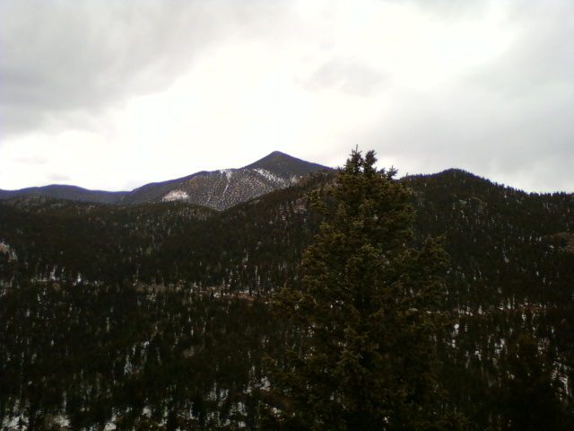 Mount Rosa11,499 ft · Colorado1 route8.0 mi awayPhoto: Xnatedawgx, CC BY-SA 3.0 (via Wikimedia Commons)
- Mays Peak8,281 ft · Colorado1 route8.5 mi away
 Mount Cutler7,229 ft · Colorado1 route9.8 mi awayPhoto: Lance Cpl. Graham Benson, Public domain (via Wikimedia Commons)
- Pike's PeakRock climbing0.1 mi
- Pikes Peak West SummitMountain biking0.3 mi
- Bottomless PitMountain biking1.1 mi
- Ghost Town HollowMountain biking1.5 mi
- Crags CampgroundCamping4.6 mi
- The Crags CampgroundCamping4.8 mi
- Colorado SpringsRock climbing7.5 mi
- Middle Beaver CreekCanoeing7.5 mi
Source: Roamze catalog (indexable pages within 10 miles, PostGIS distance)
- Mount RosaSummit · ~14 min drivePhoto: Xnatedawgx, CC BY-SA 3.0 (via Wikimedia Commons)
 Saint Peters DomeSummit · ~17 min drivePhoto: Langdon & Company, Denver, Public domain (via Wikimedia Commons)
- Mount CutlerSummit · ~17 min drivePhoto: Lance Cpl. Graham Benson, Public domain (via Wikimedia Commons)
 Mount PisgahSummit · ~19 min drivePhoto: James St. John, CC BY 2.0 (via Wikimedia Commons)
 Blodgett PeakSummit · ~19 min drivePhoto: Thomson200, CC0 (via Wikimedia Commons)
 Mount HermanSummit · ~31 min drivePhoto: Jeffrey Beall, CC BY 4.0 (via Wikimedia Commons)
 Elephant RockSummit · ~36 min drivePhoto: Oclupaca, CC0 (via Wikimedia Commons)
 Badger MountainSummit · ~50 min drivePhoto: Jeffrey Beall, CC BY 4.0 (via Wikimedia Commons)
 Devils HeadSummit · ~50 min drivePhoto: Jeff Albright, CC BY-SA 3.0 (via Wikimedia Commons)
 Dawson ButteSummit · ~55 min drivePhoto: Jeffrey Beall, CC BY 4.0 (via Wikimedia Commons)
Also worth it near here


