Mountain Park Campground
Campground
Campground · 0.7 mi from the trail
Alert in the area
The Forest Service lists 4 alerts for Canyon Lakes Ranger District.
Salt Cabin Prescribed (RX) Fire Closure
Agency alert covering Canyon Lakes Ranger District · Order 02-10-05-26-11 · USFS · Canyon Lakes Ranger District
Fire Restrictions
Agency alert covering Arapaho and Roosevelt National Forests · USFS · Arapaho and Roosevelt National Forests
West Crystal A - Mechanical Fuelbreak Area and Road Closure
Agency alert covering Canyon Lakes Ranger District · Order 02-10-05-26-04 · USFS · Canyon Lakes Ranger District
Cameron Peak Fire Road Closures
Agency alert covering Canyon Lakes Ranger District · Order 02-10-05-26-01 · USFS · Canyon Lakes Ranger District
As of · Source: USFS · Canyon Lakes Ranger District. Agencies don't list every closure — check before you go.
Mount McConnel is a summit of 8,009 feet in the Cache La Poudre Wilderness, part of the Canyon Lakes Ranger District of the Arapaho and Roosevelt National Forests in Colorado. The nearest town is Red Feather Lakes, about 11 miles away. Summer is the most comfortable time to visit. Typical averages from a nearby weather station at a similar elevation show July highs around 79°F with lows near 56°F, while winter highs stay around 40°F. The Mount McConnel Nature Trail starts about half a mile from the summit, and Mountain Park Campground and Mountain Park Group Campground are each about 0.7 miles away. Climbers can find The Beach about 1.7 miles off.
Mountain Park Campground
Campground
Mishawaka Ampetheatre
Restaurant
Homestead Museum
Museum
Places © OpenStreetMap contributors
More in Red Feather LakesDaily highs and lows, wind and the chance of precipitation at the summit and route start for the next 7 days, from the Open-Meteo model.
Elevation from USGS 3D Elevation Program terrain data (about 10 m resolution).
| Mount McConnel Nature Trail | Wheeler Nat. Rec. Trail - Colorado | |
|---|---|---|
| Starts at | Mountain Park Trailhead | Calico Trailhead |
| Climbing | About 1,064 ft | About 4,009 ft |
| Round trip | 4.5 mi | 27.4 mi |
| Difficulty | Moderate | Hard |
| Terrain | Hike | Hike |
8,009 ft (2,441 m).
2: Mount McConnel Nature Trail and Wheeler Nat. Rec. Trail - Colorado.
Mount McConnel Nature Trail, about 4.5 mi.
Mount McConnel Nature Trail starts at Mountain Park Trailhead (about 6,935 ft). Wheeler Nat. Rec. Trail - Colorado starts at Calico Trailhead (about 12,347 ft).


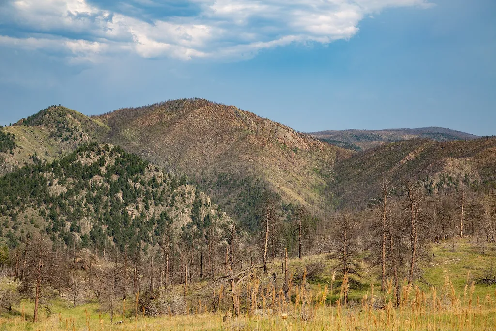 Mount McConnel Nature TrailHikingPhoto: Tony Webster — Wikimedia Commons (CC BY 2.0)0.5 mi
Source: Roamze catalog (indexable pages within 10 miles, PostGIS distance)
Greyrock MountainSummit · ~16 min drivePhoto: Lvaughn7, CC BY-SA 4.0 (via Wikimedia Commons) Goat HillSummit · ~27 min drivePhoto: Jeffrey Beall, CC BY-SA 4.0 (via Wikimedia Commons)Mummy MountainSummit · ~27 min drivePhoto: Hogs555, CC BY-SA 3.0 (via Wikimedia Commons)Hagues PeakSummit · ~28 min drivePhoto: Thomson200, CC0 (via Wikimedia Commons)
 Fairchild MountainSummit · ~30 min drivePhoto: Thomson200, CC0 (via Wikimedia Commons)
 Ypsilon MountainSummit · ~32 min drivePhoto: James St. John, CC BY 2.0 (via Wikimedia Commons)
 Mount ChiquitaSummit · ~34 min drivePhoto: Rationalobserver, CC BY-SA 4.0 (via Wikimedia Commons)
 Sundance MountainSummit · ~38 min drivePhoto: Dakota Duff, CC BY-SA 2.0 (via Wikimedia Commons)
 Iron MountainSummit · ~40 min drivePhoto: Thomson200, CC0 (via Wikimedia Commons)
 Specimen MountainSummit · ~41 min drivePhoto: Thomson200, CC0 (via Wikimedia Commons)
Best months: May–October. Best months have typical highs of 55–85 °F, lows of 30 °F or warmer (32 °F where the station doesn't record snow), at most one snowy day and no more than 12 wet days.
Jan
40° / 21°
5 wet
Feb
40° / 20°
6 wet
Mar
47° / 26°
8 wet
Apr
51° / 30°
10 wet
May
60° / 39°
12 wet
Jun
72° / 49°
11 wet
Jul
79° / 56°
11 wet
Aug
78° / 55°
11 wet
Sep
70° / 47°
8 wet
Oct
57° / 36°
7 wet
Nov
47° / 28°
6 wet
Dec
40° / 20°
6 wet
Typical high / low (°F) and days with rain or snow, 1991–2020. Measured at Buckhorn Mtn 1 E, CO, 9.6 mi away at 7,400 ft. The station sits about 600 ft lower than this place, so expect it a little cooler here. This station doesn't record snowfall. Source: NOAA NCEI U.S. Climate Normals 1991–2020.

