
Mountain · 1 route
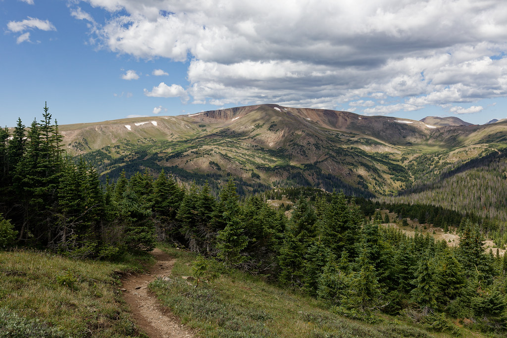
Mount Chiquita
13,052 ft · Colorado
Photo: Rationalobserver, CC BY-SA 4.0 (via Wikimedia Commons)
- Summit
- 13,052 ft
- Routes
- 1 way up
- Managed by
- National Park Service
Route up Mount Chiquita
About Mount Chiquita
Mount Chiquita is a summit in Colorado, 13,052 feet elevation. It is managed by the National Park Service.
Forecast on Mount Chiquita
Daily highs and lows, wind and the chance of precipitation at the summit and chapin pass trailhead for the next 7 days, from the Open-Meteo model.
Questions about Mount Chiquita
How tall is Mount Chiquita?
13,052 ft (3,978 m).
How many routes go to the summit of Mount Chiquita?
One: Mount Chiquita.
Where do the routes up Mount Chiquita start?
Mount Chiquita starts at Chapin Pass Trailhead.
Mountains nearby
 Ypsilon Mountain13,508 ft · Colorado1 route1.0 mi awayPhoto: James St. John, CC BY 2.0 (via Wikimedia Commons)
 Fairchild Mountain13,503 ft · Colorado1 route2.2 mi awayPhoto: Thomson200, CC0 (via Wikimedia Commons)
- Marmot Point11,910 ft · Colorado1 route2.5 mi away
 Hagues Peak13,554 ft · Colorado1 route3.6 mi awayPhoto: Thomson200, CC0 (via Wikimedia Commons)
- Rowe Peak13,384 ft · Colorado1 route4.0 mi away
 Mummy Mountain13,415 ft · Colorado1 route4.1 mi awayPhoto: Hogs555, CC BY-SA 3.0 (via Wikimedia Commons)
Facts about this place
Where it is
- Rocky Mountain National Park Wilderness · Wilderness
- Rocky Mountain National Park · National Park Service
- Nearest town
- Estes Park, Colorado · 9.7 mi
- Managed by
- National Park Service
Nearby
- Ypsilon MountainRock climbing1 mi
- Spectacle LakesHiking1.3 mi
 Chapin Pass Trail - Lower ForkHikingPhoto: KimonBerlin, CC BY-SA 2.0 (via Flickr)1.8 mi
- Rocky Mountain National Park Aspenglen CampgroundCamping5.9 mi
- McGregor SlabRock climbing6 mi
- La Poudre Pass CreekCanoeing6.3 mi
- Long Draw CampgroundCamping6.5 mi
- Glacier CreekCanoeing9.6 mi
Source: Roamze catalog (indexable pages within 10 miles, PostGIS distance)
Is Mount Chiquita open right now?
Closure in the area
There's a closure order in Rocky Mountain National Park. It doesn't name Mount Chiquita, so check the source for the area it covers.
Trail Ridge Road Status Update
Park closure covering Rocky Mountain National Park · NPS · Rocky Mountain National Park
As of · Source: NPS · Rocky Mountain National Park. Agencies don't list every closure — check before you go.
