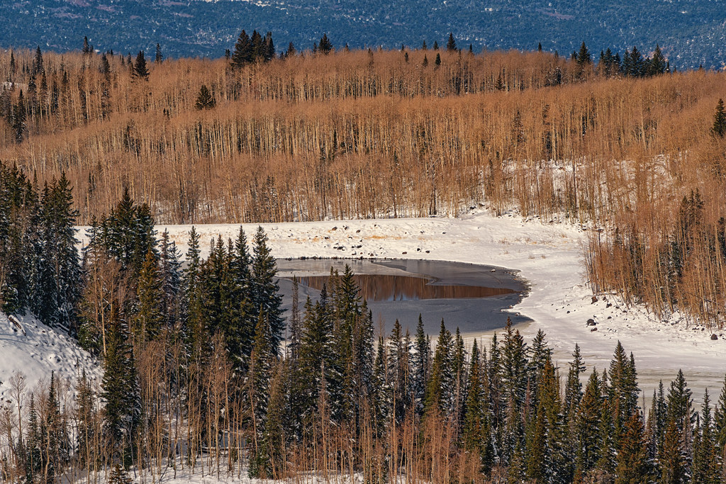
Spruce Grove Campground - Grand Valley RD
Campground
Campground · 1.3 mi from the trail
 Photo: KimonBerlin, CC BY-SA 2.0 (via Wikimedia Commons)
Closure in the area
There's a closure order in Grand Mesa, Uncompahgre and Gunnison National Forests. It doesn't name Lions, so check the source for the area it covers (2 listed).
Gold Mountain Wildfire Roads and Trails Closure Order v 4.0
Agency closure covering Grand Mesa, Uncompahgre and Gunnison National Forests · USFS · Grand Mesa, Uncompahgre and Gunnison National Forests
Ophir Pass Road Closure
Agency closure covering Grand Mesa, Uncompahgre and Gunnison National Forests · USFS · Grand Mesa, Uncompahgre and Gunnison National Forests
TERMINATION OF ORDER - FIRE RESTRICTIONS
Agency alert covering Grand Mesa, Uncompahgre and Gunnison National Forests · USFS · Grand Mesa, Uncompahgre and Gunnison National Forests
Dallas Area Closure order
Agency alert covering Grand Mesa, Uncompahgre and Gunnison National Forests · USFS · Grand Mesa, Uncompahgre and Gunnison National Forests
Island Lake Road Closure
Agency alert covering Grand Mesa, Uncompahgre and Gunnison National Forests · USFS · Grand Mesa, Uncompahgre and Gunnison National Forests
As of · Source: USFS · Grand Mesa, Uncompahgre and Gunnison National Forests. Agencies don't list every closure — check before you go.
Lions is a cross-country skiing route in the Grand Valley Ranger District of the Grand Mesa, Uncompahgre and Gunnison National Forests in Colorado, managed by the Forest Service. The route starts at about 10,675 feet and reaches a high of about 10,680 feet, with a total climb of about 62 feet over a distance of about 1.3 miles. The steepest stretch, with a grade of about 9 percent, comes at about 0.7 miles from the start. Winter is the season for skiing here. Typical averages from a nearby weather station show January highs around 26°F with lows near 6°F, and July highs around 68°F with lows near 42°F, so midsummer is the mildest stretch. Scales Lake Road and Kannah Crossing both sit about 0.1 mile away. Spruce Grove Campground is about 1.3 miles off, and Grand Mesa, a pier fishing spot, lies about 3.8 miles away.
Spruce Grove Campground - Grand Valley RD
Campground
Slopeside cafe
Restaurant
 If it rainsJeffrey Beall, CC BY-SA 3.0 · Wikimedia Commons
Places © OpenStreetMap contributors · Photos: Jeffrey Beall, CC BY-SA 3.0 (commons)
More in CliftonNot on Roamze yet. Their page has how to reach them.
Best months: June–September. Best months have typical highs of 55–85 °F, lows of 30 °F or warmer (32 °F where the station doesn't record snow), at most one snowy day and no more than 12 wet days.
Jan
26° / 6°
Feb
27° / 4°
Mar
34° / 12°
Apr
40° / 17°
May
49° / 27°
Jun
62° / 37°
Jul
68° / 42°
Aug
64° / 40°
Sep
57° / 34°
Oct
45° / 24°
Nov
34° / 14°
Dec
26° / 5°
Typical high / low (°F) and days with rain or snow, 1991–2020. Measured at Bonham Rsvr, CO, 9.5 mi away at 9,852 ft. The station sits about 800 ft lower than this place, so expect it a little cooler here. This station doesn't record snowfall. Source: NOAA NCEI U.S. Climate Normals 1991–2020.
Photo: KimonBerlin, CC BY-SA 2.0 (via Wikimedia Commons)Will'S Hill
Next door
0.23-mile trail in Colorado with 116 ft of elevation gain.
Photo: KimonBerlin, CC BY-SA 2.0 (via Wikimedia Commons)Arroyo
Next door
0.54-mile cross-country ski trail in Colorado with 46 ft of elevation gain.
Photo: KimonBerlin, CC BY-SA 2.0 (via Wikimedia Commons)Summit Trail
~1 min drive
Summit Trail is a 1.48-mile route in Colorado with 206 feet of elevation gain.
 Photo: NASA, Public domain (via Wikimedia Commons)
Rhubarb Trail
~1h 11m drive
Rhubarb Trail is a 1.47-mile route in Colorado with 310 feet of elevation gain.
 Photo: Jeffrey Beall, CC BY 4.0 (via Wikimedia Commons)
Powderhorn Ski Area
~9 min drive
Powderhorn Ski Area in Colorado has 5 lifts and 49 runs with 1,653 ft of vertical drop.
SKI
Shark Park
~48 min drive
Short, beginner-friendly Colorado ski route ideal for quick winter outings.
Photo: KimonBerlin, CC BY-SA 2.0 (via Wikimedia Commons)Winslow
Next door
0.58-mile cross-country ski trail in Colorado with 57 ft of elevation gain.
Photo: KimonBerlin, CC BY-SA 2.0 (via Wikimedia Commons)Practice Loop
Next door
0.25-mile loop with 20 ft gain in Colorado.
SKI
Sp Tie in - Stevens Gulch Both
~45 min drive
26.24-mile cross-country ski trail in Colorado with 1,048 ft gain.
Photo: NASA, Public domain (via Wikimedia Commons)Tower Trail
~1h 12m drive
2.46-mile route in Colorado with 304 ft of elevation gain.
Map and trail data © OpenStreetMap contributors